Hello Everyone! It’s been an amazing week out here on the road in southern Utah. I’ve seen some absolutely beautiful country, driven some spectacular roads and visited some amazing archaeological sites. I did have a bit of a stomach bug midweek which wiped me out for a couple of days, but it seems to have passed. The weather has been amazing, the photography opportunities plentiful and it’s just generally been a good week all around.
I left off last week in Panguitch, a cute little town about half an hour west of Bryce Canyon National Park. When I finished up last week’s post, I wandered around town for a bit and then made my way on into the park. I’ve been to Bryce at least 50 times in my life and it never ceases to amaze me. The view from one of the many overlooks on a sunny day will rival any view, anywhere in the world for natural splendor and beauty. It truly is nature’s little fairyland. The sandstone spires of Bryce, called “hoodoos”, are mostly the result of the extreme temperature fluctuations Bryce sees during the year. Located above 8000’, it’s not unusual to have freezing temperatures any day of the year, but it can be sunny and warm and beautiful any day as well. It’s the cycle of freezing and thawing which has helped shape the landscape more than wind or flowing water. Bryce Canyon is named after Ebenezer Bryce, who you may remember built the Pine Valley Chapel which I wrote about two weeks ago. He and his wife homesteaded in the area in the 1870s and he spent many months digging a canal to funnel the water to the valley below. When asked about the canyon which would forever bear his name, Bryce was once quoted as saying “it’s a hell of a place to lose a cow”. It most certainly would be. It was quite icy out on the trails this time through, so I settled for a few nice views from the rim. After the sun went down I enjoyed a warm seat by the fire out at Ruby’s Inn, just outside the entrance to the park, where I read my book for a while before calling it a night.
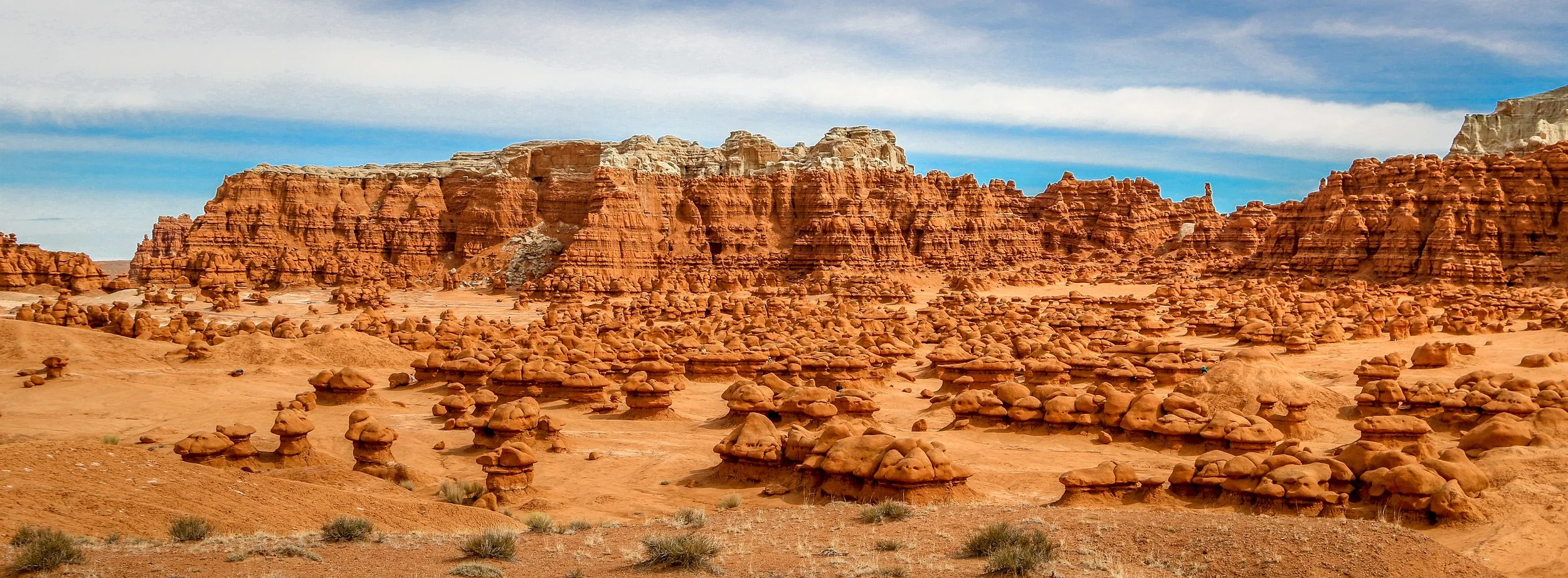
Goblin Valley is another of Utah’s incredible fantasy landscapes. It’s a place that quickly captures your imagination and leaves you smiling the whole time you are there. Located in a remote part of Emery County, you have to make an effort to get to Goblin Valley, but you’ll definitely be glad you did. The “goblins” are technically hoodoos, made of soft lower layers of sandstone and capped with a harder layer which causes water to erode them from the outside in instead of from the top down. The main amphitheater has thousands of goblins and is an incredible place to just wander, especially during the edges of the day when the low light illuminates the goblins and cooler air prevails. Beyond the amphitheater are other dream landscapes to explore, including the caves known as the Goblin’s Lair and the Goblette’s Lair, the Toadstools, beautiful Wild Horse Butte and the amazing Wild Horse Slot Canyon. Most people spend about an hour in Goblin Valley, but the longer you spend, the more you’ll find to keep you busy. Thanks to the prompting of my friend, Jack, I spent the whole day there and was definitely happy that I did. I hope you enjoy these photos from beautiful Goblin Valley - Magic in the Red Rocks of Utah.
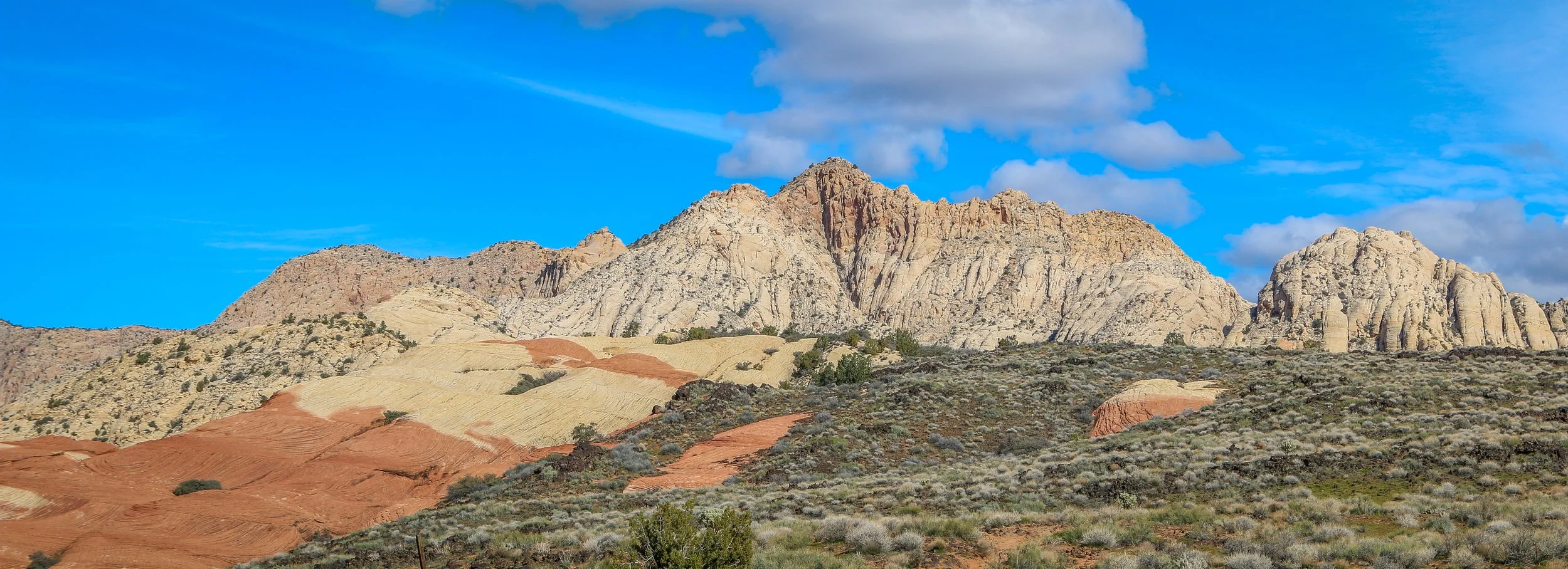
Snow Canyon State Park is one of the most stunning state parks I’ve ever seen. When I was considerably younger, I dated a woman who was an identical twin. When I met her sister, I could obviously tell that they were twins, but they were also completely different. Having spent many months of my life in nearby Zion National Park, driving into Snow Canyon felt much the same. The scenery looks so familiar to me, but it was all totally new as well. I loved it.
Located just north of St. George, Snow Canyon is a part of the Red Cliffs Desert Preserve. Much like Zion, Snow Canyon rests at the junction of the Colorado Plateau, the Mojave Desert and the Great Basin, exhibiting characteristics of all three. The rock formations are composed mainly of sandstone. The red formations contain iron while the white cliffs do not. Unlike in Zion, there are also cool volcanic areas including several lava tubes.
Human history here stretches back over 2000 years. Ancestral Puebloan cultures passed through the area often, and later, Paiute Indians would come to Snow Canyon. Mormons arrived in the area in the 1850s. One of Utah’s first state parks, it was originally called Dixie State Park and was later renamed after local Mormon pioneers Lorenzo and Erastus Snow. If you ever have the opportunity to visit, definitely come check it out. I hope you enjoy these photos from beautiful Snow Canyon State Park.
It’s been a cold week out here in southern Utah and the snow which came down on Thursday and Friday has decided to stick around for a while. Despite the cold and wind, the skies have been sunny most of the week and it’s really hard to complain about that. I hung around St. George, avoiding the worst of the snow and then made my way out to Kanab for the Balloons and Tunes Festival. From there I cruised out to Coral Pink Sands State Park and then north to the cute little historic town of Panguitch, where I am writing this post from today. I know it’s only Monday, but I don’t think there’s going to be much opportunity to jump on the internet for the next few days so I thought I would just finish this up today and then next week will just pick up where I leave off.
When I left you last week, I was in the library in St. George. After I finished up with my newsletter for the week, I headed up the road to the old opera house to catch a local performance of the musical Kiss Me Kate. I love the fact that St. George is supporting local theater and even though there were probably only 30 people there on a Wednesday night, the show did go on. There were some parts of this show that are particularly dated, but it was a great performance and all of the actors seemed as though they were really having fun out there. The building itself dates back to the early days of St. George, having been built in 1864 as a wine cellar. It was sold in the 1870s and became a social hall and performance center, and later an opera house in 1886. During the Great Depression the building was used to process sugar beets and wouldn’t be restored to its earlier function as an opera house until 1988. It’s a cool building and I was happy to see the inside of it and I also really enjoyed the performance.
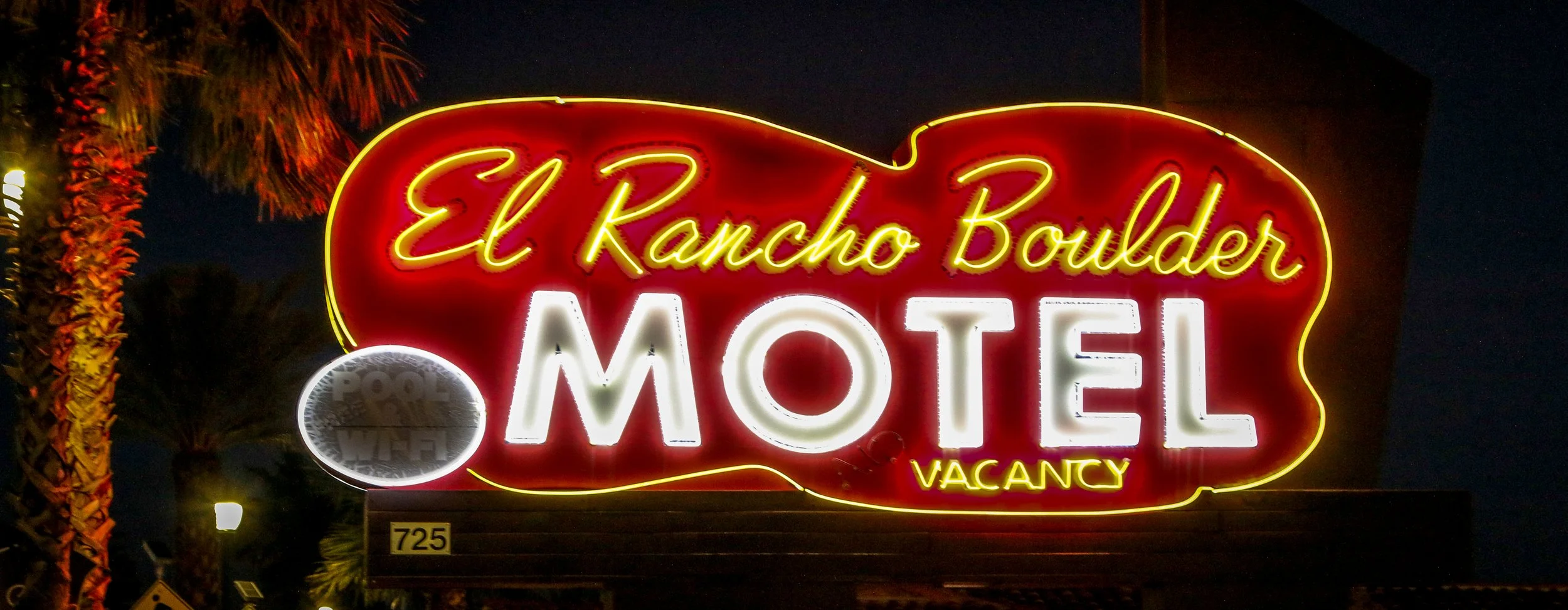
Boulder City, Nevada was founded in 1931 by the United States Bureau of Reclamation to house workers who were there to construct the Boulder Dam (which was renamed the Hoover Dam in 1947). Originally intended to house 5,000 workers for several years while the dam was being built, the town was thoughtfully laid out with plenty of parks and recreation opportunities and thus earned the early nickname of “Nevada’s Garden City”. Founded during prohibition and with the goal of having productive workers, alcohol was prohibited in Boulder City until 1969 and gambling has never been allowed within the city limits making it look and feel different from any other town I visited during my time in Nevada. The federal government maintained control of Boulder City until 1959 when the town was finally incorporated and the citizens elected their first mayor. Boulder City is a pleasant little community which I really enjoyed. The people were friendly and there were some great bars and restaurants and a surprising amount of live music on offer. I also loved all of the public art around town, especially the statues dedicated to the regular folks who made up the community in the early days. There’s a statue of a woman hanging laundry, one of a man with a shovel and another of the janitor resupplying toilet paper to the public restrooms (an unsung hero if ever there was one). All of the statues in town were tastefully decorated for the upcoming Valentine’s Day during my visit which put a smile on my face. I had a great stay in Boulder City which may be only 45 minutes from downtown Las Vegas, but feels a world apart. I hope you enjoy these photos from Boulder City - The Town that Built the Hoover Dam.
Hello Everyone!
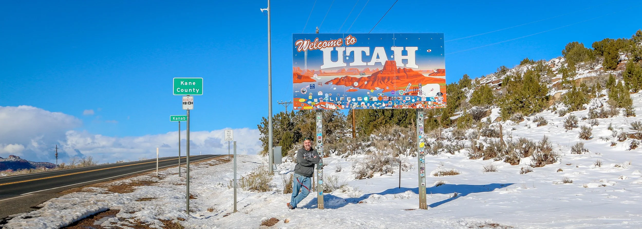
It’s been an interesting first week here in Utah. I’ve visited some absolutely beautiful places, learned some fascinating history, and generally had a really good time. Utah is a tremendous contrast to Nevada in so many ways. The landscape is on a smaller scale with more canyons and valleys, buttes and mesas and fewer vast stretches of open desert surrounded by imposing mountain ranges. Culturally, Utah is a predominantly Mormon state so it is more modest and conservative than Nevada (in a cultural sense, not necessarily a political one as Utah is also very conservative politically). Mormons are also very serious about preserving their culture and history, especially from the pioneer days which they consider pre-1869 which was when the railroad across Utah was completed. Because of this there is a tremendous amount of information available and the Daughters of Utah Pioneers have some wonderful museums to display items from Utah’s history. Bars are few and far between and with the exception of a few drinks on Mardi Gras Day, I’ve been sober since I arrived in the Beehive State which is a good thing. But also, I haven’t been bored as there are actually things to do at night here which don’t involve alcohol which I’ve really been enjoying. The weather has gone from hot and sunny to blustery and snowy and I haven’t traveled in more than about 60 miles from the border where I entered the state. All in all, it’s been a fascinating week which has really reinvigorated my journey, so let me tell you all about it.
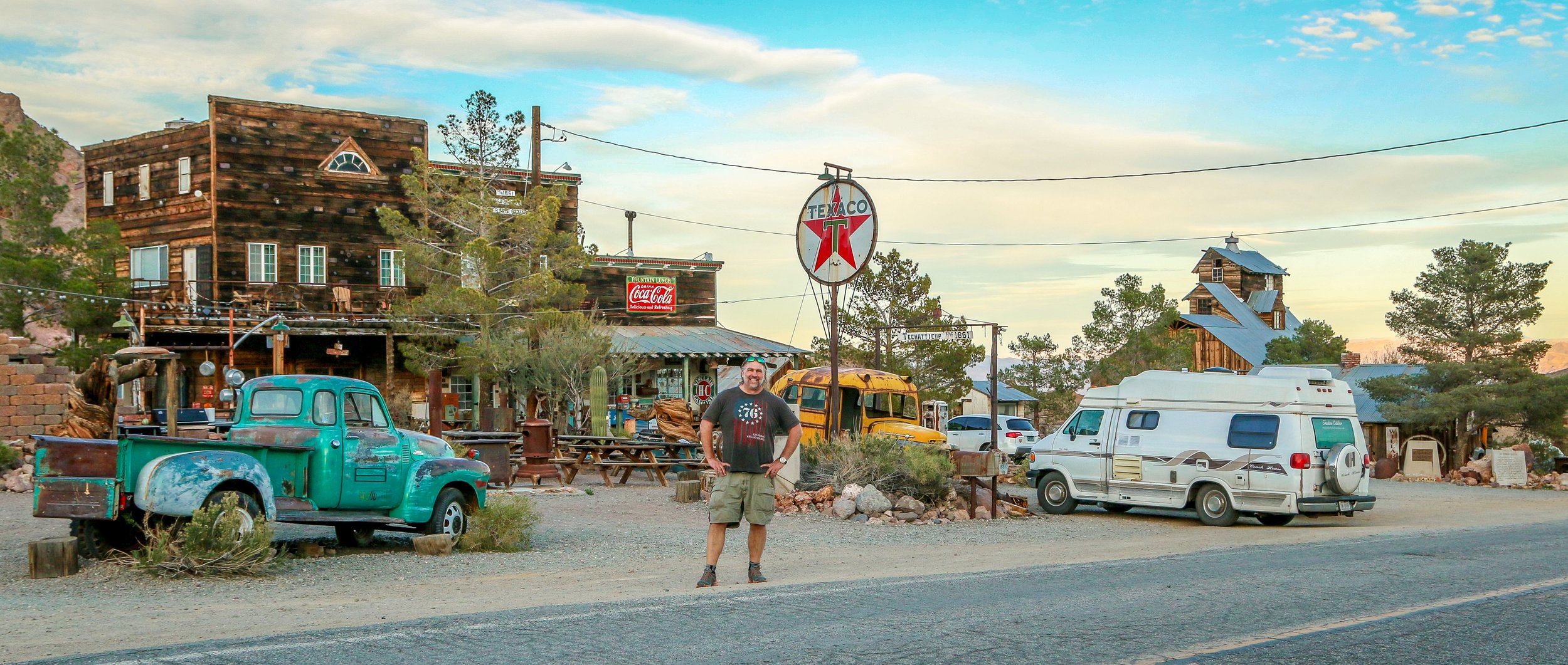
I absolutely loved visiting this old ghost town just south of Nelson, Nevada. It’s located near the site of the old Techatticup Mine in the heart of El Dorado Canyon. Gold and Silver were discovered in El Dorado Canyon in 1859 and a huge population influx soon followed. It grew to be a rough and sinister town and was named for Charles Nelson, a mining director who was killed in his home. Because of its proximity to the Colorado River, it was relatively easy to get people and supplies in and out when compared to other mine locations. The mines in the area were active until 1945, producing several million dollars worth of minerals. Today, the town is privately owned and open to visitors during daylight hours. It’s clearly staged for photography but that didn’t make me love it any less. It seems as though a lot of weddings are held on the property as well. I hope you enjoy these photos from the colorful ghost town of Nelson, Nevada deep in the heart of El Dorado Canyon.
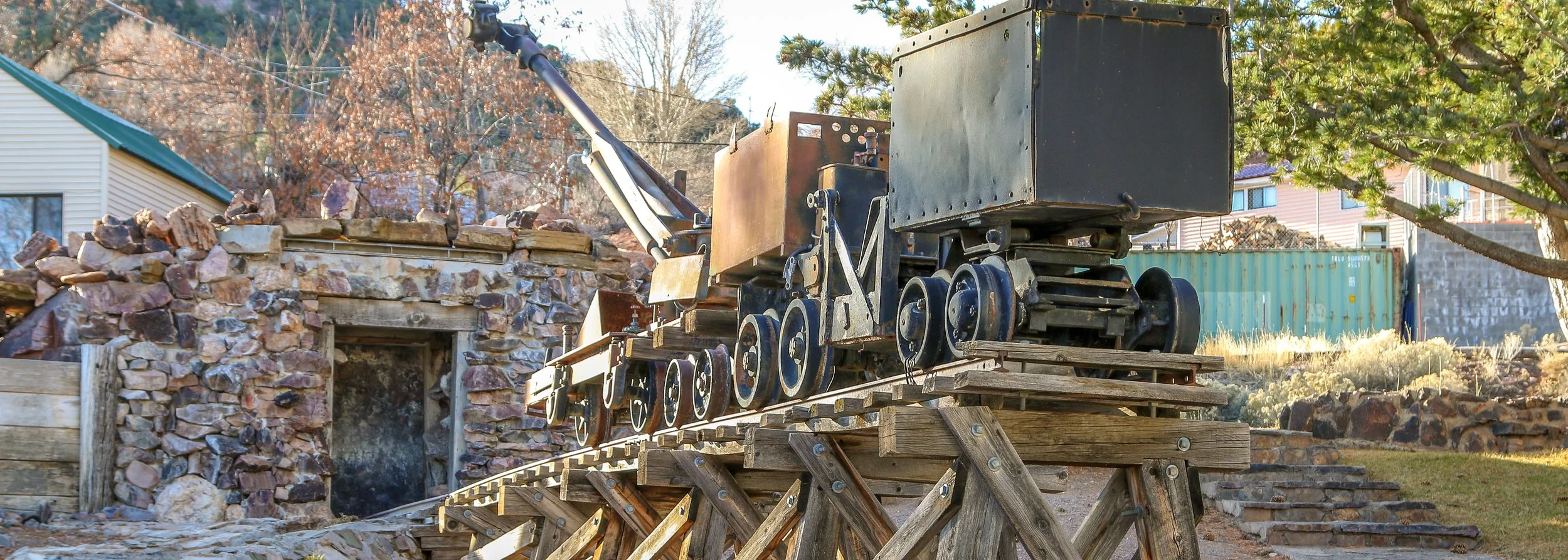
Silver was found in the hills surrounding what is now Pioche in the early 1860s, but conflict with the local Indian bands led the area to be abandoned soon thereafter. In 1868, San Francisco based land speculator François Louis Alfred Pioche purchased the mining claims and the surrounding area and founded a town he humbly named after himself. Within two years hundreds of miners had come to the mines of Pioche to find work, and it quickly gained a reputation as one of the roughest towns in the west. Signs around town will tell you that 72 men were killed in Pioche before the first citizen died of natural causes. Many of these men were buried in a “Boot Hill” cemetery outside of town. In 1872, Pioche became the county seat of the newly formed Lincoln County and a courthouse was commissioned for $88,000. Bonds were issued to cover the costs and then more bonds were issued to pay back the original bonds. This cycle continued until the state of Nevada devised a repayment plan in 1907 to help pay off the debt. The courthouse was finally paid off in 1938 to the tune of a million dollars, two years after the building was condemned. Next door to the courthouse is the old Mountain View Hotel, where Herbert Hoover apparently stayed when he visited Pioche. The old opera house and the 1937 Gem Theater are other distinct local landmarks. I loved my time in Pioche. In addition to these historic sites, the aerial tramway is such an eye-catching feature for the old mining town. I had a great breakfast with the locals at the counter of the Silver Café, and enjoyed a few beers at The Alamo Club and the Overland Saloon which also hosted a rousing round of Bingo when I was in town. I also absolutely loved their historic marker signs, each of which was topped with a unique design referencing the specific location (see some great examples below). To top it all off, Pioche has a free RV park for visitors to stay in while visiting. I had never heard of Pioche when I passed through, but I’m sure glad I stopped. This was my first visit but it won’t be my last. I hope you enjoy these photos from the old mining town of Pioche, Nevada - a once wild place in the heart of Lincoln County.
Hello Everyone!
It’s been a relatively mellow week out here on the road. Warm temperatures in southern Nevada have been very welcome and have not inspired me to move back into colder climates with any unnecessary speed. I hung around Las Vegas for an extra day to do some work on my van and then lingered in Boulder City longer than I expected. I did see a fascinating old mining town in the El Dorado Canyon near Nelson, Nevada, visited the Lost City Museum in Overton and finally made it out to the Valley of Fire which did not disappoint. I’m ending my week here in Mesquite, right on the border, as I plan to make my exit from the Silver State tomorrow. It’s not been the busiest week I’ve ever had, but sometimes that’s a good thing.
How can you not go visit a place with the motto “The Town That Refused to Die”? Ione has been on my list for quite some time and I’m glad I finally got there. It adds a little extra to the long detour to Berlin-Ichthyosaur State Park which is just minutes up the road. Ione was founded after a silver strike in the area in 1863. Ione took it’s name from a California mining town and would be named the county seat of the newly created Nye County in 1864. The town’s population would peak at about 600 people, but many would leave when a strike was made in nearby Belmont. Belmont would become the county seat in 1867. Ione would have another small boom in 1897 when a new stamp mill was built and again in 1912 when cinnabar (an ore refined into elemental mercury) was discovered in the area. When that played out in the 1930s, the town’s population would dip to around 40. The post office closed in 1959 and yet the town persisted. There isn’t much to Ione these days - a boarded up saloon and a few old stores and mining era buildings. But there are some newer houses around as well and a population of 41 people who must really like to get away from it all. This is an end-of-the-road town, but one worth wandering through if you’re ever in the area. I hope you enjoy these photos from Ione, Nevada - The Town That Refused to Die.
Berlin was established as a mining town in 1897 by German prospectors who named the town after the city in their native homeland. It had a small decade-long boom cycle but declined quickly after the Panic of 1907. By 1911 Berlin was virtually a ghost town and would begin to deteriorate. The land was acquired by the State of Nevada in 1970 to become part of Berlin-Ichthyosaur State Park. Since it was acquired, volunteers have stabilized the buildings and replaced the roofs and now it sits in a state of “arrested decay”. There are some great old buildings to see in Berlin, especially the massive stamp mill. I hope you enjoy these photos from the tiny old goldmining ghost town of Berlin, Nevada - definitely a cool place to see.
The Lincoln Highway was the original road-tripping route across the country. Dedicated on Halloween, 1913, the Lincoln Highway stretched 3,389 miles from Times Square in New York City to Lincoln Square in San Francisco. It was really the first transcontinental route designed specifically for automobiles and became known as The Main Street Across America. The stretch of the Lincoln Highway that crossed Nevada was planned along a well-trodden path. This route had previously served as a stagecoach route, the main trail for the Pony Express and the transcontinental telegraph also ran along this path. Many years after the highway was built, in 1986, Life magazine called this stretch of road across Nevada “The Loneliest Road in America”, and that wasn’t meant as a compliment. Nevadans, however, loved it and set out to make it a state scenic byway, erecting signs, creating a passport and marketing it to outsiders as The Loneliest Road. It connects fascinating old mining towns like Austin, Ely and Eureka and passes by old Pony Express stations, vast expanses of desert and the ruins of Fort Churchill (now a state park). I’ve made this run across Nevada several times and always really enjoyed it. There’s a lot of history out there and some great bars along the way as well. I hope you enjoy these photos from my time traveling down Nevada’s section of Route 50, The Loneliest Road in America.