Viewing entries in
small town

This Week on the Road - April 13th-20th

2 Comments

This Week on the Road - April 13th-20th

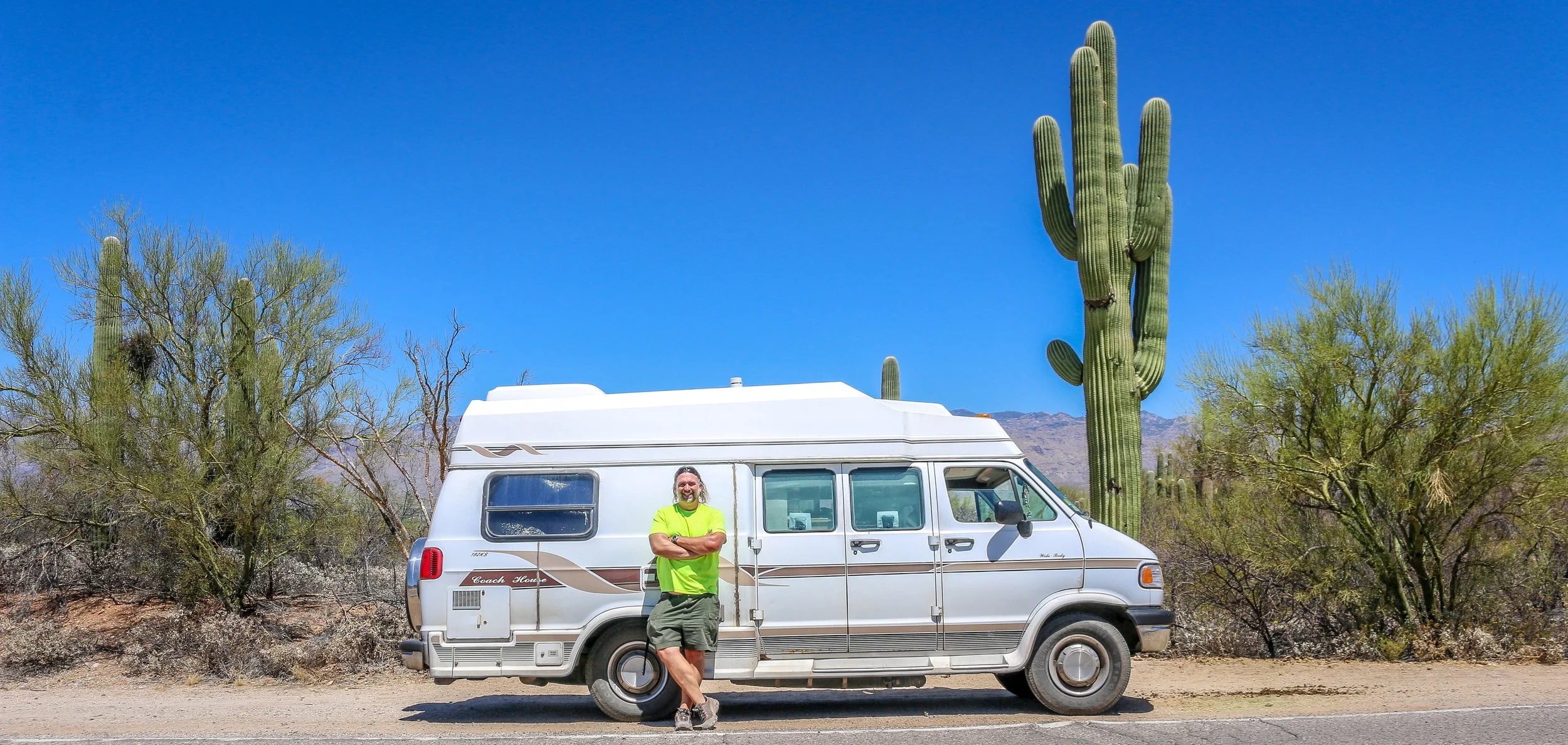
Hello Everyone! First and foremost I wanted to wish those of you who celebrate a belated Happy Passover and/or a belated Happy Easter. As those of you who have been following me for several years already know, I was brought up in the Eastern Orthodox tradition so we do not celebrate Easter before or during Passover. Our Easter will be this coming Sunday this year so it totally slipped my mind last week. I hope if you were celebrating that it was a wonderful day however you chose to spend it. This week has had considerably fewer headaches than last week which I’m very grateful for. I have traveled down the east coast and across Southeastern Arizona this week, visiting with and learning about the Apache, exploring Arizona’s copper mining past and present and checking out some beautiful National Park Sites along the way. Since I’ve come down about 5000’ in elevation from the high desert to the low desert, the temperature has risen considerably with daily highs reaching into the 90s. Thankfully it is a dry heat, which really does make a huge difference, and it cools off at night which is the most important thing. I am trying to avoid being outside and/or driving in the heat of the day at this point, but overall it hasn’t caused me any problems. I’ve certainly seen some fascinating places this week, so let’s get right to it.

When I left you last week, I was in the interestingly named town of Show Low which was a quaint and quiet vacation town which seemed nice enough but didn’t have much of interest to me. I spent Wednesday night just a little bit south of there in Pinetop and was up and off early the next day. I headed straight for the White Mountain Apache Reservation which is centered around the old Fort Apache. Fort Apache was built there at the confluence of the East and North Forks of the White River beginning in 1870. The fort was built in that location with the permission of the White Mountain Apache, and many members of that band served as scouts in the U.S. Army during the Apache War which was waged mostly with the Chiricahua Apache. I was fascinated to learn about this conflict between the different bands at the wonderful museum and cultural center located there at the old fort, and it seemed to me as though they were proud of the role their ancestors played in that campaign. The fort remained an active one until 1924 and after it closed the buildings were converted into the Theodore Roosevelt Indian Boarding School which educated both Navajo and Apache children. I’m not a huge fan of the Indian Boarding Schools, which sought to strip young Native Americans of their culture, but I do believe there were good intentions involved. The campus is still a school today, but run locally by the White Mountain Apache. I spent the morning at the museum which, while it discussed some of this history, was clearly designed to present the White Mountain Apache as a modern community proud of its heritage and working towards the future. I spent the afternoon touring the old fort and trying to soak it in. Everyone I met there was incredibly friendly and welcoming and I spent considerably longer there than I had planned. I did get out to visit the Kinishiba Ruins in the afternoon which is a small Ancestral Puebloan site just down the road. It is protected and managed jointly by the White Mountain Apache, the Hopi and the Zuni, all of whom claim ancestry at Kinishiba. From there I was off to the twin cities of Eager and Springerville for a quiet and an early night.

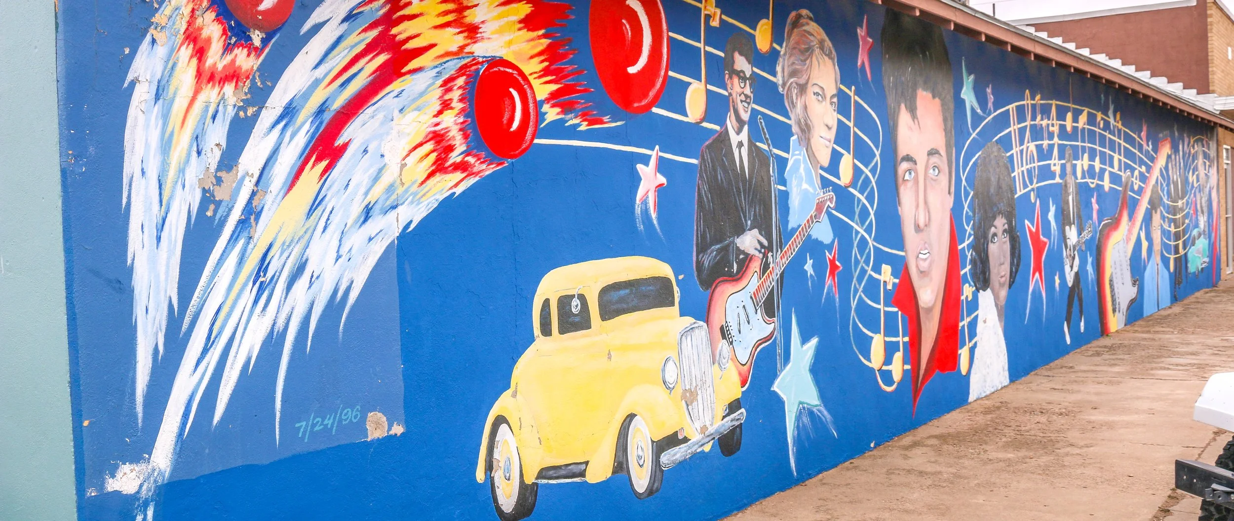
Friday morning I was up early and headed down the Coronado Trail Scenic Byway which at some point likely crosses the trail Coronado took in 1540 on what was the first European penetration into the region. What their exact route was is unknown as there were no maps of the region for them to follow, but there is evidence that they spent time in that general vicinity. The scenic byway was a beautiful, winding 120 mile route which took every bit of four hours to travel. There were some stunning viewpoints along the way as I descended out of the White Mountains and into the desert below. It was a great road to crank up some good tunes, roll my windows down and cruise. At the other end of it, I found myself in the heart of the Morenci Mine, the largest copper mine in North America. It’s not pretty by any measure, but it is massive and definitely something to see. The small town of Clifton, on the other end of the mine, was an interesting little place to visit. The main street through town was a dirt road and a narrow one at that. The buildings were definitely a century old and not necessarily in very good repair for what should be a prosperous mining town. Everything seemed coated in red dust. It was unlike anywhere I’ve seen in the US and reminded me of some of the small mining communities I visited in Western Australia. They did have a beautiful old train station though. From there I was off and running towards Safford, another 45 minutes or so down the road. When I got there I was excited to see a Jack in the Box, one of the only fast food restaurants that I actually like. I don’t eat fast food as a general rule, but I haven’t seen a Jack in the Box in years, so I treated myself. Then I headed out to a great little private hot springs park called the Essence of Tranquility. The owner was super friendly and I had a wonderful night there soaking in the tubs and kicking my feet up in the communal areas. While I stayed in my van, they do offer little casitas and dorm beds as well. It’s definitely a worthwhile little stop and it was a nice respite from the road for a night.

I had a quick soak in the morning as well and then set off to Fort Bowie National Historic Site high up on Apache Pass…

2 Comments

Snapshots: Tucumcari - Getting My Kicks on Route 66

Comment

Snapshots: Tucumcari - Getting My Kicks on Route 66

The area that is now Tucumcari was once home to dinosaurs who walked the shores of an inland sea. When the water receded, the sediment formed into sandstone and one of the formations it left is now called Tucumcari Mountain (although it’s really more of a mesa). Prehistoric people tracked mammoths and mastodons in the area and later developed farming techniques and built villages. In the 18th century, the Apache and Comanche moved through the area, hunting bison and pronghorn. The name, Tucumcari, comes from an Apache word “tukanukaru,” meaning “to lie in wait for something to approach”. In the early 20th century, the Chicago, Rock Island and Union Pacific Railroad was making its way across the country and a tent city sprung up called Ragtown and, later, Six Shooter Siding. As the camp grew into a town, they changed the name to Tucumcari and it stuck. Route 66 came through in 1926 and the town became an overnight stop for people headed west. Signs for miles declared “Tucumcari Tonight” and people pushed through for the promise of a hot meal and a comfortable bed. Tucumcari today still capitalizes on nostalgia for the “Mother Road”, but also has a wonderful museum downtown which has a place for everything and everything has been lovingly put into place. I had a great stop in Tucumcari and definitely got my kicks on Route 66. I hope you enjoy these photos from beautiful Tucumcari, New Mexico.

Comment

Snapshots: Clovis - New Mexico's Rock and Roll Capital

Comment

Snapshots: Clovis - New Mexico's Rock and Roll Capital

People have been in the Clovis area for at least 10,000 years as is evidenced by the “Clovis-man” finds at the nearby Blackwater Draw archaeological site. The town itself came much later, in 1906 in fact, when the Atchison Topeka and Santa Fe Railroad was making its way across the country. It’s the first town of any size you’ll find coming from Texas and the town has some Texas tendencies to be sure. It’s grown to a population of nearly 40,000 people and is the county seat of Curry County. For all it has to offer, it was a man named Norman Petty that brought me to Clovis. Petty started playing piano at an early age and in his mid-twenties had a hit record with his wife, Vi, and guitarist Jack Vaughn when they recorded the great DC born Duke Ellington’s Mood Indigo. The record’s success gave Norman enough money to open his own recording studio and in 1954 the Norman Petty Recording Studio was born. Petty recorded local artists and plenty from nearby Texas as well. In 1957, he produced a hit called Party Doll for Happy, Texas’ Buddy Knox. It was another Buddy though, Buddy Holly, who would really put Petty and Clovis on the music map. Norman would go on to produce records for Roy Orbison, Bobby Vee, The Fireballs and many others and their distinct style would be remembered as the Clovis Sound. I had a great time in Clovis and found a lot to like about it from its art deco buildings to its wonderful Vi and Norman Petty Museum. The downtown wind art was both beautiful and appropriate. Sadly it was cloudy for much of my visit, but it did manage to clear up right before I left so I did grab a few photos under sunny skies. Who knew New Mexico played such an important role in music history. If you’re ever in the area, stop in and check it out. I hope you enjoy these photos from musical Clovis, New Mexico.

Comment

Snapshots: Las Vegas - New Mexico's Historical Gem

4 Comments

Snapshots: Las Vegas - New Mexico's Historical Gem

“The Original Las Vegas” was founded along the Galinas River in 1835 in the midst of Mexican rule in the area and quickly grew as a popular stop on the Santa Fe Trail. It was on the Plaza in Las Vegas where Stephen Watts Kearny claimed New Mexico for the United States during the Mexican-American War in 1846. In 1879, the Atchison, Topeka and Santa Fe Railroad came to Las Vegas and the town quickly grew into one of the largest in the region. The New Mexico Normal School (now Highlands University) was established in 1893 and Fred Harvey built the Castañeda Hotel in 1898 as part of his hospitality empire in the southwest. Las Vegas hosted Teddy Roosevelt’s Rough Riders’ first reunion in 1899, a tradition that continued for many years. In more recent years, Las Vegas has been the filming location for many movies including No Country For Old Men, Wyatt Earp (with Kevin Costner), and perhaps most notably for me, Red Dawn where it served as the fictional town of Calamut (the massive “Calamut Says Howdy” mural is still a prominent feature downtown). I found Las Vegas to be a quiet, charming University town with some spectacular architecture, fascinating history and friendly people. It may be the “other Las Vegas”, but it’s a town not to be missed on your travels in New Mexico. I hope you enjoy these photos from wonderful Las Vegas, New Mexico.

4 Comments

This Week on the Road - March 23rd-30th

Comment

This Week on the Road - March 23rd-30th

Hello Everyone! It’s been a wildlife viewing week out here on the roads of Northern New Mexico. I’ve seen eagles and hawks in the air, deer, bighorn sheep and pronghorns in the fields and lots of prairie dogs running around searching for their underground tunnels. I like seeing wildlife. These animals make me smile. I’ve actually done a lot of smiling this week as I’ve found myself in wild places surrounded by beautiful landscapes and breathtaking sunrises and sunsets. I’ve managed to keep most of the demons in my head at bay this week and have felt pretty good all around. The weather has generally been great this week as well which hasn’t hurt. Warm, sunny days and cool, pleasant nights work really well for me. I do find that I need to change from shorts to long pants very soon after the sun goes down – it doesn’t take long to cool down in this dry air. It’s hard to believe I’ve been in New Mexico for over a month at this point, but I’m starting to make plans for the final stretch of my time here and then I’m off to Arizona for the rest of my winter/spring. My month in New Mexico has been special and memorable and I definitely understand why they call it The Land of Enchantment.

When I left you last week, I was in tiny Clayton, New Mexico in the far northeast of the state. I did head out to Clayton Lake State Park that evening which has a fascinating “pad” of over 200 dinosaur footprints from when the area was the muddy shoreline of a vast inland sea. Some of the footprints were very pronounced in the evening light and while it was very windy out there it was still really cool to see. I decided to spend the night at one of the campgrounds by the lake and ended up having the whole place to myself which was really nice. It was windy and cold, but I stayed out to watch the sunset and then popped out periodically to check out the stars which were really bright and mesmerizing.

Thursday morning I stuck around my campsite for a bit, enjoying my coffee and the warm sun on my face by the lake. I’ve been rereading the book Blood and Thunder by Hampton Sides which essentially tells the history of early American New Mexico. It’s an excellent book, and I’m enjoying it even more now that I’ve been to a lot of the places he writes about. A pair of bald eagles were cruising around the lake while I read which was awesome. Eventually I pulled up stakes and headed back into town to take a few more photos and then got on the road west to Capulin Volcano National Monument. I had noticed on my way out to Clayton Lake the evening before that the landscape was much more volcanic in that part of the state and it became even more pronounced as I went west. I drove past Sierra Grande, which is an incredible example of a shield volcano and then headed towards Capulin which is one of the country’s best specimens of a cinder cone volcano. This volatile and quick-forming volcano (which looks like what you imagine in your head when you think of a volcano) formed sometime around 60,000 years ago. The fertile soil it produced made for some fine grazing land so ranchers have used the land around the volcano for centuries and its distinct and easily recognizable shape made it a landmark on the Santa Fe Trail. Today, you can drive right to the top which is pretty cool but probably not for the faint of heart as there is a pretty severe drop-off and not many guardrails on the road. Once you get up there, though, you are rewarded with remarkable views in all directions and you can hike around the rim and down into the crater. You can look east at the seemingly endless plains stretching to the horizon and west to where they run into the Rocky Mountains. When I left the park, I headed north to Folsom and planned on taking the road over Johnson Mesa to Raton so I could drive past the Folsom Man Site, an archaeological area similar to the Clovis Man Site I talked about last week when I visited the Blackwater Draw museum. Somehow I took a wrong turn and ended up going a half hour down the wrong road but it was a beautiful road and a nice detour. When I finally figured out I had gone astray, I returned to Folsom and found the road I wanted to take. It was poorly marked and when I made the turn, I found it was also closed. Two hours later, I was back at Capulin but thankfully it was only a short drive from there to Raton. Raton is a cute little town on the railroad line with an old theatre and an older train station. I did wander around town a little bit but I was pretty tired and didn’t find out much about it. I stopped in for a great craft beer and one of the best burritos I’ve ever had at the Cellar Brewery (which is actually on the first floor, but they brew the beer in the basement) and then called it a night.

On Friday morning I headed just down the road to the town of Cimarron. Their sign reads “Where the Plains Meet the Mountains” and you can look west from town and see the Rockies emerging from the flat plains. Cimarron is also home to the Philmont Scout Ranch, a massive wilderness area donated by oilman Waite Phillips to the Boy Scouts in 1938. Way back in 1992, I came to Philmont on my very first trip to New Mexico and my first trip anywhere west of the Mississippi. My Boy Scout troop spent 10 days backpacking through the Sangre de Cristo Mountains and covered about a hundred miles on foot if my memory serves. It was an amazing experience for a city kid like me and a formative one…

Comment

Snapshots: Cerillos - An Old West Town on the Turquoise Trail

4 Comments

Snapshots: Cerillos - An Old West Town on the Turquoise Trail

Native Americans mined turquoise in the hills which now surround the tiny town of Cerillos. In more recent times, miners have also found gold, silver, copper, lead and coal in the area. An early Spanish explorer commented on the mineral wealth in these “little hills”, which gave the town its name. While all of the things that are mined in the area are valuable, it was the 1879 discovery of gold which really put Cerillos on the map. The railroad came through the following year and the town boomed. The town’s population grew to over 3,000 and it supported 21 saloons, 4 hotels, 3 churches, an opera house and several newspapers. At one point, Cerillos was even in consideration to be the capital of New Mexico and was visited by Teddy Roosevelt. With every boom comes a bust and by 1930 most of the big mines had closed, although turquoise is still mined nearby and is considered some of the finest in the country. The dirt roads and old buildings of Cerillos have made it a great Western filming location with Walt Disney's Nine Lives of Elfego Baca and Young Guns being two of Cerillos’ most famous productions. I’ve probably seen Young Guns several dozen times, so Cerillos felt familiar as I walked the streets and when I saw the faded Murphy-Dolan Store sign on the side of the old Wortley Hotel it really made me smile. Cerillos is a great little turn-off from the Turquoise Trail Scenic Byway which connects Albuquerque and Santa Fe and I definitely enjoyed my visit. I hope you enjoy these photos from the old mining town of Cerillos.

4 Comments

Snapshots: Madrid - An Old Coal Town Reborn

Comment

Snapshots: Madrid - An Old Coal Town Reborn

Madrid was the first town I came to along the beautiful Turquoise Trail, the scenic byway which connects Albuquerque and Santa Fe. Pronounced MAD-rid for some maddening reason, I couldn’t find a clear story as to how the town got its name. The earliest Europeans in the area most likely came from Spain, but it doesn’t appear that Madrid got its name until New Mexico was an American territory. First lead and then coal were mined in the surrounding hills and in 1892 a 6 mile spur was built to connect the town to the Santa Fe Railway. By 1906, coal mining in the area was consolidated under the Albuquerque and Cerrillos Coal Company and a company town grew to a population of over 3,000, more than that of Albuquerque at the time. In 1922, Madrid boasted the only baseball field with lights west of the Mississippi River, and the Brooklyn Dodgers’ minor league affiliate the Madrid Miners played there for many years. The mines did well until the early 1950s and in 1954 the Coal Company left Madrid and many of the residents went with them. By the early 1970s, Madrid was almost a ghost town but then artists discovered the town and started moving in. Today, Madrid is a vibrant and colorful town with many reminders of the old mining town that it once was, but truly reborn as an artists’ colony and a tourism destination. I hope you enjoy these photos from beautiful Madrid, New Mexico.

Comment

This Week on the Road - March 17th-23rd

Comment

This Week on the Road - March 17th-23rd

Hello Everyone! First and foremost this week, I want to say how much my heart goes out to those affected by the tornadoes yesterday in New Orleans and across Texas. The Lower 9th Ward of New Orleans suffered enough for a lifetime with Hurricane Katrina and I’m heartbroken by the images coming from there today. I wish them well with their recovery. As for me, I’ve spent most of this week traveling across the Llano Estacado or the “Staked Plains” of northeastern New Mexico. This is not an area that sees a lot of tourism, but there is actually quite a bit to see out here and I’ve been enjoying it. The winds, however, have been blowing hard at me all week, which makes it hard to drive and since no matter which way you turn it never seems to be at your back, it doesn’t help with my gas mileage. When I pulled into Clayton an hour ago though, gas was at $3.70/gallon, the cheapest I’ve seen in over a month! It would have seemed expensive 3 months ago, but for today it brought a smile to my face. I’ve spent a lot of the week dodging suicidal tumbleweeds which wait until the last second and then make a beeline for my undercarriage. The beautiful pronghorns I’ve seen out in the grasslands have made up for it, though. I’ve actually been feeling really good this week and have been enjoying seeing this region of the state. Even though towns are few and far between and the wind makes me feel like I’m captaining a boat instead of driving a van, it’s been a really good week out here.

When I left you last week, I was on my way out to take some photos around Santa Fe, but clouds had moved in and it was a bit gloomy. I tucked into a little bar and met the most cantankerous person I’ve met thus far in New Mexico. Since he was the bartender and owner, it seemed like a good sign to call it an early night and get a good jump on my Thursday.

I hit the gym first thing Thursday morning and came out to find it snowing pretty heavily out. Since I couldn’t take my camera out in the snow, I went for an early lunch at a spot called Horseman’s Haven which my friend Estilla had recommended. When I got there, I double checked my phone to make sure I was in the right place because it was a little plain-looking spot tucked into the corner of a gas station parking lot. I’m sure glad I didn’t judge the book by its cover, because it turned out to be a really great restaurant. I had some chicken adovado, a New Mexican dish of chicken marinated and cooked in red chili, and I also got a side of their famous green chili which was as good as I had been promised (Anthony Bourdain apparently said it would “melt your face off”). It may be the best restaurant I’ve been to thus far in the state.

From there I headed back downtown and went to see the New Mexico History Museum and the Palace of Governors. The museum was pretty good and set out to tell the history of the state from the earliest Paleo-Indians to the modern day. I must admit my ignorance on a lot of the details of this region. Even though the names were all familiar from guiding tours here for many years, I didn’t have a good chronological understanding in my head and this museum really helped with that. I also enjoyed their in-depth look at the Harvey Hotels, an early chain of hotels and restaurants that grew up with the railroad, of which Santa Fe’s own La Fonda was one. I’ve been to La Fonda many times, and El Tovar and the Bright Angel Lodge at Grand Canyon, but I’ve always been interested in the brand, which was also one of the first big tourism operations in the Southwest. After early run-ins with locally hired employees, Fred Harvey decided to hire mostly young, single women - lovingly remembered as the Harvey Girls. In doing so, the Harvey brand may have had more responsibility for populating the region than they intended by bringing single, adventurous women to the Southwest. The Palace of Governors, which is attached to the museum, has been on the plaza in Santa Fe since 1600. It’s been occupied by the Spanish, the Pueblo Indians, Mexico, the United States and even, briefly, the Confederacy. The building has been altered, expanded, contracted, and was even given Victorian flourishes at one point. When you learn all of this, it’s amazing that this adobe building has survived for 400 years. Sadly, there isn’t much to it on the inside except a bunch of whitewashed walls and I wish they would furnish it from its many different periods. It was still interesting to see and I’m glad I went.

It being St. Patrick’s Day, my next stop was Boxcar – a very un-Irish bar, but seemingly the only game in town for the big day. To be fair, they did try and they all worked very hard to make it enjoyable. There was corned beef, Guinness and green beer…

Comment

Snapshots: Socorro - A Lucky Stop Under Perfect Skies

Comment

Snapshots: Socorro - A Lucky Stop Under Perfect Skies

In 1598, Juan de Oñate y Salazar was on a conquest to colonize Nuevo Mexico for Spain. Traveling north of El Camino Real, his caravan had just passed through the dreaded 90 mile stretch known as the Journada del Muerto or “Journey of the Dead Man” when they encountered the Piro people of the Tempana Pueblo. These people offered the party food and water and Oñate called the place “Socorro” meaning succor or aid. In 1626, the Spanish built a mission church nearby and christened it Nuestra Señora del Perpetuo Socorro or Our Lady of Perpetual Succor. The mission was abandoned and destroyed during the Pueblo Revolt of 1680 and wouldn’t be resettled until 1815. A beautiful new church was built and named after San Miguel.

I came to Socorro because it was where I was when I ran out of steam for the day. It was on my radar, but I didn’t know if I would have time to stop. I’m sure glad I did. There are so many wonderful historic buildings around town, and the evening was absolutely perfect for photography. I enjoyed a nice long walk around downtown and then settled into the mining-era Capitol Bar for a couple of their house-brewed beers. Then I ventured out to El Camino Restaurant and Lounge, a holdover from another time. Both the restaurant and the lounge are worth visiting for the ambiance alone. It snowed overnight and while there wasn’t much on the ground, the mountains had a lovely dusting. I happily snapped a few more shots with the snow before hitting the road. Socorro is definitely worth a stop on your way through New Mexico and I hope you enjoy these photos from my brief time in this wonderful little town.

Comment

Snapshots: Truth or Consequences - Interesting Name, Beautiful Town

10 Comments

Snapshots: Truth or Consequences - Interesting Name, Beautiful Town

People have been visiting the natural hot springs in the Palomas Basin for centuries. The Spanish called them Ojo Caliente de Las Palomas and the cowboys called them Palomas Hot Springs. In the late 18th century, a public bath was built on a ranch in the area where people could come and take the waters. When the Elephant Butte Dam was built in 1912 to help with irrigation, the area became more attractive to settlers and the town of Hot Springs, New Mexico was incorporated in 1916. Twenty-one years later, it would become the county seat of Sierra County. In 1950, Ralph Edwards, the host of the popular radio show Truth or Consequences, promised to air their 10th anniversary show live from any town that would change its name to match that of the show. Hot Springs residents jumped at the opportunity and officially changed its name to Truth or Consequences. Edwards made good on his promise and visited the town on the first weekend of May every year for the next 50 years. His visit was turned into a celebration, Fiesta, which still happens every year at that time. T or C, as the locals call it, is a wonderful and colorful little town full of hot springs resorts and art galleries and with a backdrop of beautiful mountains that light up when the sun is low in the sky. I loved my brief stay in one of the country’s most uniquely named towns, and I hope you enjoy these photos of fabulous Truth or Consequences.

10 Comments

This Week on the Road March 10th-16th

2 Comments

This Week on the Road March 10th-16th

Hello Everyone! Well I’m finally starting to feel more adjusted to the dryness of the desert and the altitude here in Northern New Mexico. It definitely takes a few days to get used to in my sinuses and with just walking around. On the other hand, Shadow Catcher has gotten better gas mileage this week than at any time since I’ve had her, and it is definitely the right time for that. Daylight Savings is back and I’m absolutely enjoying the later sunset – it stretches my day out a bit and I feel a little less hurried. I spent a good chunk of this week in Albuquerque, a city I had only visited in passing before. At first it seemed a little bit seedy, but it really grew on me and I enjoyed it quite a bit and look forward to returning. Beyond that, the weather has been near perfect all week and I’ve continued to really enjoy my time in New Mexico. It’s growing nearer and dearer to my heart every day. I guess they don’t call it The Land of Enchantment for nothing.

So when I left you last week, I was in the small town of Truth or Consequences which turned out to be a neat little town and one of the most photogenic I’ve been through so far. I headed out to Elephant Butte Lake State Park to take some photos and grab a quick shower, but the lake out there is really low after years of drought. I returned downtown in the evening and enjoyed wandering around and taking photos until the sun went down. Then I stopped in for a couple of beers at the great little Truth or Consequences Brewery and enjoyed speaking with the lady who worked there who had moved to T & C from El Paso and never looked back.

I was up and off on Thursday with big plans that I couldn’t quite fit into a day. My first stop was at old Fort Craig, an army fort built in 1854 - soon after the New Mexico Territory became a part of the United States as part of the Treaty of Guadalupe-Hidalgo. The fort was established to provide protection from Indians for settlers moving west into the newly acquired territory. It was staffed mostly by recent immigrants, one of whom described Fort Craig as “some lonesome sort of hole on the edge of the hot and dusty desert”. It would become the unlikely site of a fairly important battle (for the Western Theatre) of the Civil War as the Confederacy had its eyes on Colorado and California gold and a Pacific port which would be free from a Union blockade. To get to either, they had to cross New Mexico first, no small feat in the 1860s. Confederate General Henry Hopkins Sibley, who led the charge, planned on providing for his troops by “living off the land”. I don’t think he was quite prepared for the desolate and sparsely populated desert environment he found. Fort Craig, at the time, had tremendous storehouses and provided food and supplies to the entire region, so Sibley set his sights on the small desert fort. The armies met on the Valverde Battlefield, not far away, and the Confederates managed to send the Union troops retreating back to the fort. Sibley then demanded the fort’s surrender, which was probably met by laughter but was definitely refused by Commanding Officer Colonel Edward Canby who saw no reason to surrender his secure and well-armed fort. Sibley didn’t have the ammunition or the firepower to attack the fort, so he was forced to move on in search of provisions for his men further north. Canby left in pursuit, leaving Kit Carson in command in his absence. A defeat near Santa Fe sent the Confederates high-tailing it back to Texas. The fort would go back to serving its original purpose of fighting off the Apache, but was abandoned by the 1890s. Today it is just a collection of ruins overseen by the Bureau of Land Management, but it’s an interesting place. The caretaker told me they average just 8 visitors a day, but sometimes get as many as 20.

After a few hours at the fort, I headed on to the beautiful Bosque del Apache National Wildlife Refuge just up the road. These natural wetlands are an essential stopover for migrating birds, and seeing it helps to show the importance of the Wildlife Refuge System…

2 Comments

Snapshots: Old Mesilla - New Mexican, Old West Charm

Comment

Snapshots: Old Mesilla - New Mexican, Old West Charm

When the Mexican-American War ended with the 1848 Treaty of Guadalupe Hidalgo, much of present-day New Mexico became part of the United States. Mesilla was founded just south of the new border for local Mexicans who wanted to remain in Mexico and the town grew quickly to a population of over 800 in 1850. In 1854, Mesilla would be included in the Gadsden Purchase and become a part of the United States from that time forward. Mesilla would briefly serve as the Confederate capital in New Mexico during the Civil War. Billy the Kid once called Mesilla home and it was there that he was sentenced to die by hanging for the murder of Sheriff Brady in the Lincoln County War. Mesilla was also a stop on the famed Butterfield Stagecoach route. Today, the bells still ring in the San Albino Church and the Historic Plaza is a vibrant gathering place. The incredible bar and dining room at the Double Eagle are a must-see if you visit, even if just for a margarita. Just around the corner is La Posta Restaurant which used to be the old Corn Exchange Hotel where the likes of Billy the Kid, Kit Carson and Pancho Villa once stayed. There is a ton of history in old Mesilla and it’s one of the coolest little towns I visited in Southeast New Mexico. It’s definitely worth a stop if you’re ever in that part of the state. I hope you enjoy these photos from fabulous Old Mesilla.

Comment