Viewing entries in
Off The Beaten Path

Snapshots: Wickenburg - The Dude Ranch Capital of the World

2 Comments

Snapshots: Wickenburg - The Dude Ranch Capital of the World

The area that is now Wickenburg was once Yavapai Indian land and the river that runs through it is the Hassayampa which means “following the water as far as it goes” in the Yavapai language. In 1863, German prospector Henry Wickenburg came to the area in search of gold. He found it and opened the Vulture Mine which would eventually produce 340,000 ounces of gold and 260,000 ounces of silver.

Ranchers came to the area as well and soon a community sprang up. In 1895, the railroad came through Wickenburg which spawned even more growth. The town was incorporated in 1909, making Wickenburg the oldest Arizona town north of Tucson and the 5th oldest in the state. In 1866, Wickenburg missed being named the territorial capital by just two votes.

Today Wickenburg is a quaint little community with a real wild west feel to it (some of the light posts are even wearing cowboy hats). There are some amazing art installations around town and the Desert Caballeros Western Museum is one of the best in the state. I love the design of the Saguaro Theatre which was also probably my favorite theatre in Arizona. You’re never alone when you’re in Wickenburg as life-like statues are spread throughout town making for a family friendly feel. I hadn’t planned on staying long in Wickenburg, but it’s a great town worth exploring and I was there way longer than I expected to be. Next time you’re in this part of Arizona, stop in for a spell. You’ll be glad you did. I hope you enjoy these photos from tiny Wickenburg - the Dude Ranch Capital of the World.

2 Comments

In Focus: Organ Pipe Cactus National Monument

Comment

In Focus: Organ Pipe Cactus National Monument

Organ Pipe Cactus National Monument was one of the top spots on my list of places to visit during my time in Arizona. It’s a remote park, located two hours from anywhere and right on the U.S./Mexican border, but it’s the only place in the country that you can find naturally occurring organ pipe cactus. In addition to these beauties, there are so many other species of cactus and desert plants as well which has led to this region also being named a part of UNESCO’s International Biosphere Reserve.

Organ Pipe Cactus was made a National Monument by Franklin Roosevelt back in 1937. A special act was passed to allow mining in the area during World War II, an act which sadly wasn’t repealed until 1976. The park’s remote location on the Mexican border used to bring both drug runners and human smugglers through the area, making this America’s most dangerous park. This danger is memorialized in the Kris Eggle Visitors Center which was named for a park ranger who was killed protecting visitors from drug smugglers in 2002. In the wake of his death, the border was reinforced and I felt safe there during my stay.

It was unbelievably hot when I arrived on an afternoon in late April. So hot that I couldn’t actually do anything but hover in the shade of the restroom and wait until the sun started to go down. I did enjoy a wonderful evening hike and an early morning one the following day as well. The area is beautiful and it was great to see the Organ Pipes in their native habitat. It was definitely just a one night stop, but I’m very glad I went. I hope you enjoy these photos from Organ Pipe Cactus National Monument.

Comment

In Focus: Fort Bowie National Historic Site

Comment

In Focus: Fort Bowie National Historic Site

Construction on Fort Bowie began in 1862 after two separate confrontations between the United States Army and the Chiricahua Apache. The fort was erected to protect the Apache Pass through the mountains and Apache Springs, a vital water source in the area. Six years later a more substantial fort was built just up the hill from the original fort and would be in service until 1894. The Apache Wars would end in 1886 with the surrender of Chiricahua leader, Geronimo, and the removal of the Chiricahua from the area. As you may remember from a recent post, the U.S. Army was aided in this endeavor by the White Mountain Apache scouts based in Fort Apache to the north who were the sworn enemies of the Chiricahua.

The fort today is a mere remnant of what it once was. The adobe walls have all but melted back into the surrounding desert and the stone foundations and a few odds and ends are all that is left. This park is unique in that it is a “hike-in” park, meaning the only way to visit it is by hiking the 1.5 miles from the parking lot up to Apache Pass. This walk takes you past the old stagecoach stop ruins, the cemetery, an old Apache village, Apache Spring and up to the pass where the fort is located. While the rangers at the park will provide access for people with disabilities, this walk is an amazing way to get a feel for the remoteness of the fort and the isolation the men who were once stationed there must have felt. I was definitely glad I visited in the winter months as I’m sure making this walk in the summer is quite hot and dusty. I was definitely glad I finally made it out to Fort Bowie as it’s been on my to-do list for many years now and I’m glad I finally got there. I hope you enjoy these photos from Fort Bowie National Historic Park.

Comment

Snapshots: Patagonia - Southern Arizona's Prettiest Small Town

Comment

Snapshots: Patagonia - Southern Arizona's Prettiest Small Town

The area around what’s now Patagonia, Arizona was once a Tohono O’odham village called Sonoitac. It may take its current name from the southern region of South America, christened by Welsh miners who had moved north for work. Another theory is that early settlers found a large footprint, perhaps from a grizzly bear (or Sasquatch himself), and called it “Land of the Bigfeet”. However it got its name, Patagonia is a wonderful little town that’s big on art and seems to have sought to beautify even the smallest details of their town.

When the Spanish moved north into the area, they established the Mission Los Reyes de Sonoitac. The region became part of the United States through the Gadsden Purchase of 1853 and lead and silver mines were quickly opened. Fort Buchanan was established to provide protection for the settlers from Apache raiders, later to be joined by Forts Crittenden and Huachuca.

Comment

Snapshots: Fort Apache

Comment

Snapshots: Fort Apache

Fort Apache was constructed between 1874 and 1932 and served as an important military outpost during the Apache Wars. It rests in the midst of the beautiful White Mountains of Eastern Arizona. and is well situated at the convergence of the North and East Forks of the White River. The area is the ancestral home of the Cibicue and White Mountain Apache tribes who welcomed the United States Army to build the fort there, as they had a common enemy in the Chiricahua Apache. The White Mountain Apache are very proud of their service as scouts in the U.S. Army, and the role they played in the defeat of the Chiricahua and the capture of the great Chiricahuan leader, Geronimo. I learned a lot about the Apache Scouts and their campaigns at the wonderful "Nohwike' Bagowa" (House of Our Footprints), more commonly referred to as the Apache Cultural Center & Museum. which should be everyone’s first stop on any visit to Fort Apache.

After visiting the museum, I set off to explore the rest of the fort on a self guided walking tour which took in all of the wonderful historic buildings which remain on the post. After Geronimo’s capture in 1886, the fort remained an active military post for many years, finally closing in 1924 (although several Apache scouts remained in the army until 1947). After the army pulled out, the Theodore Roosevelt Indian Boarding School was established and the land was transferred to the Bureau of Indian Affairs as part of the White Mountain Apache Reservation. The school is still there and functioning today. I had a great visit with the kind and welcoming people of the White Mountain Apache band and really enjoyed my visit to this fascinating historic fort. I hope you enjoy these photos from Fort Apache.

Comment

In Focus: Chiricahua National Monument

Comment

In Focus: Chiricahua National Monument

Chiricahua National Monument in southeastern Arizona preserves a magical landscape created by a 27 million year old volcanic eruption. The lava hardened into rhyolite and erosion has carved out a wonderland of rock spires, balanced rocks and hoodoos. This little visited park site is truly spectacular and definitely worth a detour.

I arrived in the park late in the day so I didn’t have a ton of time to explore. After a quick stop at the Visitor Center, I made my way all the way up to Masai Point at the end of the 8 mile scenic drive and did the short nature loop there to get a good overview of the area. Then I set off on the magnificent 3.3 mile Echo Canyon/Hailstone/Ed Riggs loop trail which was really fantastic. When I finished this hike, the sun was on its way down and I enjoyed the glow on the rocks as I made my way back down the hill and on down the road.

While I was only in Chiricahua for a few hours, I really enjoyed my stay and look forward to returning again in the future. I hope you enjoy these photos from beautiful Chiricahua National Monument.

Comment

Snapshots: Lowell, Arizona - A Step Back in Time

3 Comments

Snapshots: Lowell, Arizona - A Step Back in Time

Whenever I am driving to a new town and I don’t have a specific destination in mind, I just put the town name into my GPS and it usually brings me to either the courthouse or City Hall. Wherever it leads me is usually in the center of town and I can sort myself out from there. You can imagine my surprise, then, when I was approaching Bisbee, Arizona and I turned onto Erie Street and found myself not in the center of town, but somewhere in the 1950s. It was quite surreal to drive up the street and see nothing but classic cars, vintage gas stations and old signs with no streetlights burning and not a person in sight. My GPS told me I had reached my destination but my mind was telling me otherwise. It turned out that it had indeed led me to Bisbee’s City Hall, but that building was situated in the midst of a wonderful local art/history instillation called the Lowell Americana Project which commemorates small-town life in the 1950s.

The Lowell & Arizona Copper Mining and Smelting Company began operation way back in 1899 under the leadership of Frank Hanchett, who named his business after his hometown of Lowell, Massachusetts. Three years later, the mine would be incorporated into the Copper Queen Consolidated Mining Company. Two years after that, the town of Lowell was laid out to house local miners and their families and Erie Street became the commercial center. In 1908, Lowell was annexed into nearby Bisbee and the population would grow to 5,000 people. From what I’ve read it sounds like it was a bustling community and a pleasant place to live.

That would all start to change in 1950 when the Lavender Pit Mine was opened and the community’s population had to sell their homes and move out…

3 Comments

An Update From The Road - July 2nd

Comment

An Update From The Road - July 2nd

Hello Everyone! Time really starts to fly when I go back to work. When last we met, I was headed out on my first trip of the season and thought I knew exactly where I would be the following week. Little did I know that torrential downpours would wash out roads and bridges in the northern section of Yellowstone, closing the park indefinitely the day before our arrival. This meant that my tour couldn’t visit the park around which the entire itinerary was developed, leaving me with an unhappy group and four full days to fill. Talk about crisis mode! Thankfully if I’ve learned anything over the last few years it’s that I can only worry about the things I have control over, so I took a deep breath, put a smile on my face and moved forward.

When I was a kid, I played basketball and when I was a teacher I coached our school team. In both instances, I really admired the kids who wanted the ball when there were three seconds left and we were down by two. That was never me, but there was always someone who believed they were the best person to have their hands on the ball when the pressure was on. That’s how I felt on this tour and I’m glad I was there because this was a great group of people who needed someone to give them 110% and try and pull this tour from the ashes. Throw me the ball, coach, I’ve got this.

And I did. I talked with our General Manager and pulled out my maps and got to work on Plan B. It wasn’t the same as the first thing I would tell a group in that particular park is that there is no other Yellowstone. But that didn’t mean that we couldn’t have fun and see some extraordinary things along the way. After all, planning trips to places I’ve never been is literally what I’ve been doing for most of the last few years and you all have seen the results of that firsthand. I sat my group down and made sure that they understood that I felt terrible about the situation but that, going forward, when I was positive and upbeat it wasn’t that I had forgotten what had happened. I also made sure they remembered that their vacation had been ruined, but others had lost their homes and livelihoods.

We ended up staying an extra day in Jackson which gave us an extra day of hiking in Grand Teton National Park. The weather was stunning and everyone enjoyed our bonus day. From there, we detoured around the park and visited Bannock, an old Montana ghost town preserved as a state park. We hiked the Humbug Spires and spent a quiet night in Butte. We spent an extra day in Glacier National Park as well, my favorite place on the planet.

Comment

This Week on the Road - May 25th-June 1st

1 Comment

This Week on the Road - May 25th-June 1st

Hello Everyone! First and foremost I wanted to thank you for all of the kind messages and comments you sent this week. Each one made me feel a little bit better and they were all appreciated. I do believe that my bout with Covid is over and while it was not a fun time, so many of my friends are currently infected that at least I didn’t feel as isolated as I could have. The illness was bad, but the loneliness was difficult as well. I’m used to being alone and I’m comfortable with being alone, but I always have the option of going to a bar or a restaurant and at least being among people. With this I wanted to minimize contact as best I could so I got take-out and sat in my room or my van. It’s also been hard not being able to exercise as much as I’m used to, but I have read too much about people pushing themselves through Covid and doing permanent damage to their lungs through scarring and didn’t want to risk it. But it seems to have passed at this point and I am ready to get back to some of my routines which I’m really looking forward to. This won’t be a long newsletter this week as I’ve spent most of my time recuperating and driving, but there have definitely been some cool moments – most notably the two days I spent on the North Rim of Grand Canyon.

When I left off last week, I was recuperating in a hotel room in Flagstaff. Flagstaff was a godsend to me last week, with its walkable downtown, Whole Foods and especially the cool, clean high-desert air. It was also one of the most photogenic towns in all of Arizona, but sadly I didn’t take any photos as I just wasn’t really in the mood. I will return in the future though, and I look forward to getting some photos when I do. I did make it out to Walnut Canyon while I was there, a small National Park site about 20 minutes out of town. It’s a beautiful little park where an oxbow bend in a seasonal river has left an island of land surrounded by a deep valley. This landscape provided a nice protected location for a small Sinagua village site about a thousand years ago. The ruins in the park became a hotbed for looters and tourists in the late 19th century, prompting government protection of the site. Most of the ruins there are reconstructions, but it’s still a lovely canyon to stroll around. Back in Flagstaff I also enjoyed a wander through the old Weatherford Hotel which has been lovingly restored after being threatened with demolition. Despite my illness, I did have a nice stay in Flagstaff.

I left Friday morning and after a short stop at the Navajo Bridge, which is one of the major crossings of the Colorado River in Arizona, I headed on up the Kaibab Plateau to the North Rim of Grand Canyon. I have been to Grand Canyon no less than a hundred times in my life, but always to the more popular South Rim. The South Rim has always been the centerpiece of the park since the railroad arrived over a century ago. The North Rim is higher, averaging almost 9,000’ above sea level, and far less crowded. I spent two days there - taking photos, doing short hikes and just sitting on the rim and reading my book -and I loved every minute of it. It was beautiful, cool, relatively quiet considering it was a holiday weekend and a perfect place to wind up my stay in Arizona. I enjoyed two sunrises and two sunsets and found some wonderful viewpoints along the canyon rim. There seemed to be quite a few rim-to-rim hikers and it is a pretty serious 21 mile hike from the South Rim down and then up the Kaibab Trail. After dark, the talk seemed to all focus on those hikers who hadn’t yet made it out of the canyon. Some made it out later in the night and many finally emerged the following morning admitting they had either underestimated the hike or overestimated their own abilities or, most likely, a combination of the two. It was fascinating to see and listen to and I provided what reassurances I could, knowing all too well how easy it is for hikers to struggle up out of the canyon. All-in-all, I really had a great time up on the North Rim and will definitely return there in the future.

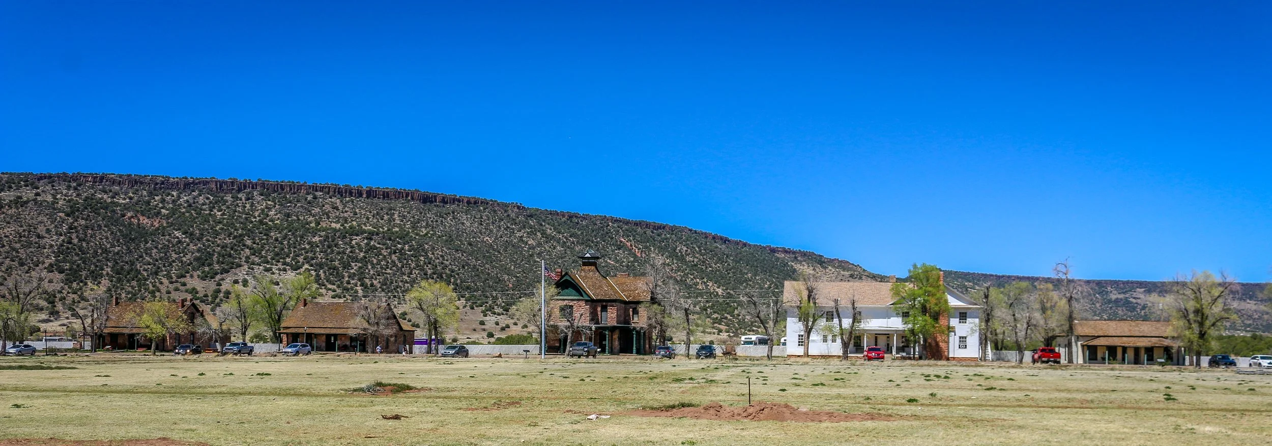
After sunrise and breakfast at the lodge on Sunday, I headed on down the road. After a brief stop at Pipe Springs National Historic Site, I drove on to St. George, Utah to catch up with my friend Jenny. Jenny worked at the same tour company that I did for a number of years and has continued guiding with other companies since. Right now she guides hiking and llama-packing tours, primarily in the Desert Southwest, and is also in the process of building out a small school bus to live in. I haven’t seen her in years and we spent the day catching up and talking about old times and new adventures and about our mutual friends and what they’re up to. I always enjoy her company and it was nice to have someone to chat with for a while. We had some tasty tacos and then went to a trailhead parking lot outside of town where we parked our vehicles side-by-side for the night.

1 Comment

Snapshots: Rio Grande del Norte National Monument

Comment

Snapshots: Rio Grande del Norte National Monument

Rio Grande del Norte is one of our more recent National Monuments, having been designated as such in 2013. It protects the confluence of the Red River and the Rio Grande which are both designated Wild and Scenic Rivers. Both gorges are gorgeous and the point of land above the confluence, called simply El Punto, provides amazing views from high above the two rivers. I hiked the Little Arsenic Trail while I was there, which brought me down to the Rio Grande and led me straight to the confluence. It was one of the better hikes I did during my stay in New Mexico and was very rewarding around every turn. I spent the night at the campground on the canyon rim and enjoyed a beautiful sunset in the evening and a magical sunrise the following morning. In between, the stars were spectacular. I debated whether to drive out to this park as it was somewhat out of the way, but I’m sure glad I did as it is stunning from end to end. If you’re ever in the area, you should as well. I hope you enjoy these photos from beautiful Rio Grande del Norte National Monument.

Comment

Snapshots: Red River - New Mexico's Classic Ski Town

Comment

Snapshots: Red River - New Mexico's Classic Ski Town

Shhh. This is one of the towns nobody wants me to tell you about. Red River is a stunning little ski town along the Enchanted Circle in Northern New Mexico. It looks a lot like a Colorado ski town, but smaller, quainter, cheaper and with that special New Mexico sense of enchantment. I was there on a beautiful spring morning when the sun was shining but the air was cool and crisp. Despite plenty of snow on the mountain, it was sadly closed for the season.

Native Americans have hunted up and down the Red River for centuries, but the town’s beginnings were as a mining camp in the late 19th century when gold, silver and copper were being pulled from the hills. The town boomed to a population of around 3000 by the turn of the century, and as the mineral deposits started to dwindle, Red River gained a reputation as a cool weather getaway and a trout fishing paradise.

Red River today has a year-round population of just around 500, but it will multiply many times over on winter weekends when the town is buzzing with vacationers. No matter where you are staying in town, you could probably walk to the slopes with the lifts taking off from right in the center of town. In the warmer months, the area is full of trails and fishing is still a major draw and the the high elevation makes it cooler than towns to the south, east and west. I loved my short stay in Red River and it is one of the towns that I will definitely be returning to in the future. I hope you enjoy these photos from Red River, New Mexico’s classic ski town.

Comment

Snapshots: Nara Visa - A Modern Day Ghost Town

40 Comments

Snapshots: Nara Visa - A Modern Day Ghost Town

Nara Visa, New Mexico got its start as a rail town when the Chicago, Rock Island and Pacific Railroad was being built around the turn of the 20th century. It was originally called Narvaez after a local family who had farmed in the area for decades, but was eventually anglicized to some degree to Nara Visa. Within a decade, the town had grown to include 4 churches, 8 saloons, a couple of hotels and a whole array of small businesses. In 1921, with a growing population of 651, a fine school was built and the Works Progress Administration helped add a gymnasium a decade and a half later. The depression took its toll on the town though and lean years were ahead for Nara Visa. By 1968, there were only 7 students enrolled at the school when it closed its doors for the last time. Today less than a hundred people call the town home, and none of the businesses from this once thriving little community are open. It’s easy to pass through Nara Visa and not see it at all. I’m glad I got out and had a look. It makes me sad when towns die, but the reality is that everyone leaves at some point, one way or another. It looks like times were good there once, and maybe will be again at some point in the future. It sure made for some nice photos though. I hope you enjoy these photos from Nara Visa - a modern day ghost town in eastern New Mexico.

40 Comments