Hello Everyone,
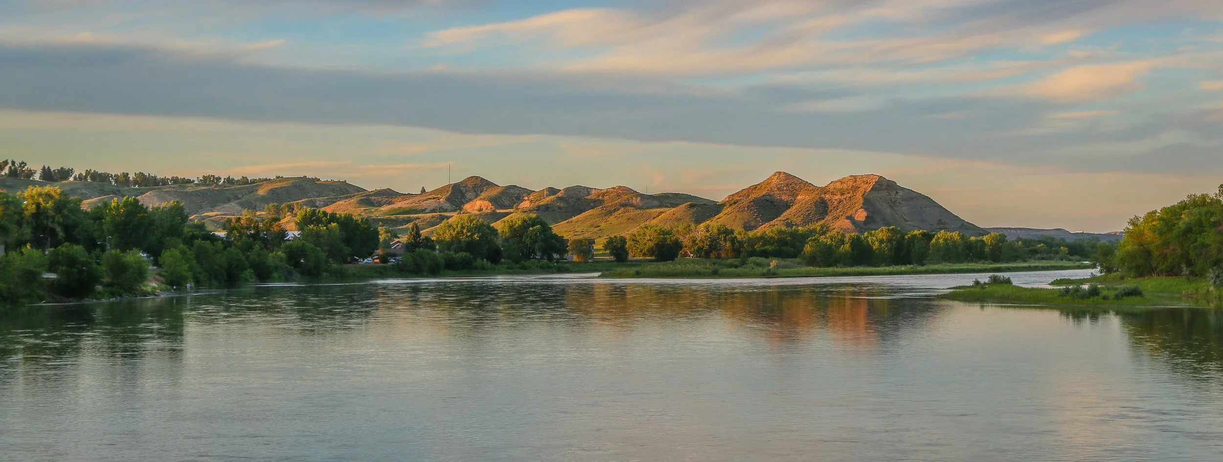
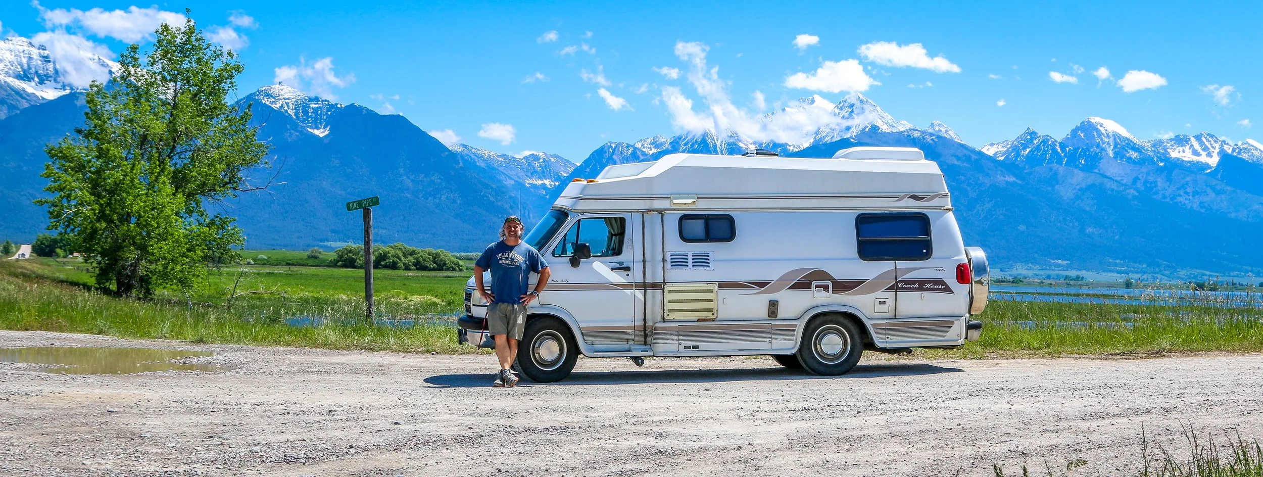
It’s been a hot week here in Montana. Two weeks ago it was snowing in Butte and two days ago we were hitting record high temperatures across the state. It’s been dangerously hot out, especially since I have no air conditioning in my van. I’ve been holed up here in Livingston for a few days and spent the last two nights in a nice, air conditioned hotel room. It was a nice break from the road and from the heat, but it’s frustrating to feel penned in and not be able to go exploring. It’s been a tough summer so far, and the heat is not making things any easier. I’m much better at dealing with the cold than dealing with the heat and my van is the same. That being said, I did get out and see some cool places this week and I’m very grateful to have some friends to hang out with this week, as that really makes a big difference in my morale. The heat should break in the next day or two, and then hopefully it will be a little easier going.
So after I finished up this post last week, I meandered down to the little local history museum there in Great Falls. It was a cute little museum with some interesting exhibits on the history of Great Falls, one called Spirits of Cascade County: Bootlegging, Bureaucracy, and Breweries, and one about feisty Montana women (their words, not mine). There were some cool bronze sculptures and some neat miniature building models as well. They also had a really interesting exhibit in what must have been some sort of event space on the historic Ozark Club, a black owned nightclub which had opened in Great Falls the day that prohibition ended and lasted until the owner’s death. After a nice visit to the museum, I did return to the Sip ‘n Dip Lounge to watch the mermaid in her pool behind the bar. Their tiki drinks were not very good, but the show was fun and I really enjoyed being there. Leaving the lounge, I wandered around downtown a bit and then called it a night.
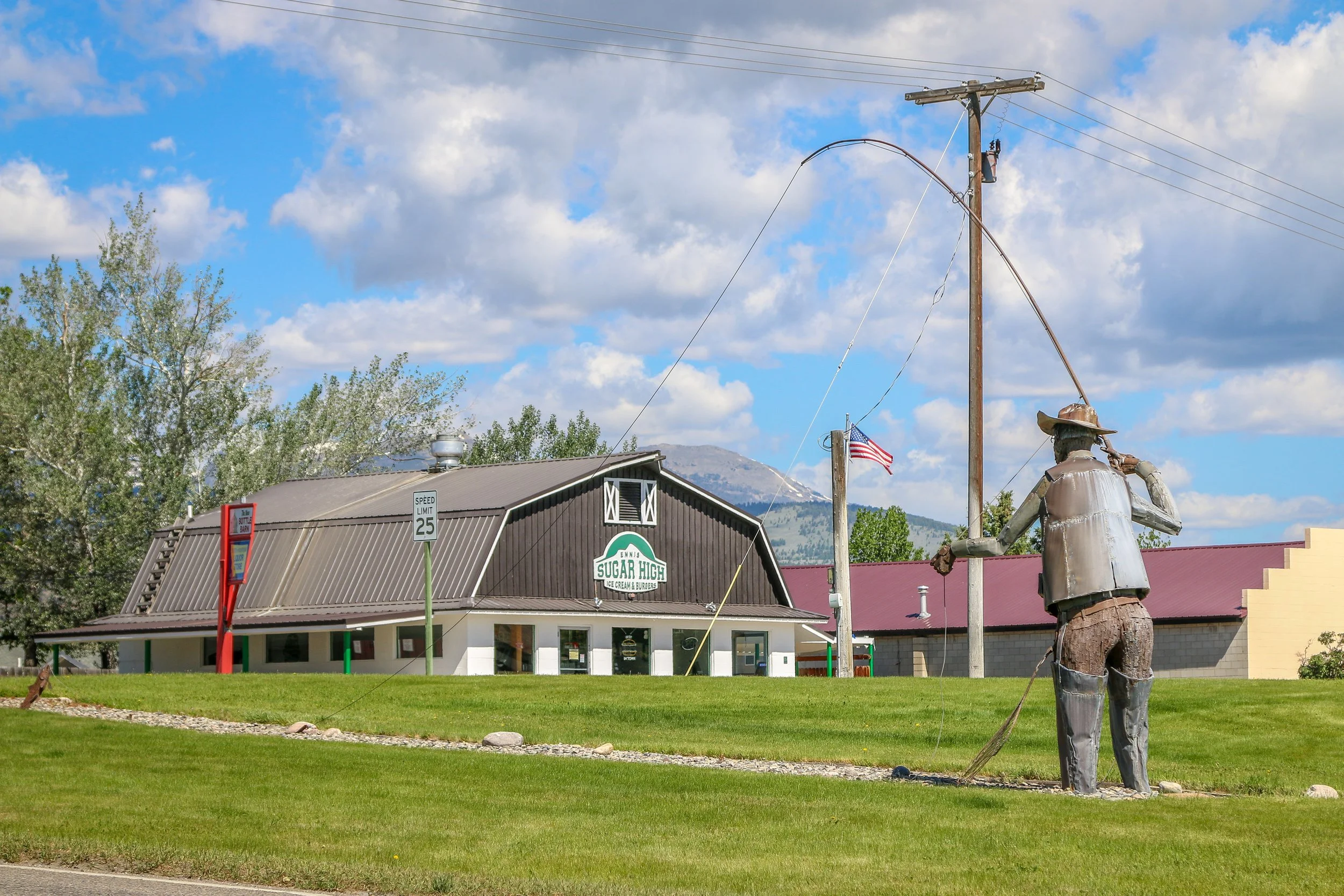
Located on the Madison River in Madison County, tiny Ennis, Montana is known for its abundant fly-fishing opportunities and public outdoor art. The area was originally settled in 1863 by William Ennis and the town that grew up there bears his name. I’ve been through Ennis a few times and always find it to be a quiet and charming little town. I hope you enjoy these photos from tiny Ennis, Montana.
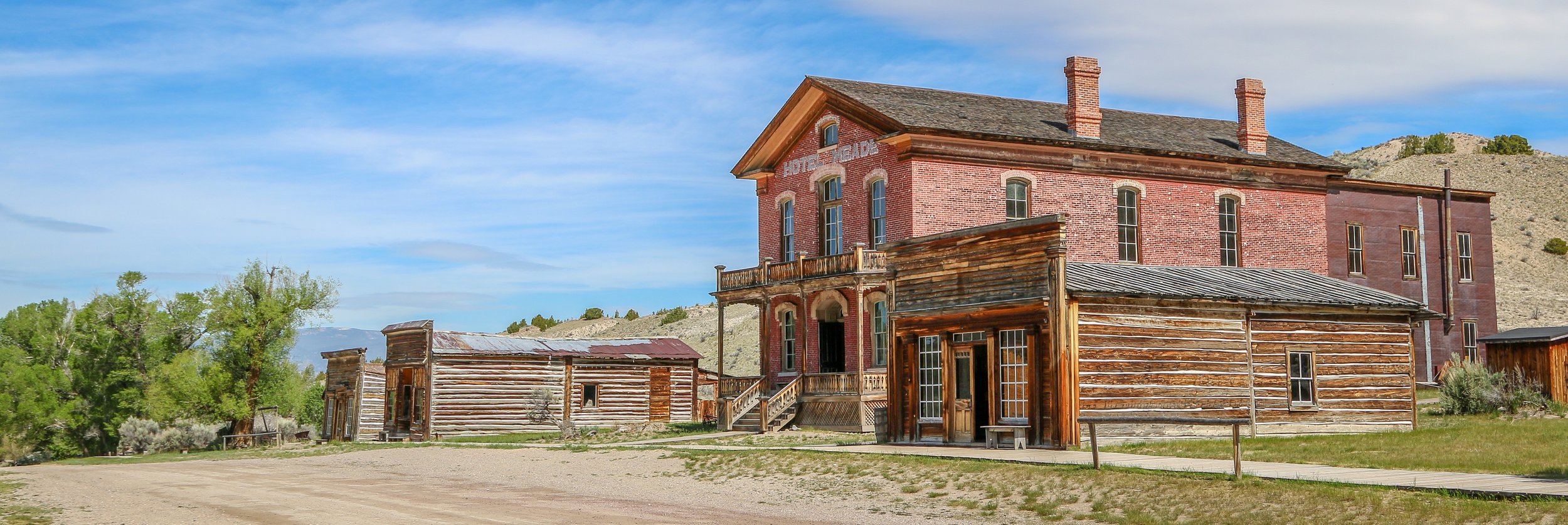
Gold was discovered on Grasshopper Creek in 1862 and the town of Bannack would quickly sprout up nearby, eventually growing to a population of over 10,000 people. Named after the local Bannock Indians, Bannack would serve as Montana’s territorial capital for 2 years before Virginia City took over the role. During its heyday, Bannack boasted three hotels, three bakeries, three blacksmith shops, two stables, two meat markets, a grocery store, a restaurant, a brewery, a billiard hall, and four saloons. In 1864, Bannack elected Henry Plummer as their sheriff. Plummer was the leader of a gang of outlaws known, ironically, as The Innocents, which prayed on supply wagons making their way between Bannack and Virginia and Nevada Cities. Eventually, a posse was raised in Virginia City known as the Vigilance Committee of Alder Gulch or, more simply, The Montana Vigilantes. They tracked down Plummer and his gang and lynched him in the middle of Bannack without a trial in 1864. Bannack’s population would fluctuate over the next hundred years with the price of gold, but the last resident left town in the 1970s. Thankfully a group of local residents stepped in to preserve Bannack and today it is a Montana State Park. I also thought it was cool that the Masonic Temple is still in regular use. I really enjoyed my time wandering the streets of town and I hope you enjoy these photos from beautiful Bannack, a classic Montana ghost town.
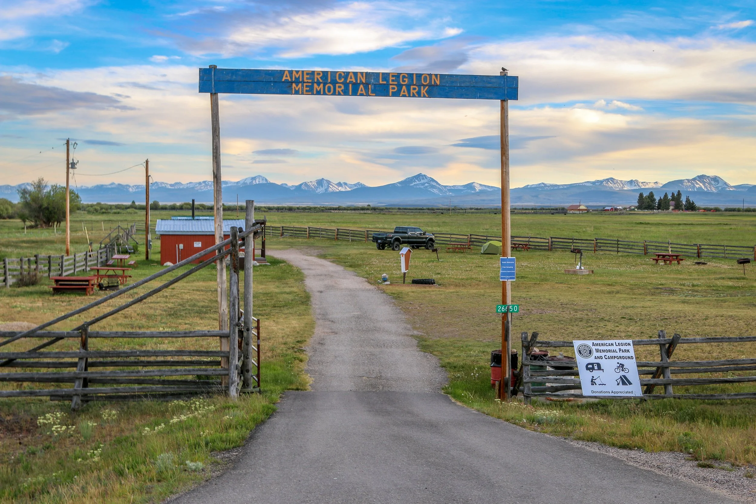
Tiny Wisdom, Montana takes its name from explorers Merriweather Lewis and William Clark’s name for the river which runs through town. Today we call it the Big Hole River, but who would change a town called Wisdom? It would seem unwise to me. Resting in the Big Hole Valley between the Pioneer, Anaconda and Beaverhead Mountains, Wisdom is also surrounded by Beaverhead-Deer Lodge National Forest. The Big Hole Valley is also known as the “Valley of 10,000 Haystacks” due to the ranching in the area which uses the beaverslide hay stacking technique developed nearby. There isn’t much to Wisdom, but I found it a pleasant place nonetheless. I stayed at the immaculate American Legion campground just outside of town and enjoyed a visit to the Antlers Saloon. My friend, Crystal, grew up in Wisdom and remembers it as a fun place when she was a child. Her grandmother owned several businesses in town and her brother still lives nearby. Today, Wisdom’s big draw is fly fishing, but it’s also along quite a popular cycling route. I hope you enjoy these photos from tiny Wisdom, Montana - a cute little town in the Big Hole Valley.
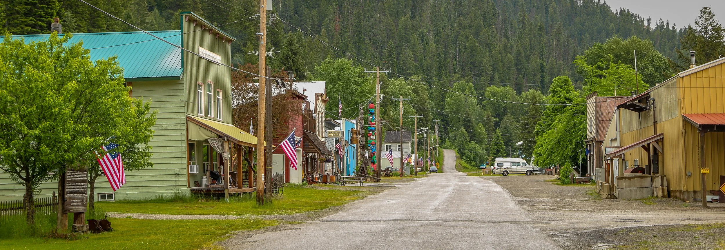
Gold was discovered along Prichard and Eagle Creeks back in 1882, sparking a small rush to the area. The town of Murray was established in 1884 and named for a local miner, George Murray. 5000 miners made their way to the valley, but the placer gold soon played out and the town’s population would drop to about 500 by 1910. Mining would continue in the area until the late 1950s. Wyatt Earp spent some time in Murray at the end of the 19th century. Perhaps the most loved and remembered citizen of Murray was the prostitute turned madam Maggie Hall, AKA Molly Burdan, AKA Molly B’Damn. Maggie was born in England to Irish parents and moved to New York in 1870. She came west a few years later and made her way to Murray during the gold rush in 1884. While quite a popular prostitute in town, Molly was also known and remembered for her kindness and generosity, being sure that everyone in town was fed and clothed. She died of tuberculosis in 1888 at the age of 34 and was buried in the town’s cemetery. Murray still celebrates their favorite lady every year during the annual Molly B'Damn Gold Rush Days.
There isn’t much to Murray these days, but what there is is fantastic. The Sprag Pole Inn and Museum is a sprawling complex stretching through several buildings and containing the personal collection of Walt Almquist. It displays everything from old matchbooks and cigarette packets to one of the world’s longest wooden chains. Down the road is the Bedroom Goldmine which has a plexiglass covered mine shaft in the back room. Guests were allowed to pan for gold until a flood washed out all of the support structures. I thought Murray was just the coolest little town and I’m glad I stopped to check it out. I hope you enjoy these photos of tiny Murray, Idaho, an old gold rush town in the Silver Valley.
Hello Everyone,
Greetings from Big Sky Country. It is wonderful to be back in the Rocky Mountains. I have just gotten to Montana and am really looking forward to my pending exploration of this fascinating and beautiful part of the country. This last week brought me north through the Idaho panhandle, where I explore some beautiful lakes and cute little towns along the way. I got a couple of short hikes in and have had some time to relax and catch up with a friend as well. It’s been overcast and drizzly for most of the week, but it has cooled off significantly, so I’m not going to complain. I would have loved to have taken my photos of some of these towns under blue skies, but I’ve been enjoying them nonetheless. Before I tell you what’s to come here in Montana, let me tell you what I got into with my last few days in Idaho.
After finishing up this post last week, I went out and took a walk around downtown Pullman, Washington. There was a cool old train depot, some nice bridges and a fabulous used bookstore which is one of my weaknesses. I also went up to see an old pioneer cemetery in town which had graves from the 1890s and was hidden away in a residential neighborhood. I crossed back into Idaho and took a stroll around Moscow as well before hitting the road north.
I dropped into a little town called Potlatch to see their historic train depot and then continued north to Saint Maries, a cute little town sitting at the confluence of the Saint Joe River and the Saint Maries River. The town was named by the locally famous Jesuit missionary Father Pierre DeSmet during the 1840s.
Mount Angel got its start as Roy, Oregon back in 1850. Thirty years later, Reverend Adelhelm Odermatt arrived with a group of Benedictine monks from Engelberg, Switzerland. Together, they established an abbey, a church and a school and were soon joined by a group of settlers from Bavaria. When a post office was established, they took the name “Mount Angel” which is the English translation of the town Engleberg. This sleepy little town of about 4,000 people grows a hundredfold each fall as tourists from around the world arrive for their annual Oktoberfest celebration. Mount Angel built their glockenspiel in 2006 and it is apparently the largest in the United States. It was a joy to watch when it came to life and on a quiet Sunday afternoon, I was the only one there to see it. There are some great old buildings and some beautiful cast iron signs and signposts around town which I have to believe came from the local Windischar's General Blacksmith Shop. I especially enjoyed the beer at the Benedictine Monastery’s wonderfully named St. Michael Taproom and will have to visit the monastery itself on my next visit. I definitely enjoyed wandering the streets of this little Bavarian town in the heart of the Willamette Valley and would absolutely recommend a stop to anyone passing through the area.. And if you’re there in September, you’ll be in for a real treat as their Oktoberfest looks like a heck of a good time. I hope you enjoy these photos from quaint and picturesque Mount Angel Oregon, the Willamette Valley’s Little Bavaria. Prost!
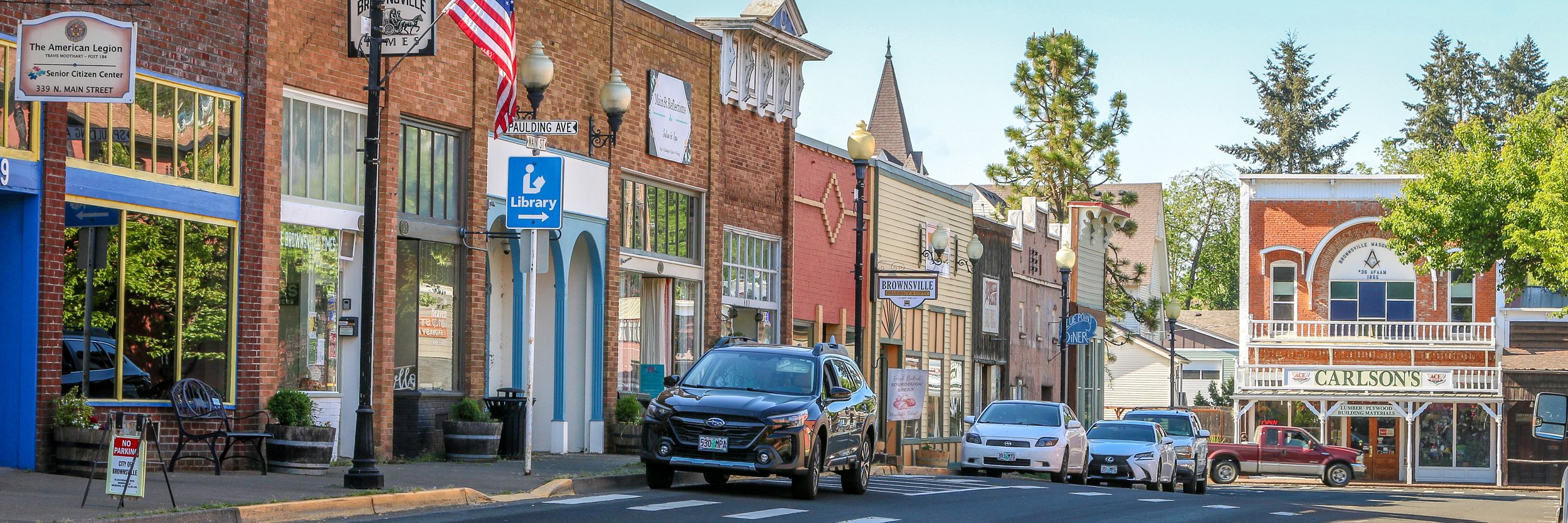
Driving into historic Brownsville, Oregon put a huge smile on my face. I first saw the movie Stand By Me as a teenager, and I had read the Stephen King novella The Body even earlier. This coming-of-age story of four boys navigating adolescence in the small town of Castle Rock (Maine in the novella, Oregon in the movie) really moved me. I’ve seen it dozens of times in the intervening years and Brownsville was where it was filmed. The whole town felt so familiar to me and it really is a quintessential small town and the perfect location for the movie to have been filmed in. I loved just walking the streets and taking it all in and I had a beautiful day to be there. I went to Pioneer Park and watched some young people playing baseball which was fun (the park was the scene of the pie-eating contest in the film with locals used as the extras in the scene). I enjoyed a great lunch at Randy’s and dinner at the Brownsville Tavern and just really enjoyed my visit. I even sat in my van and watched Stand By Me while I was there. I’m not the only person who visits Brownsville because I’m a fan of a 40 year old movie. They even have an annual festival to remember and celebrate the film. If you’re ever cruising through Linn County, pop in and have a look around. It’s a wonderful town full of wonderful people and I’m sure they’ll be glad to have you. Enjoy these photos from Brownsville, Oregon which will always be Castle Rock to me.
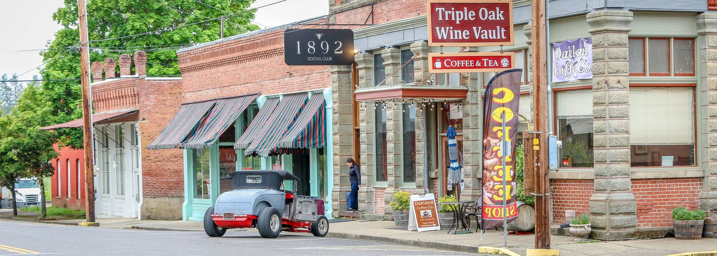
Pulling through Oakland, Oregon on an overcast spring morning, I caught a glimpse of a great, old Bull Durham Tobacco ghost sign next to a vacant lot. Turning onto Locust Street so I could hop out and take a photo of the sign, I found myself in the middle of a delightful historic district. Back in 1846 as westbound emigrants were making their way down the Oregon Trail, the last obstacle they faced was one of their greatest: navigating the treacherous Columbia River Gorge. A party led by Scott Applegate pioneered a cutoff from the trail to avoid the river and the Applegate Trail was born. Following this trail, the Campbell and Cornwall families ran into winter conditions before reaching the Willamette Valley and ended up settling right where they were. Their settlement would eventually grow into the town of Oakland. When the railroad arrived in 1872, Oakland would grow into a transportation hub. Stearns Hardware opened in 1887 and has been going ever since. Over 80 of the buildings in town were built between 1852 and 1890 which led to Oakland being the first city placed on Oregon’s historic register back in 1968. I didn’t stay in Oakland long, but it really made an impression and I hope to return in the future. For a small town, it sure seemed to have a lot to offer. I hope you enjoy these photos from historic Oakland, Oregon.
I was very excited to have a whole day to check out some of the many waterfalls flowing into the North Umpqua River as I made my way down Route 4 from Crater Lake to Roseberg. I love everything about waterfalls - from the spray on my face to the sound they make as they roar over the rocks. They are also among my favorite things to photograph as they really are magical, especially with a nice long exposure. The day I made this journey I visited six waterfalls: Clearwater Falls, Whitehorse Falls, Watson Falls, Toketee Falls, Fall Creek Falls and Susan Creek Falls, Toketee was probably the most stunning of the six because of its setting, but Fall Creek Falls sure did take a good photo. I also really loved Whitehorse Falls and I think my favorite photo is the one I saved for last. The lush green surroundings of Clearwater Falls made me hang around for a while, and the sheer drop of Watson Falls was simply awesome. Susan Creek Falls was in a great setting, too and it was truly stunning. It’s hard to have a bad day when you’re out chasing waterfalls, and I hope you enjoy these photos from the spectacular Umpqua Canyon.
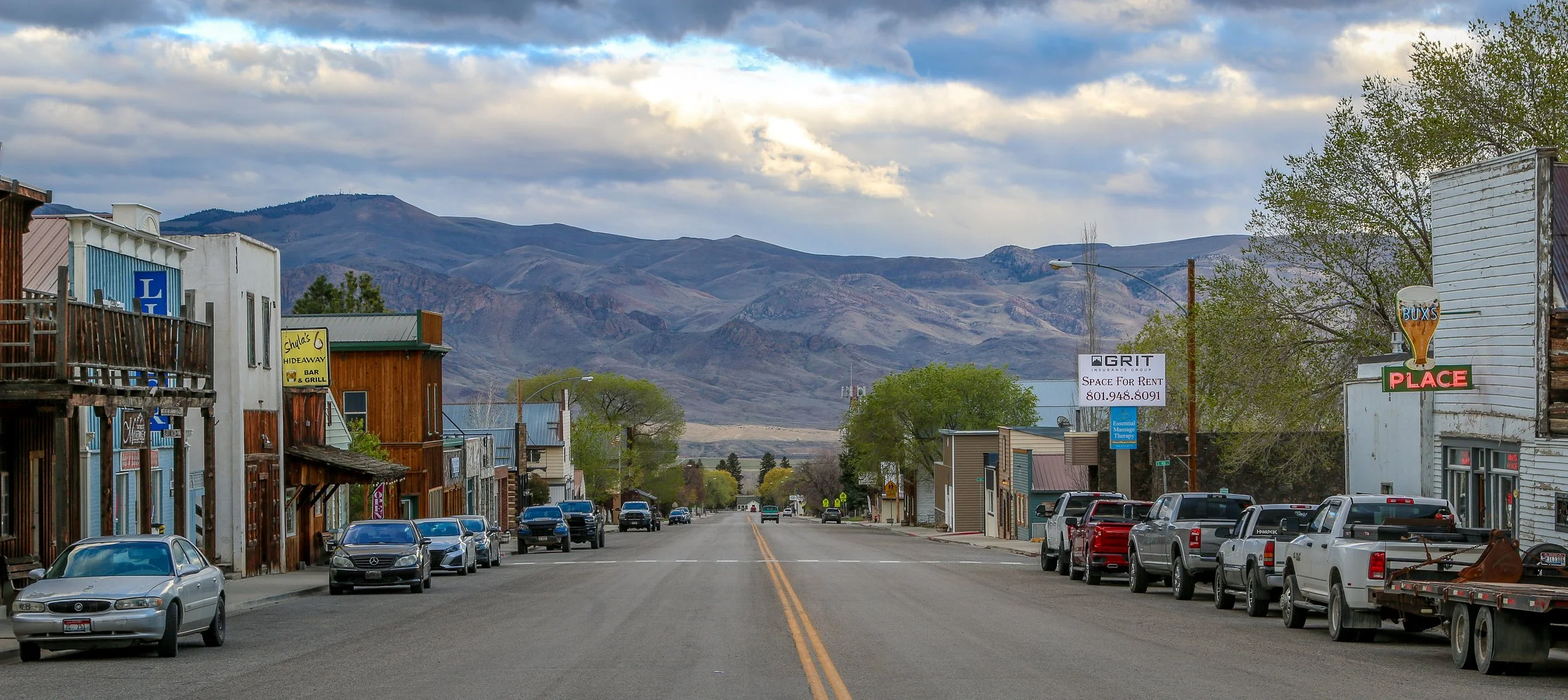
I had planned on spending an hour or two in tiny Challis, Idaho, but ended up there for the better part of the week. My van had a bearing act up on the way into town which is never a good feeling, but thanks to good luck and good karma, I found two excellent mechanics to get us back on the road. John and Scott took good care of my van and became friends along the way, but the age of my van and the remoteness of Challis meant we had to wait a few days for parts to come in. I passed much of that time at the town’s wonderful library, reading in the park or hanging out at Shyla’s Hideaway or Bux’s across the street. All of these things were a blessing and I’m truly grateful to have landed in such a pleasant little town during a time of distress.
The land on which Challis would come to occupy was once the seasonal hunting ground of Shoshone and Nez Perce Indians. Fur traders came through in the early 19th century looking for beaver, and the ranchers that still occupy the area would follow. But, like so much of the west, it was a gold strike that caused the area to really take off. Gold was discovered in 1873 on the Yankee Fork of the Salmon River and miners rushed in from all corners of the globe, inevitably followed by saloonkeepers, shop owners and prostitutes who relied on the miners’ trade. Challis was founded in 1878 and named after the man who surveyed the townsite. It became a central supply town for the surrounding mines, a role it still fills today. With a population of just over a thousand people, Challis is the largest town and the county seat of Custer County. I wish I had taken more photos while I was there as it is quite a scenic town, but I had a lot on my mind and wasn’t in the mood. I did take some though, and I hope you enjoy these photos of Challis, the gateway to the Yankee Fork.
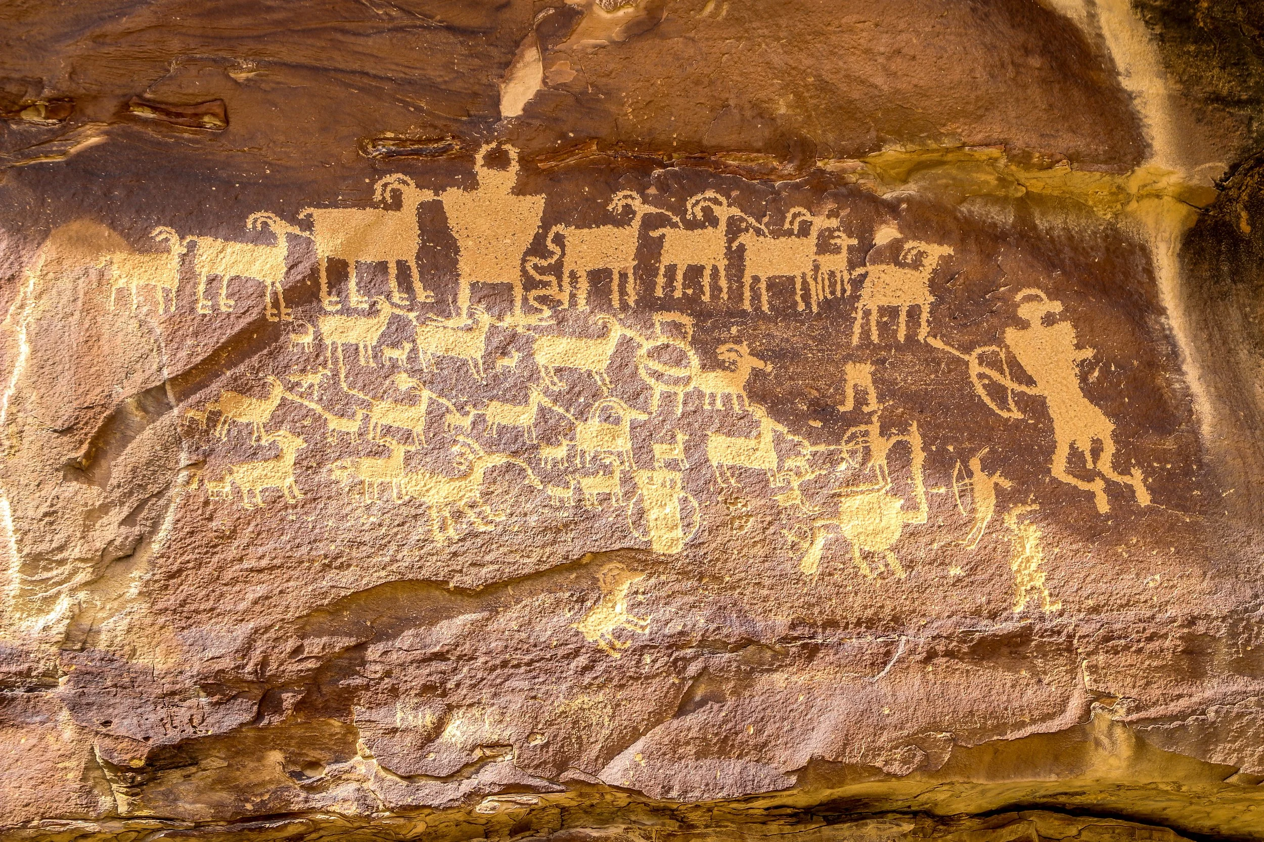
Nine Mile Canyon as often been called “The World’s Longest Art Gallery”. Despite its name, the canyon stretched 46 miles through east central Utah and has as many as 10,000 petroglyphs along its course. This route has been traveled for thousands of years, undoubtedly beginning as a wildlife trail which followed the easiest path through the mountains. It was used by a people we refer to as the Fremont People for many hundreds of years and they are responsible for most of the petroglyphs chipped into the canyon walls. Later, Ute Indians made their way through the canyon and made their own carvings, including those of horses and bison. Fur trappers and settlers followed the old Indian trails. The Nine Mile Canyon Road was originally built by the Black Buffalo Soldiers of the Ninth Cavalry to connect old Fort Duchesne to the railroad at Price. Once the road was complete, stagecoaches started using the canyon to deliver mail and freight and settlements began to spring up. Later, mining and natural gas extraction began in Nine Mile Canyon and continues today. Nobody knows how 46 mile long Nine Mile Canyon was named. Many people believe that explorer John Wesley Powell named it because the name first appears in his journals, but Powell was pretty good at naming things so I’m not buying that explanation. Also, I love a good mystery and don’t mind when one goes unsolved.
I started my drive from Wellington, just south of Price. The road is paved all the way to the Great Hunt Panel (and beyond if you continue up the side canyon), but has a stretch of decently maintained gravel road if you want to continue through to Myton (which I did). I loved seeing so many wonderful petroglyphs in such a small area and I know I only scratched the surface (pun intended) of what was out there. My favorite is the first one pictured below: Coyote Placing the Stars. I also loved the Owl Panel and the Juggling Man and of course the Great Hunt which is one of Utah’s most famous panels. There were a lot of old homesteads along the way and even an old townsite once called Harper but abandoned over a hundred years ago. There are some beautiful new homes out there as well and aside from the mining trucks rumbling past I imagine it’s pretty quiet out there most of the time. I really enjoyed my day out in Nine Mile Canyon and I hope you enjoy these photos I took along the way.