Thief River Falls gets its name from the falls at the confluence of the Red Lake River and the Thief River (which traces its name back to a conflict between the Ojibwe and Dakota people). These falls made navigation by boat impossible beyond this point, so a town was born here in 1887. Thief River Falls was originally a lumber town and then shifted to wheat farming, but it really took off when the Great Northern and Soo Line railroads came to town in the end of the 19th and beginning of the 20th centuries respectively. The rivers and railroads still power the local economy today and Thief River Falls is also the home of an Arctic Cat Snowmobiles plant. Thief River Falls has a population of around 8,600 people today and it really put on a show for me during my visit. The temperature hovered around 70 degrees under sunny skies and the sunset was absolutely spectacular. I hope you enjoy these photos from my visit to beautiful Thief River Falls, Minnesota.
South Haven, Michigan is a charming little port town where the Black River flows into Lake Michigan. Originally inhabited by the Potawatomi people, the first settlers arrived in the 1850s. Like many towns along this coast, South Haven started out as a lumber town, supplying the trees to build the towns as the United States expanded westward. As the trees were cleared, farmers took advantage of the open fields to plant fruit, and the area grew to be a major supplier of fruit to the Great Lakes region and beyond. Today there is still plenty of traffic moving up and down the Black River and in and out of Lake Michigan, but South Haven has also made tourism a major industry. The beach is warm and welcoming, the downtown area is clean and lively and there is definitely plenty to keep you busy on a short or long stay. Of course, sunset is the highlight of every day along the Sunset Coast of Michigan. I was there over the 4th of July weekend and while it was probably busier than usual, South Haven maintained its small-town cool and handled the busy weekend well. I really enjoyed my stay in South Haven and hope you enjoy these photos from my visit.
Tiny Marshall, Michigan sure has a lot to see in a very small area. Most of the downtown area is part of the National Historic Landmark District which includes over 850 buildings, a staggering amount for a town of just 7,000 people. It is not easy to maintain a town in the condition Marshall is in, and I really take my hat off to those who are working so hard to keep it the way it is.
Marshall was founded in 1830 and grew as a transportation hub catering to road, rail and river travelers with several historic inns and restaurants in the city dating back to those early days. The town was named for U.S. Supreme Court Justice John Marshall and of the more than 20 towns named after Marshall, this was the only one so-named before his death. Marshall became an early innovator in the public schools movement and their model was copied across the country. The town was also one of the final contenders to become the State Capital when it was moved from Detroit, but lost out to Lansing in the end.
Today, Marshall is incredibly well maintained. I loved that I could pick up a map outside of their tourism office at any time of day and the music playing on the street made me smile. There were historic walks laid out on the map, and markings on the sidewalks to help guide you along. The buildings downtown were well preserved and some truly transported me back in time. The homes in the surrounding neighborhood were equally historic and also well cared for. My favorite was Honolulu House which offered a wonderful guided tour. I came to Marshall planning on spending an hour and ended up there for more than half the day. It was definitely the cutest town I saw in all of southern Michigan and I am definitely looking forward to returning in the future. If Marshall isn’t on your list of Michigan small towns to visit, it certainly should be. I hope you enjoy these photos from beautiful Marshall, Michigan.
A few weeks ago I had the wonderful opportunity to go and spend a week with my brother in southern New Hampshire. We went out to explore some of the most beautiful parts of the area by car, by boat and on foot. The fall colors were just starting to kick into high gear, and some of the scenes we saw were truly spectacular. We saw covered bridges over the Ashuelot River, lakefront vistas at Lake Winnipesaukee, and charming small towns like Peterborough and Amherst. I took a lot of photos, and this is the first of at least two posts which will allow you to see the area through my lens. I hope you enjoy these photos from fabulous southern New Hampshire.
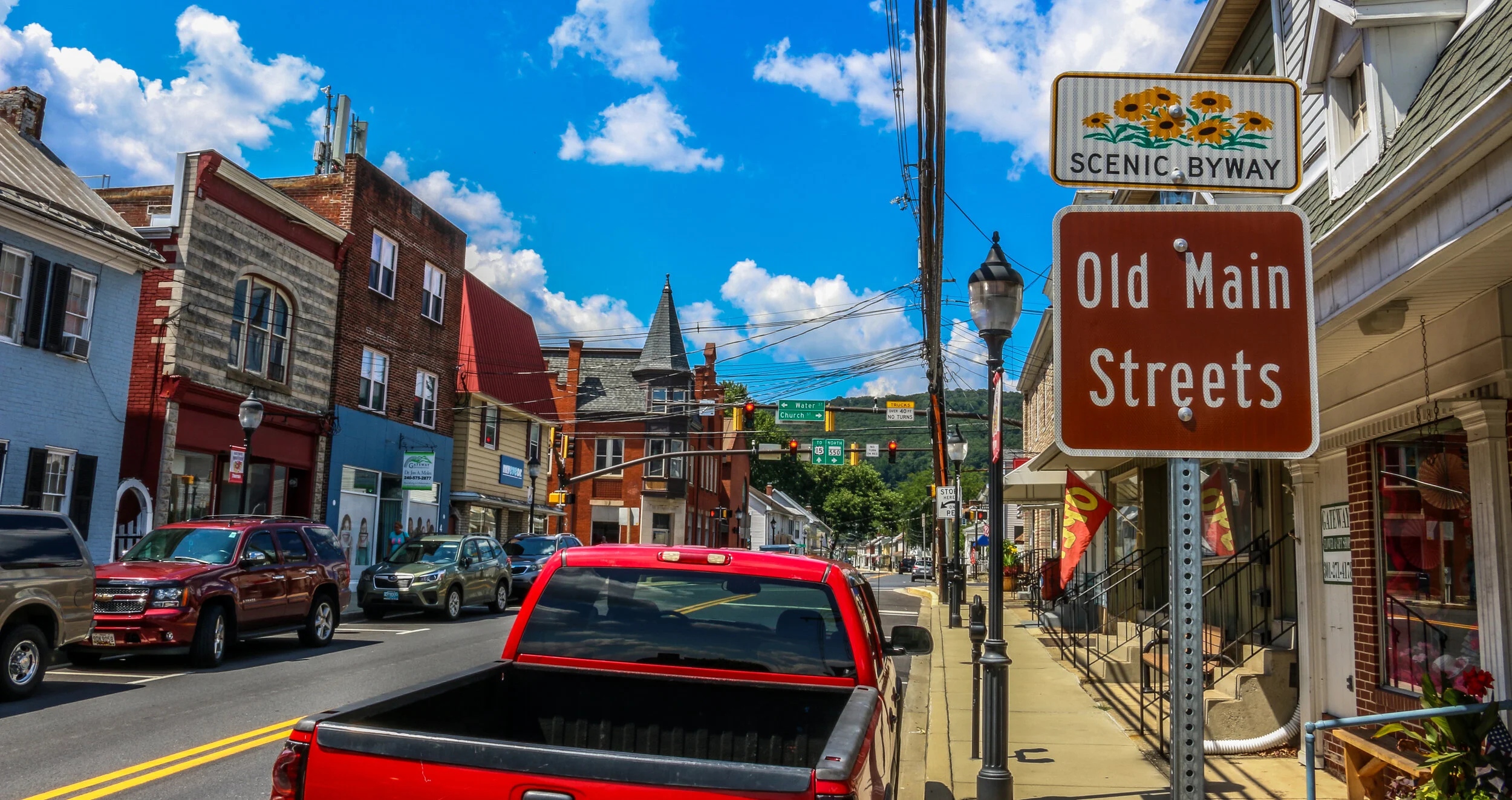
Maryland’s Old Main Streets Scenic Byway is a wonderful trip through some of the state’s most charming and historic towns. The byway begins in Emmitsburg where Maryland’s Catholic roots are on display at the incredible National Shrine to Our Lady of Lourdes and the Minor Basilica Shrine to St. Elizabeth Ann Seton. Both are beautiful places worth spending some time and it was definitely interesting to learn about Elizabeth Seton, the first person born in what would become the United States to be canonized by the Catholic church.
From there, the byway travels through historic Taneytown and on to Westminster, although since we were a bit pressed for time we headed straight to New Windsor. New Windsor is such a cute little town with beautiful Victorian homes and pleasant small-town feel. We stopped to pick up lunch at Uncle Matty’s Eatery and enjoyed it in the town’s small park.
After lunch we traveled on to Union Bridge where the beautiful old railway station has been converted into a museum. It was another quiet and pleasant town for a wander. The byway finishes in Thurmont with it’s beautiful old Main Street. log cabins and the Roddy Road Covered Bridge.
The Old Main Streets Scenic Byway is a pleasant way to while away a day and enjoy some small-town Americana. There are wonderful historic homes and businesses along the way, and it seemed like there would be some interesting museums under normal circumstances. I hope you enjoy these photos from the Old Main Streets of Northern Maryland…
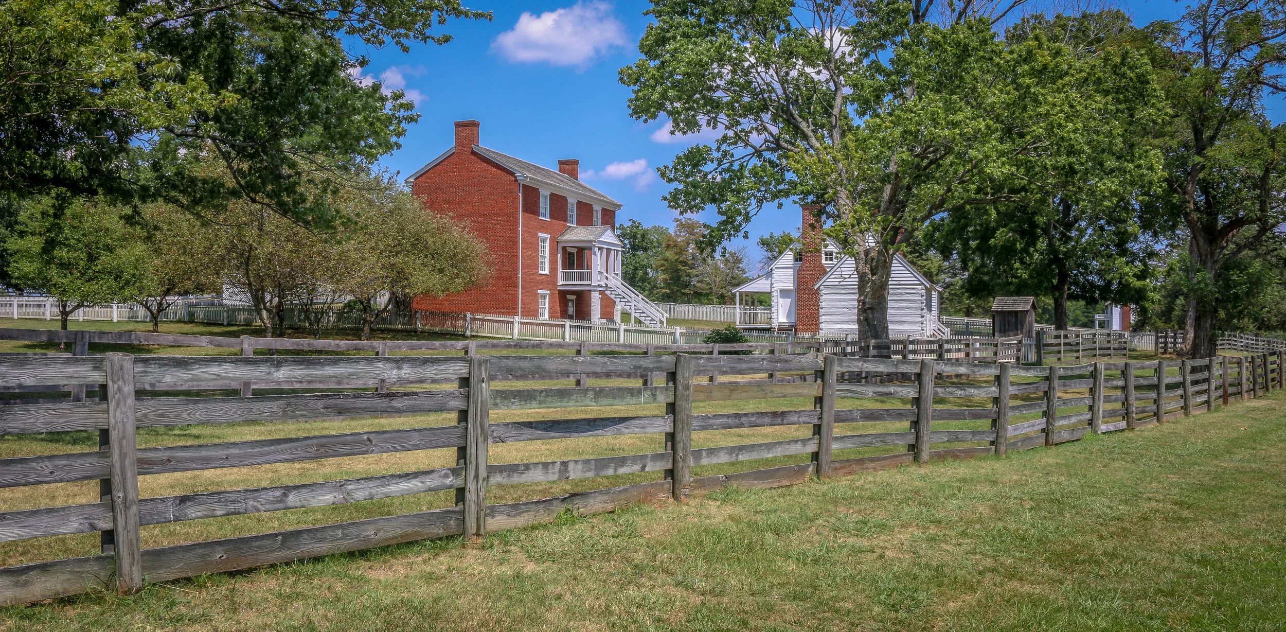
The photos below come from a recent visit to Appomattox Court House National Historical Park near the town of Lynchburg, Virginia. It was the site of the surrender of the Army of Northern Virginia which effectively ended the American Civil War.
After the siege of Petersburg and the fall of the Confederate Capital at Richmond, General Robert E. Lee led his Army of Northern Virginia west with the hopes of turning south to North Carolina and joining with General Joseph Johnson’s army there. They moved towards the train depot at Appomattox Station hoping to find much needed supplies waiting for them there. Union General Phillip Sheridan and his cavalry arrived first, capturing the supply trains and forcing Lee to turn his thoughts towards Lynchburg instead. Surrounded by Union troops, they made one final push at dawn on April 9th, 1865. It didn’t take long to realize that they were surrounded and Lee called for a meeting with Ulysses S. Grant to discuss the terms of surrender.
The site chosen for this conversation was the home of Wilmer McLean in the tiny village of Appomattox Court House. The generals met in the parlor, recreated above, to hammer out the details. The terms offered were very generous as the Confederate soldiers were to be immediately paroled and even allowed to keep their horses and sidearms. Their parole papers were printed in the nearby Clover Hill Tavern. The Southerners marched into town, stacked their rifles, turned over their cannons and marched out. While the surrender of Lee’s Army of Northern Virginia was not the end of the Civil War, there was little chance or hope for the Southern cause in its aftermath. The war would technically drag on until early summer, with skirmishes across the south, but the surrender at Appomattox Courthouse was the beginning of the end. Four long years of fighting which cost over 600,000 lives was finally nearing its conclusion…
Hollywood Cemetery is a beautiful, sprawling old cemetery overlooking the James River just west of downtown Richmond. Established in 1849, Hollywood Cemetery is the final resting place of two U.S. Presidents, James Monroe and John Tyler, and Jefferson Davis, the only President of the Confederacy. Also buried at Hollywood are 28 Confederate Generals including JEB Stuart and George Pickett as well as a considerable number of Confederate soldiers, both known and unknown. The Monument of Confederate War Dead is found there as well in the form of a 90 foot pyramid dedicated in 1869.
We enjoyed our visit to Hollywood Cemetery and spent several hours there. It has quite a history and some beautiful examples of funerary art. The President’s Circle includes the two presidents mentioned above and local celebrity burials as well. The south side of the cemetery offers beautiful views of the James River and Downtown Richmond. We used the Girl Scout Self-Guided Tour Pamphlet (found HERE) to help us find our way around. It can be tricky, but it’s not big enough to get really lost. I hope you enjoy these photos from Hollywood Cemetery.
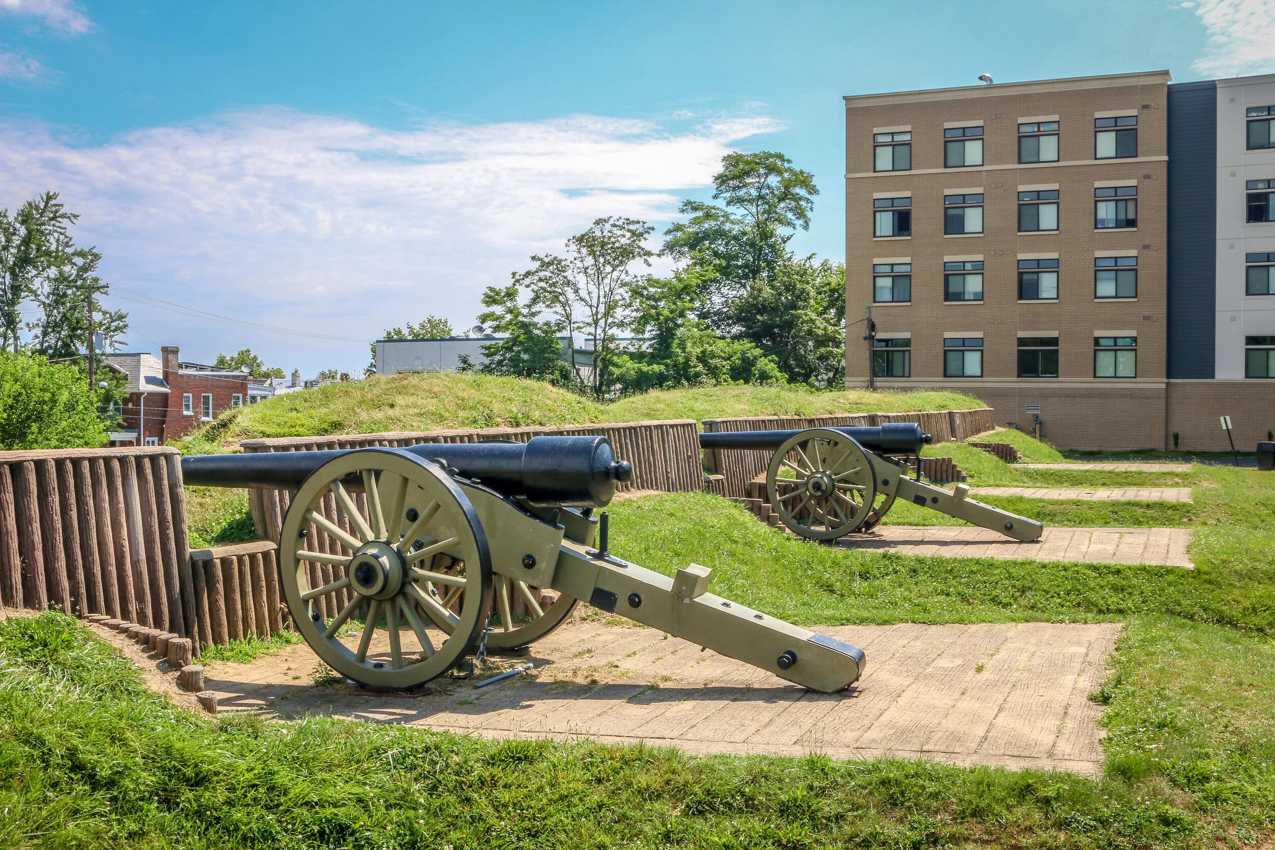
The photos below come from a recent visit to Fort Stevens in Washington D.C. - site of the only battle fought inside D.C. during the Civil War, and of Battleground National Cemetery up the street. The final photo came from Grace Episcopal Church in Silver Spring, MD. Civil War Chronicles will trace the major battles of the Eastern Theater of the war through photos and brief histories.
After overcoming Union General Lew Wallace and his men at the Battle of Monocacy on July 9th, 1864,, Confederate General Jubal Early continued his march towards the Capital of Washington D.C. The Confederate soldiers made the march in two days. Thankfully, Wallace had delayed the Confederates long enough for General Grant to send reinforcements via steamship from Richmond who soon took up position in the northern section of the circle of forts surrounding the city. Fort Stevens guarded the 7th Street Pike, one of the main roads into the city (now Georgia Avenue).
The armies exchanged fire on July 11th and 12th, but Early felt the city was too heavily defended to mount a full scale attack. Both sides lost men in the skirmishing, but casualties were relatively light by Civil War standards. Notably, President Abraham Lincoln came to Fort Stevens on July 12th with his wife, Mary. The two came under fire, the only time in American history that a sitting president was in the direct line of enemy fire. A memorial stone on the parapet marks that location today. That evening, Early would withdraw his men through Maryland and cross the Potomac back into Virginia, marking the end of the final Confederate attack into the North. They paused briefly en-route to bury 17 of their dead comrades at Grace Episcopal Church in Silver Spring…
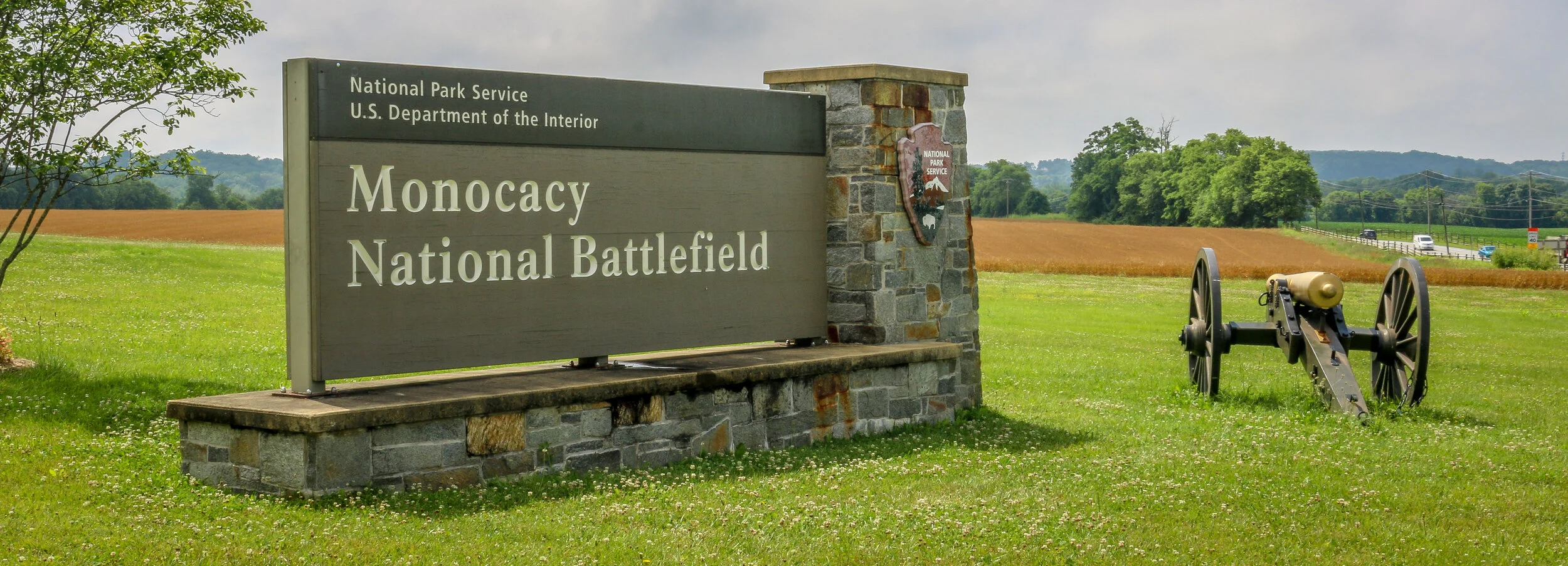
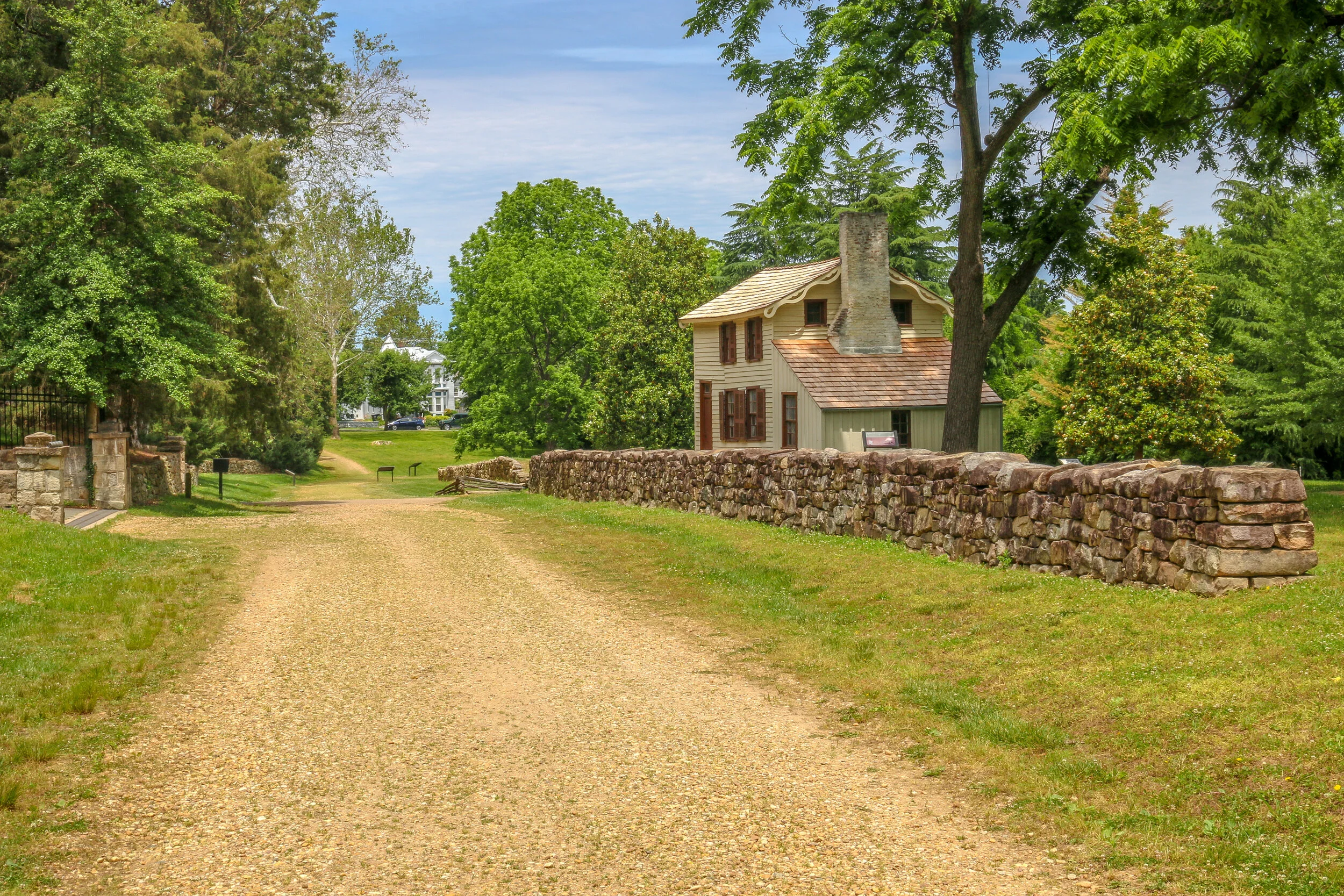
The photos below come from a recent visit to Monocacy National Battlefield Park just south of Frederick Maryland - site of the “Battle that Saved Washington”. Civil War Chronicles will trace the major battles of the Eastern Theater of the war through photos and brief histories.
The Battle of Monocacy is a bit of an outlier in that it wasn’t really a major battle of the Eastern Theater of the Civil War, but a minor one with major implications. While Generals Grant and Lee were engaged in the final grappling of the war around Petersburg, south of Richmond, Lee wanted a distraction to pull some of Grant’s army away. He attempted this by sending General Jubal Early to go on the offensive and attack into Union territory, the third Confederate invasion of the North during the war. Early was sent with 15,000 men to threaten Washington D.C. and, if possible, to raid the prison camp at Point Lookout and free the Confederate soldiers being held there. Lee also knew that a presidential election was looming and he hoped that another invasion of the North might bring about the defeat of Lincoln and a favorable end to the long and brutal war.
Early’s army crossed the Potomac River into Maryland on the 4th of July, 1864 and marched past Sharpsburg, the site of the Battle of Antietam two years earlier. You can’t march 15,000 infantry troops across a state without anyone noticing, and word quickly got to General Lew Wallace who was then the Union commander in Baltimore. Wallace gathered what men he could muster and quickly set off towards the west. Thinking quickly, Wallace decided to head towards Monocacy Junction, just south of Frederick, Maryland. He didn’t know where the Confederates were headed, but this point would allow his troops to defend the Georgetown Pike to Washington, the National Road to Baltimore and the Baltimore and Ohio Rail Line. If he got there first, he could strategically place his men along the Monocacy River and defend all three of those routes which crossed the river at that point. He arrived in time to dig in and establish a line of defense.
The photos below come from a recent visit to Fredericksburg and Spotsylvania National Battlefield Park, which also includes the Battles of Chancelorsville and The Wilderness. Civil War Chronicles will trace the major battles of the Eastern Theater through photos and brief histories.
It had been almost a year since the horrific battle of Gettysburg, and in the interim President Lincoln had turned command of the Union Army over to General Ulysses S. Grant. Grant would lay out a plan to attack the confederacy on many fronts including Sherman’s march towards Atlanta and an attack on Mobile, and Grant himself would ride with General George Meade’s Army of the Potomac. Their goal was to bring the war back to Virginia and keep the pressure on General Lee and his Army of Northern Virginia. This Overland Campaign would be a war of attrition and would bring the war to new levels of horror but ultimately lead to Lee’s surrender at Appomattox.
On May 4th, 1864 the Army of the Potomac crossed the Rapidan River and engaged Lee’s army in an area called The Wilderness. Apparently the area today bears little resemblance to what it did at the time when new growth underbrush made movement difficult, artillery less effective and confusion the norm. Fierce fighting took place on the scattered farms in the area which allowed for some open space in which to maneuver, but most of the battle took place in the dense forest. On May 6th, the Union Army had taken the upper hand and Lee’s men were in grave danger of being overrun on the widow Tapp’s farm. In a scene from the movies, Longstreet’s reinforcements arrived at just the right moment and Lee was prepared to lead them into battle himself, but the Confederates wouldn’t allow it and moved him quickly to the rear. After two days of heavy fighting neither side had gained a decisive victory. Unlike his predecessors, Grant didn’t pull back but rather pushed forward, ordering a night march towards the town of Spotsylvania Court House. His plan was to get between Lee and the Confederate Capital at Richmond. Sensing this move, Lee ordered his men to move that night as well.
The Battle of Gettysburg which took place from July 1st-3rd, 1863 would be the bloodiest battle of the Civil War. 170,000 men would clash over those three hot days in July and over 50,000 would end up dead, captured, wounded or missing. While both armies were looking for a fight, neither expected it to be in this tiny Pennsylvania town.
After his dramatic victories at Fredericksburg and Chancellorsville, General Lee decided to once again push north into Union territory. He wanted a decisive victory on Northern soil to try and force President Lincoln to the negotiating table. Lee marched his Army of Northern Virginia north, crossed the Potomac River and moved through Maryland and into Pennsylvania. The Union’s Army of the Potomac, still under the command of General Hooker, pursued. By the end of June, General George Meade had replaced Hooker at the helm…
The photos below come from a recent visit to Gettysburg National Battlefield, the site of the bloodiest and most well known battles of the war. Civil War Chronicles will trace the major battles of the Eastern Theater through photos and brief histories
After being turned back south after the Battle of Antietam, Confederate General Robert E. Lee marched his army back to Virginia. Union General George McClellan was replaced by General Ambrose Burnside to command the Army of the Potomac, and President Lincoln urged Burnside to pursue the Army of Northern Virginia deep into the state and attack the Confederate Capital at Richmond. The major obstacle lying in their way was the Rappahannock River.
Burnside arrived at Stafford Heights overlooking the river and the small town of Fredericksburg in mid-November, 1862. He had sent orders to have pontoons at the ready to provide a means of bringing his army rapidly across the river. Tragically for Burnside and his men, the pontoons didn’t arrive for several weeks. Instead of crossing the river in boats or rafts, he chose to wait for the pontoons. By the time they got there, Confederate troops had dug in on the high ground south of the city called Marye’s Heights and behind a stone wall along a sunken road to the front of this position.
Union engineers worked through the night of December 10th to assemble the pontoon bridge, but their progress was slowed by Mississippi sharpshooters in town. A small group of Union soldiers crossed the river in boats and fought a battle to secure the streets of the town. They finally secured the town in late afternoon on the 11th, but it was winter and the daylight soon gave out. The bridge would be completed and most of the army would cross it on December 12th.