Hello Everyone,
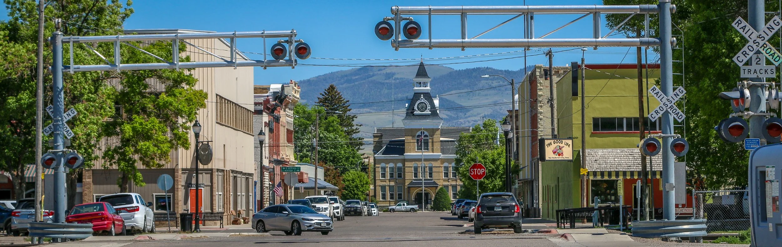
You’ll be very happy to hear that I am no longer in Missoula. I have left the mountains entirely for the moment and am writing to you this week from Great Falls, Montana on the edge of the Great Plains. It’s definitely different to see flat landscapes stretching out towards the horizon after so many months in the mountains. I do plan to loop back into the Rockies in a couple of weeks, but for now it’s just good to be on the road again and moving. It’s been a pleasant week even though I haven’t gotten too far from where I started. I spent much of the week split between Helena, Montana’s capital city, and Great Falls. Shadow Catcher is driving so much smoother than it was last week and I’m really glad I took it back in for another look. Great Falls is a great place to give it a good test, because the streets in town are absolutely terrible. I’m really hoping that the rest of the summer will be smooth sailing from here.
After I finished up this post last week, I heard from Kerry at Rocky Mountain Diesel who was taking care of my van. He told me that while they had rebuilt my drive shaft the week prior, there was still something wrong with it and it needed to go back to the shop that had rebuilt it. He told me that I could pick up my van for the night and that they would get on it first thing in the morning. It was pretty late at that point, so I picked it up and headed just down the road to Highlander Brewing Company. Highlander is a perfect example of something I’m surprised I don’t see more often in places. Highlander Beer is an historic Missoula brand first brewed in 1910 and named (with full permission) after the New York Highlanders baseball team (later renamed the Yankees). Highlander was brewed right there in Missoula until 1964 when the brewery was demolished during the construction of Interstate 90 and the beer went dormant. The branding was purchased in 2015 by a start-up Missoula Brewing Company. While they don’t brew the original Highlander beer, they sure capitalize on the name and the nostalgia with a brewery chock-full of old bottles, signs and memorabilia. The taproom is beautifully situated along Grant Creek, the beers they are brewing are pretty good and overall it’s a wonderful place to be. It’s also a quiet and easy place to park overnight which was an added bonus.
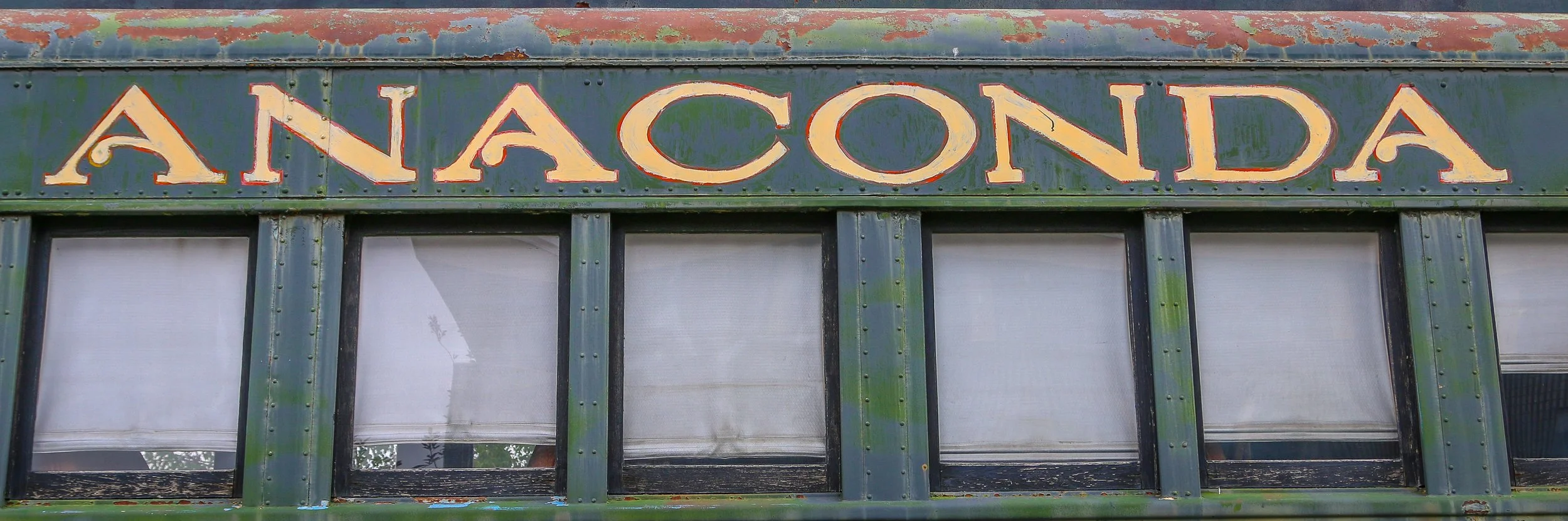
The United States is full of wonderful place names, and Anaconda, Montana is definitely one of the coolest names out there. Anaconda was founded by Copper King Marcus Daly as the location for a copper smelter to process the copper coming from the mines at nearby Butte. A smelter needs water and Butte just didn’t have a dependable enough water source to make one feasible. Daly originally called his town “Copperopolis”, but that name was already taken by another town in Montana so it was changed to Anaconda after the mountain range it is nestled in. When Montana became a state in 1889, Anaconda was in a fierce competition with Helena to become the new state capital, losing by only 2,000 votes.
Anaconda is a charming little city of just under 10,000 people. The locals are friendly and welcoming and the town itself has some really beautiful features. There are some beautiful historic homes west of downtown and some delightful bars and restaurants (don’t miss Gallicano's Pizzeria while you’re there). The Deer Lodge County Courthouse is awesome, and the Washoe Theatre is also not to be missed. I was truly surprised by how great of a town Anaconda is and I’ll definitely be back in the future. I hope you enjoy these photos from beautiful Anaconda, a true diamond in the rough.
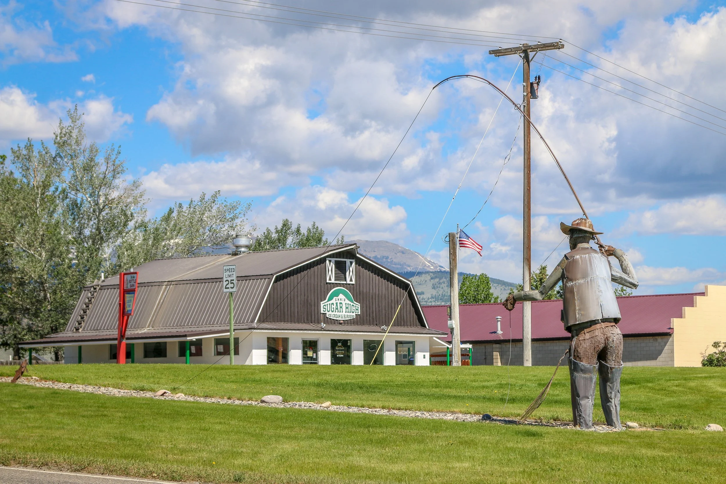
Located on the Madison River in Madison County, tiny Ennis, Montana is known for its abundant fly-fishing opportunities and public outdoor art. The area was originally settled in 1863 by William Ennis and the town that grew up there bears his name. I’ve been through Ennis a few times and always find it to be a quiet and charming little town. I hope you enjoy these photos from tiny Ennis, Montana.
Hello Everyone!
Of all the places I was hoping to be writing this post from this week, Missoula was not one of them. I had a pleasant if rainy week out exploring some nice spots in southwest Montana and heading towards Yellowstone, but by the time I got to Bozeman I had come to the conclusion that the repairs done on my van weren’t quite right. My stupid air shock continues to leak – these really are the worst designed parts I’ve ever encountered. And while sometimes I felt like we were cruising along smoothly, other times the whole van would vibrate beyond anything which was “normal”. I really didn’t want to turn back to Missoula, but on the other hand I paid a small fortune to get this work done and I expect it to be done right. Three hours back versus the whole country between me and home became an easy decision. Kerry at the shop was perfectly calm when I called him and told me to go ahead and bring it back in and they would take care of it. So here we are, back in Missoula. I’m really hoping that whatever it is, it’s reasonably easy to fix and that we’ll be back on the road by this time tomorrow, almost exactly a month after I first pulled into town.
After I finished this post last week, I was in a similar position to where I am today. I headed over to the mechanic shop with the hopes that my van would be ready. They were still working on it, and would finally hand over the keys around 8pm. I felt bad that they had stayed so late to get it done, and told them that one more day wasn’t going to kill me at that point, but they were ready to get it done and out of the shop. It sure was nice to be back behind the wheel, to start to put my things back where they belong and to sleep in my own bed. I went out and had a few beers to celebrate at the Draught Works brewery which is brewing up some great beers including one called Shadow Caster which made me smile. I had one last burger at the Missoula Club and then crawled into my van and slept and slept and slept…
Gold was discovered in nearby Alder Creek in 1863, sparking off one of Montana’s biggest gold rushes. People came from far and wide to try and earn their fortune in what is now southwest Montana. Soon after the discovery, a mining district was established and was named Verina [sic] after Confederate President Jefferson Davis’ wife, Varina. In the midst of the Civil War, this couldn’t be allowed, so the name was changed to Virginia City. When Montana Territory was carved from the existing Idaho Territory in 1864, Bannack was chosen as the capital, but the capital was moved to Virginia City just a year later. Virginia City would remain the capital for a decade before it was moved again to Helena. In the early days, a road gang called The Innocents was preying on wagons moving between the mining towns. In response, Virginia City residents formed The Montana Vigilantes who rode on The Innocents and lynched them in the streets of nearby Bannack. Virginia City is considerably quieter these days. With some lovely shops, some good restaurants and a couple of bars, including Montana’s oldest the Bale of Hay Saloon, Virginia City is a wonderful place for a wander. I hope you enjoy these photos from the cool, historic town of Virginia City, Montana’s second territorial capital.
Gold was discovered in Alder Gulch in 1863 and Nevada City sprung up almost overnight. It was a true boom and bust mining town which may have grown to as many as 2,000 residents but would dwindle down to only a hundred by the end of the decade. By 1880, the population was down to 50 and it would continue to shrink until Nevada City was all but a ghost town. In the 1950s, former state senator Charles Bovey decided to revive the old town as an outdoor living history museum. He salvaged a dozen or so buildings which were original to the townsite and then started bringing in other historic buildings from around the state. Today, Nevada City is owned by the State of Montana and managed by the Montana Heritage Commission. I unfortunately arrived after it had closed down for the night, but there was still plenty to see from the street. I’ll definitely have to get back and explore it another time. I hope you enjoy these photos from historic Nevada City - where Montana history comes to life.
Dillon, Montana is such a cool little town. Founded in 1880, it was originally called Terminus because it was, at least temporarily, the end of the line for the Utah and Northern Railway. The following year the town was renamed Dillon in honor of Sydney Dillon, the president of the Union Pacific Railroad. Located in the Beaverhead Valley, Dillon was a nice, central location to bring the train through to supply the nearby mining towns of Bannack, Virginia City, Nevada City and others. While the railroad was the impetus for Dillon’s founding, soon cattle and sheep ranches began to sprout up around town, shoring up the economy. As it grew, Dillon would become the county seat of Beaverhead County and build a gorgeous courthouse in the middle of town. In 1892, the Montana Normal College was founded in Dillon, which operates today as the University of Montana Western. Perhaps my favorite fact about Dillon is that it is the final resting place of Pit the Elephant which was struck and killed by lightning in 1943 at the fairgrounds. Too big to move, she was buried where she fell and the town continues to maintain her grave today. Dillon is a lovely little town with some great museums and plenty of bars and restaurants to explore and I really enjoyed my time there. I hope you enjoy these photos of Dillon, Beaverhead County’s classic rail town.
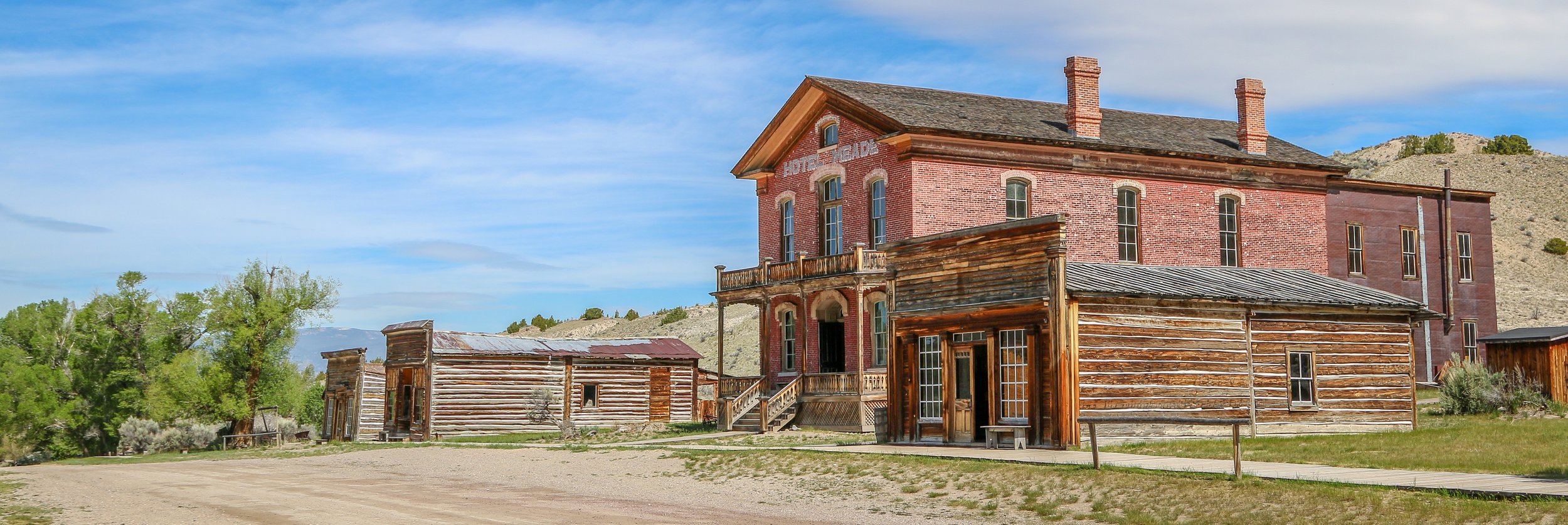
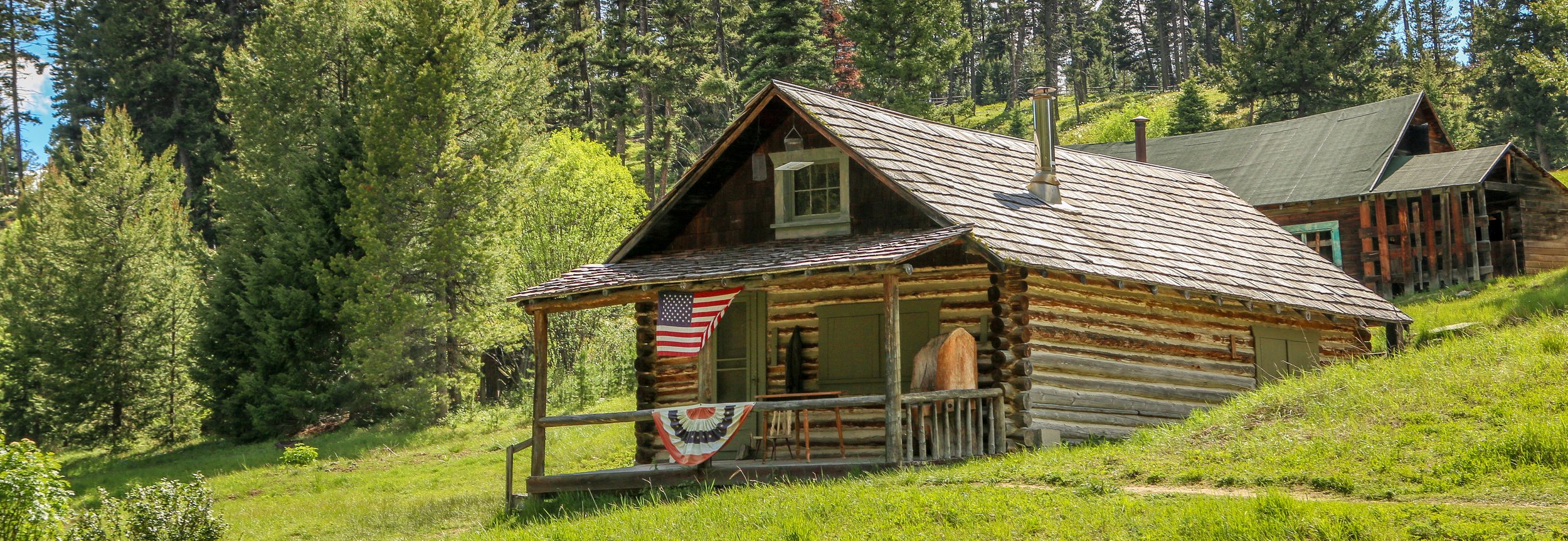
Gold was discovered on Grasshopper Creek in 1862 and the town of Bannack would quickly sprout up nearby, eventually growing to a population of over 10,000 people. Named after the local Bannock Indians, Bannack would serve as Montana’s territorial capital for 2 years before Virginia City took over the role. During its heyday, Bannack boasted three hotels, three bakeries, three blacksmith shops, two stables, two meat markets, a grocery store, a restaurant, a brewery, a billiard hall, and four saloons. In 1864, Bannack elected Henry Plummer as their sheriff. Plummer was the leader of a gang of outlaws known, ironically, as The Innocents, which prayed on supply wagons making their way between Bannack and Virginia and Nevada Cities. Eventually, a posse was raised in Virginia City known as the Vigilance Committee of Alder Gulch or, more simply, The Montana Vigilantes. They tracked down Plummer and his gang and lynched him in the middle of Bannack without a trial in 1864. Bannack’s population would fluctuate over the next hundred years with the price of gold, but the last resident left town in the 1970s. Thankfully a group of local residents stepped in to preserve Bannack and today it is a Montana State Park. I also thought it was cool that the Masonic Temple is still in regular use. I really enjoyed my time wandering the streets of town and I hope you enjoy these photos from beautiful Bannack, a classic Montana ghost town.
Hello Everyone!
Well, as of this writing my Shadow Catcher is still in the shop, but it should be ready by the end of the day, three weeks to the day after we rolled into Missoula. I certainly never expected it to take this long and can only say that I really wish Dodge hadn’t used some strange axle when they built this van. Usually Dodge parts are pretty easy to come by, but we finally ran out of luck with this one. I’m really hoping that everything is truly set to go and that we can cruise through the rest of the summer with no problems. That said, it’s been a pretty good week out here all things considered. I spent the beginning of the week out exploring in my loaner truck, came back to Missoula for the Zootown Music Festival over the weekend and then headed back south to my friend’s house in Corvallis for the rest of the week. I just pulled back into Missoula this morning and hopefully we’ll be back on the road by this time tomorrow.
View fullsize
After I finished up this post last week, I went out and had a nice long walk around Butte. Butte is truly one of the most photogenic cities I’ve ever been to and there always seems to be something new to see every time I’m there. The sun was on its way down so the light was good and my camera was very happy to be clicking away. I wandered down to the warehouse district for dinner at Casagranda’s Steakhouse, a cozy little spot tucked into the old Bertoglio building with an awesome Highlander Beer mural on the front. I have really been looking forward to eating a local steak and this was an awesome place to get one. The prices were incredibly reasonable, especially considering that the steaks came with soup AND salad, fresh baked bread, a side dish and even a scoop of ice cream at the end. It was a truly satisfying meal in a lovely setting. After dinner I wandered back up the hill into Uptown to take some more photos. I popped into Maloney’s bar for a beer and then had one more at the Copper King Saloon before calling it a night. The Copper King was located across the street from the old Milwaukee Road train station and had a lot of cool history which the ladies there were happy to discuss.
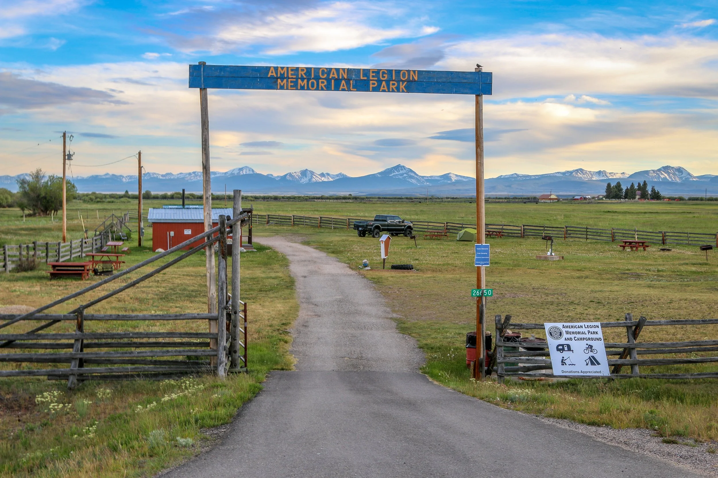
Tiny Wisdom, Montana takes its name from explorers Merriweather Lewis and William Clark’s name for the river which runs through town. Today we call it the Big Hole River, but who would change a town called Wisdom? It would seem unwise to me. Resting in the Big Hole Valley between the Pioneer, Anaconda and Beaverhead Mountains, Wisdom is also surrounded by Beaverhead-Deer Lodge National Forest. The Big Hole Valley is also known as the “Valley of 10,000 Haystacks” due to the ranching in the area which uses the beaverslide hay stacking technique developed nearby. There isn’t much to Wisdom, but I found it a pleasant place nonetheless. I stayed at the immaculate American Legion campground just outside of town and enjoyed a visit to the Antlers Saloon. My friend, Crystal, grew up in Wisdom and remembers it as a fun place when she was a child. Her grandmother owned several businesses in town and her brother still lives nearby. Today, Wisdom’s big draw is fly fishing, but it’s also along quite a popular cycling route. I hope you enjoy these photos from tiny Wisdom, Montana - a cute little town in the Big Hole Valley.
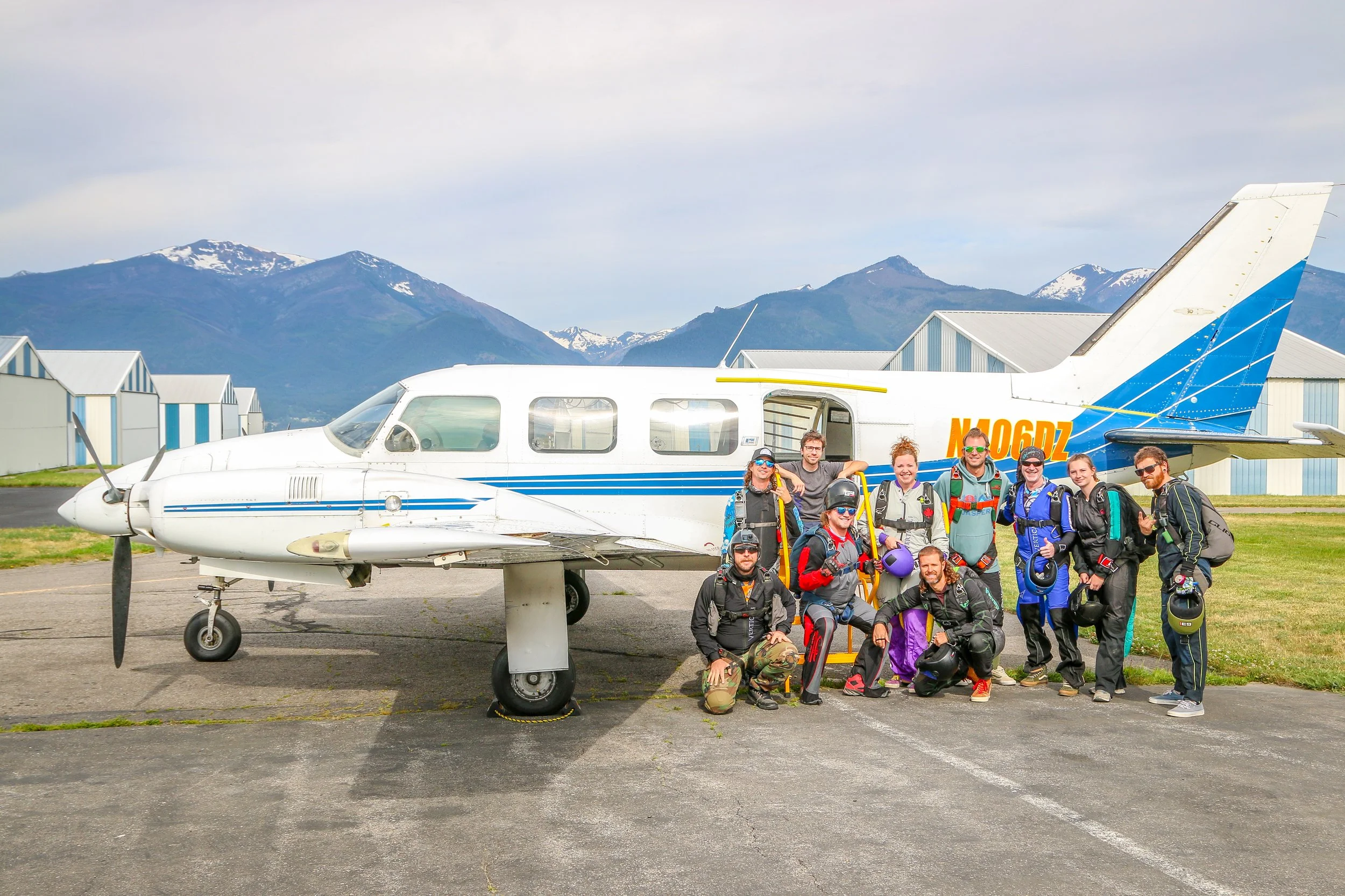
When I set off on this journey, one of my very first rules was ‘say yes’. Whenever I was going to spend time with someone, if they asked me to tag along with what they were doing, I would say yes. That rule has brought me to pee-wee soccer matches, the green rooms at music venues, into the kitchens of popular restaurants and opened the door to too many incredible experiences to list. This last week, it brought me to the airport in Stevensville, Montana - the home of Skydive Missoula. My friend, Renee, is obsessed with skydiving and spends all of her summer weekends in the “drop zone”. When she asked me to tag along, my answer came easily: yes. Because she knows everyone there, she introduced me around and over the next couple of weekends I got a serious look inside the world of skydiving. Unfortunately, because of the repair bill I’m looking at for my van this month, I didn’t jump myself, but I had an awesome time hanging around the shop, getting to know everyone and taking these photos.
The shop at Skydive Missoula wasn’t an unfamiliar environment for me. It reminded me in many ways of the scuba dive shops I’ve worked at over the years, just with a different set of equipment. It’s a vibrant place, with music pumping and a hundred different things happening at once. The longer I spent there, the more organized the chaos became until I finally saw the well-oiled machine it actually is. Everyone I met at Skydive Missoula over the last two weeks was excited for their jumps from first-time tandem jumpers to seasoned veterans with thousands of jumps in their logbooks. It really was a fun environment to experience, even though I wasn’t there to jump. I was incredibly impressed with the competence of the staff who lived, ate and breathed skydiving. Having hung out with them outside of the shop as well, I can tell you that they just keep on talking about skydiving late into the night. Even the pilot of their plane was a seasoned skydiver.
During my two weekends at Skydive Missoula, I got to be witness some really cool experiences, including my friend Renee’s 100th skydive - an epic milestone in her skydiving career. I also got to see one of the school’s students, Sereina, get her skydiving license which put a huge smile on her face. In addition, I got to see a couple of dozen people make their very first skydive ever. They looked nervous getting on the plane, but were all smiles by the time they landed.
I had an amazing couple of weekends hanging out at Skydive Missoula. If you’re ever in the area, stop on in and tell them I sent you. I’m sure they’d love to show you how to fly.
Hello Everyone,
I’ve got good news and bad news to start off this week. The bad news is that Shadow Catcher is still in the shop in Missoula, waiting on parts. My new axle housing has made its way all the way from Florida to Indiana where it is currently being rebuilt. They should be putting it on the road to Montana by Friday with it arriving early next week. Once it’s here, it should only take a day or so to get it on and to put everything back together again. I will likely be writing this post from Missoula again next week, making it three weeks since we pulled into town, but I will hopefully be on my way soon thereafter. The good news is that the shop has loaned me a truck in the interim, so I have packed up my camping gear and hit the road in it. I’m very grateful to them for the loaner as it has allowed me to get out and do some exploring this week. It’s not the easiest way to travel, but it sure beats sitting around on my hands in Missoula. I think if I had three weeks to sit there and stew, it would be hard to bounce back from. This week has taken me south through the Bitterroot Valley, across the Big Hole and the Bozeman Trail and is winding up here in Butte, where I am writing to you from today. The weather has been great and I’ve definitely been enjoying myself despite the difficulties of being out here without my van and the stresses involved with that.
View fullsize
After finishing up this post last week, I went out and enjoyed a wonderful night of music with a songwriters’ round at the Zootown Arts Community Center there in Missoula. This event brought together four unique songwriters from around Montana who took turns sharing their songs and the stories behind them. It was the first event of the newly formed Montana Songwriters Collective and it was really enjoyable. After the show, I went down and had a burger at the Missoula Club and then headed back across the river for the night.