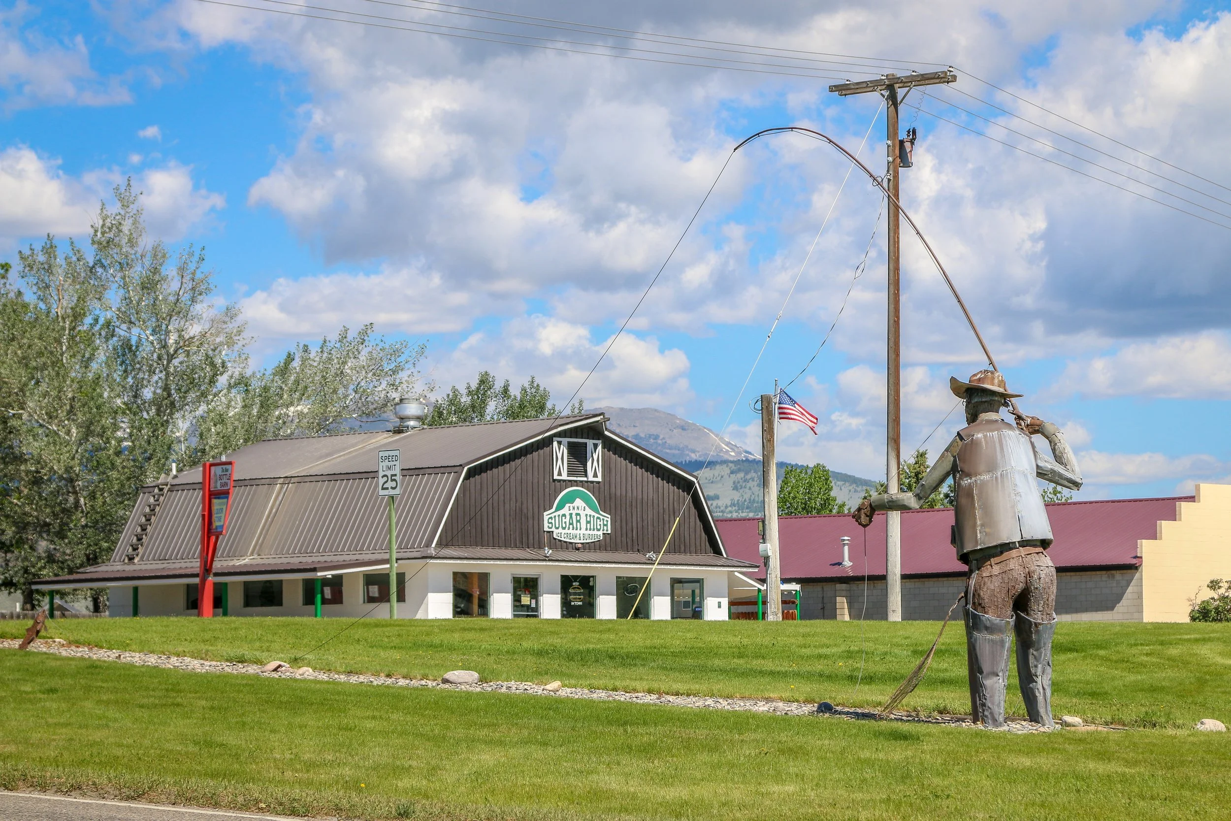
Located on the Madison River in Madison County, tiny Ennis, Montana is known for its abundant fly-fishing opportunities and public outdoor art. The area was originally settled in 1863 by William Ennis and the town that grew up there bears his name. I’ve been through Ennis a few times and always find it to be a quiet and charming little town. I hope you enjoy these photos from tiny Ennis, Montana.
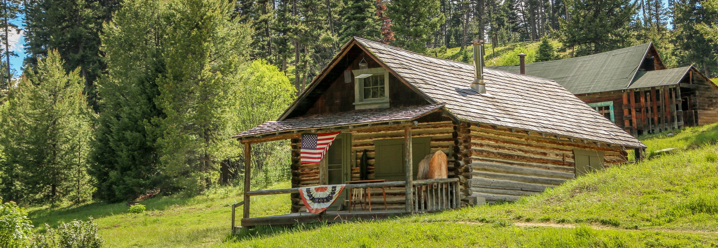
Gold was discovered in Alder Gulch in 1863 and Nevada City sprung up almost overnight. It was a true boom and bust mining town which may have grown to as many as 2,000 residents but would dwindle down to only a hundred by the end of the decade. By 1880, the population was down to 50 and it would continue to shrink until Nevada City was all but a ghost town. In the 1950s, former state senator Charles Bovey decided to revive the old town as an outdoor living history museum. He salvaged a dozen or so buildings which were original to the townsite and then started bringing in other historic buildings from around the state. Today, Nevada City is owned by the State of Montana and managed by the Montana Heritage Commission. I unfortunately arrived after it had closed down for the night, but there was still plenty to see from the street. I’ll definitely have to get back and explore it another time. I hope you enjoy these photos from historic Nevada City - where Montana history comes to life.
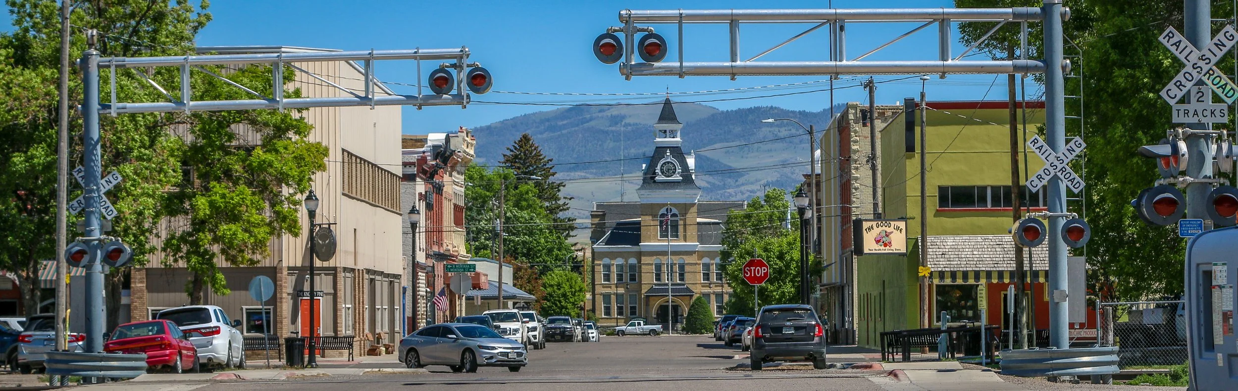
Dillon, Montana is such a cool little town. Founded in 1880, it was originally called Terminus because it was, at least temporarily, the end of the line for the Utah and Northern Railway. The following year the town was renamed Dillon in honor of Sydney Dillon, the president of the Union Pacific Railroad. Located in the Beaverhead Valley, Dillon was a nice, central location to bring the train through to supply the nearby mining towns of Bannack, Virginia City, Nevada City and others. While the railroad was the impetus for Dillon’s founding, soon cattle and sheep ranches began to sprout up around town, shoring up the economy. As it grew, Dillon would become the county seat of Beaverhead County and build a gorgeous courthouse in the middle of town. In 1892, the Montana Normal College was founded in Dillon, which operates today as the University of Montana Western. Perhaps my favorite fact about Dillon is that it is the final resting place of Pit the Elephant which was struck and killed by lightning in 1943 at the fairgrounds. Too big to move, she was buried where she fell and the town continues to maintain her grave today. Dillon is a lovely little town with some great museums and plenty of bars and restaurants to explore and I really enjoyed my time there. I hope you enjoy these photos of Dillon, Beaverhead County’s classic rail town.
Hello Everyone!
Well, as of this writing my Shadow Catcher is still in the shop, but it should be ready by the end of the day, three weeks to the day after we rolled into Missoula. I certainly never expected it to take this long and can only say that I really wish Dodge hadn’t used some strange axle when they built this van. Usually Dodge parts are pretty easy to come by, but we finally ran out of luck with this one. I’m really hoping that everything is truly set to go and that we can cruise through the rest of the summer with no problems. That said, it’s been a pretty good week out here all things considered. I spent the beginning of the week out exploring in my loaner truck, came back to Missoula for the Zootown Music Festival over the weekend and then headed back south to my friend’s house in Corvallis for the rest of the week. I just pulled back into Missoula this morning and hopefully we’ll be back on the road by this time tomorrow.
View fullsize
After I finished up this post last week, I went out and had a nice long walk around Butte. Butte is truly one of the most photogenic cities I’ve ever been to and there always seems to be something new to see every time I’m there. The sun was on its way down so the light was good and my camera was very happy to be clicking away. I wandered down to the warehouse district for dinner at Casagranda’s Steakhouse, a cozy little spot tucked into the old Bertoglio building with an awesome Highlander Beer mural on the front. I have really been looking forward to eating a local steak and this was an awesome place to get one. The prices were incredibly reasonable, especially considering that the steaks came with soup AND salad, fresh baked bread, a side dish and even a scoop of ice cream at the end. It was a truly satisfying meal in a lovely setting. After dinner I wandered back up the hill into Uptown to take some more photos. I popped into Maloney’s bar for a beer and then had one more at the Copper King Saloon before calling it a night. The Copper King was located across the street from the old Milwaukee Road train station and had a lot of cool history which the ladies there were happy to discuss.
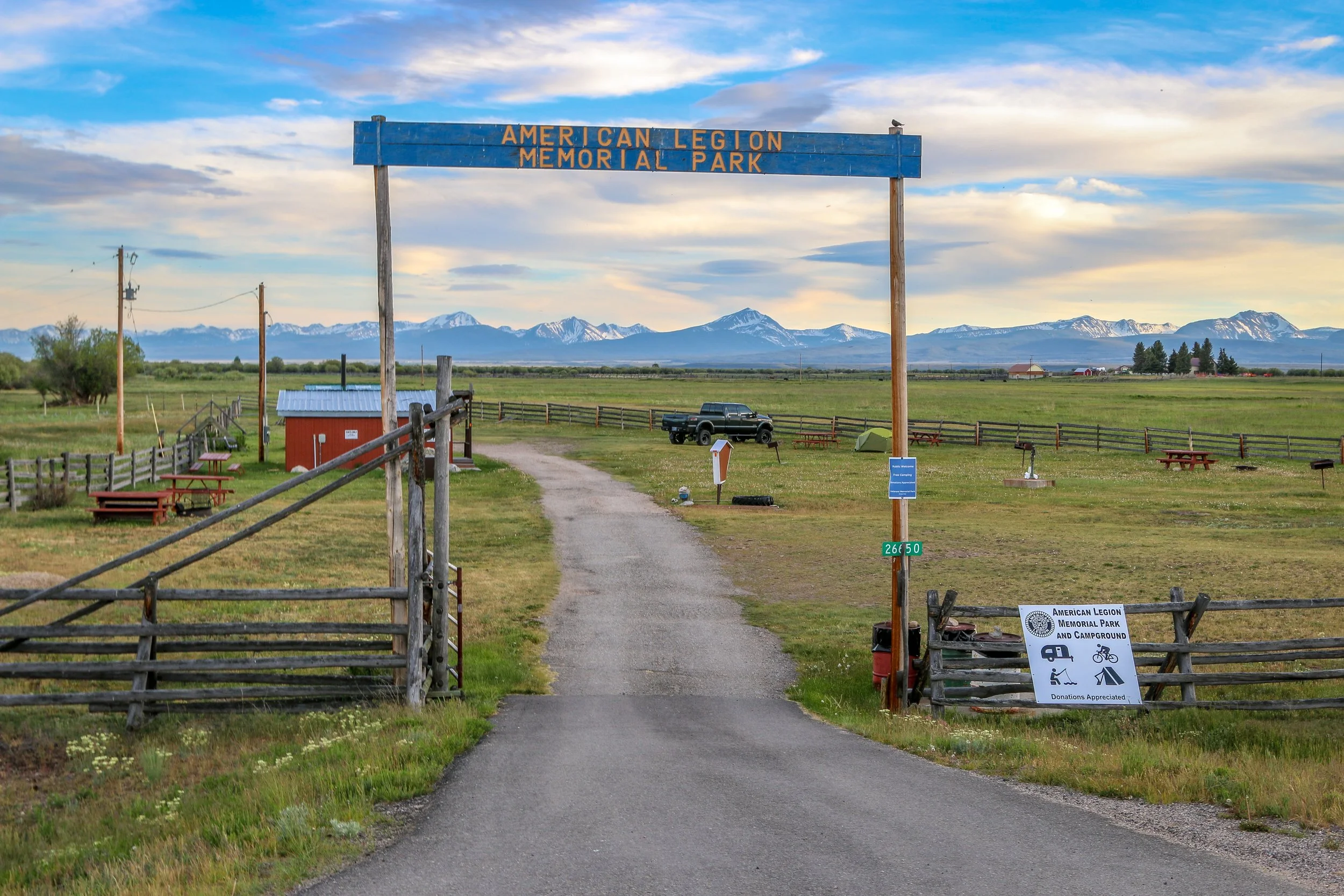
Tiny Wisdom, Montana takes its name from explorers Merriweather Lewis and William Clark’s name for the river which runs through town. Today we call it the Big Hole River, but who would change a town called Wisdom? It would seem unwise to me. Resting in the Big Hole Valley between the Pioneer, Anaconda and Beaverhead Mountains, Wisdom is also surrounded by Beaverhead-Deer Lodge National Forest. The Big Hole Valley is also known as the “Valley of 10,000 Haystacks” due to the ranching in the area which uses the beaverslide hay stacking technique developed nearby. There isn’t much to Wisdom, but I found it a pleasant place nonetheless. I stayed at the immaculate American Legion campground just outside of town and enjoyed a visit to the Antlers Saloon. My friend, Crystal, grew up in Wisdom and remembers it as a fun place when she was a child. Her grandmother owned several businesses in town and her brother still lives nearby. Today, Wisdom’s big draw is fly fishing, but it’s also along quite a popular cycling route. I hope you enjoy these photos from tiny Wisdom, Montana - a cute little town in the Big Hole Valley.
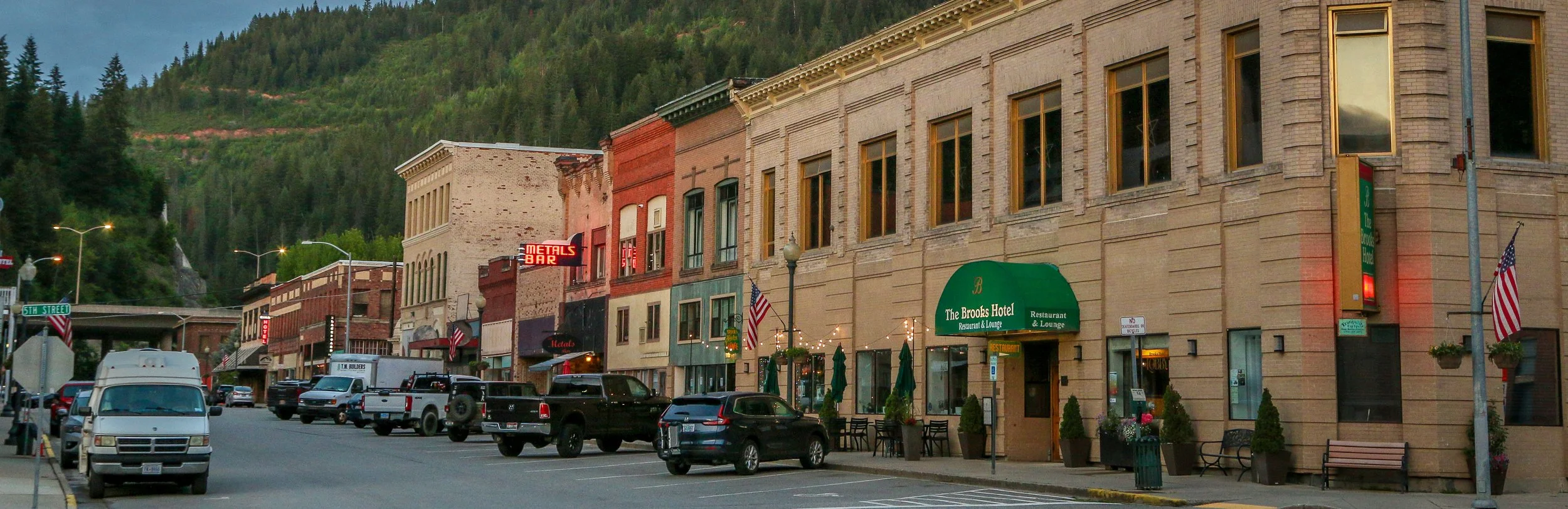
Colonel William Wallace purchased an 80 acre tract of land back in 1884 along the south fork of the Coeur d’Alene River. Over the next few years, several major silver deposits were discovered in the surrounding hills and a town grew up around Wallace’s cabin. By 1887, the railroad had made its way into Wallace and the town would grow even bigger. A fire in 1890 would burn much of the town and wooden buildings were rebuilt in brick. Despite this, Wallace would burn again in 1910 in what would come to be known as the “Big Burn”, one of the largest forest fires in American history. Wallace rebuilt again and the silver in the hills kept the town alive. The mines would thrive until after World War II and then slowly began to close. Today, Wallace’s population hovers around 800, with tourism being the town’s major industry. Wallace is the only town which is included, in its entirety, on the National Register of Historic Places. It’s a wonderful place to wander through with lots of old buildings, bars, hotels and restaurants. The historic Oasis Bordello Museum tells the story of Wallace’s storied red light district which lasted into the 1990s. Besides the history of the town, the area surrounding it is full of hiking and biking trails, ski slopes and a plethora of other outdoor activities. I first came to Wallace over 20 years ago and every time I return it makes me smile. It’s just a lovely little town, well preserved and open for business. I hope you enjoy these photos from fabulous Wallace, Idaho - small town perfection in Idaho’s Silver Valley.
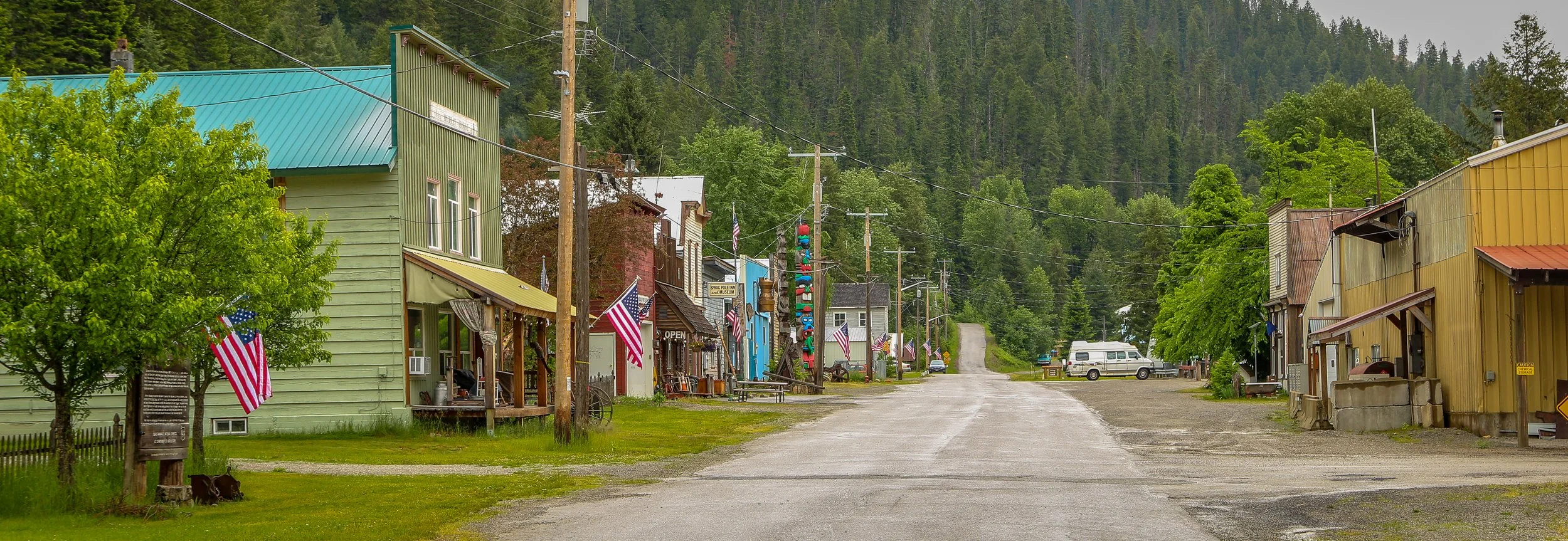
Gold was discovered along Prichard and Eagle Creeks back in 1882, sparking a small rush to the area. The town of Murray was established in 1884 and named for a local miner, George Murray. 5000 miners made their way to the valley, but the placer gold soon played out and the town’s population would drop to about 500 by 1910. Mining would continue in the area until the late 1950s. Wyatt Earp spent some time in Murray at the end of the 19th century. Perhaps the most loved and remembered citizen of Murray was the prostitute turned madam Maggie Hall, AKA Molly Burdan, AKA Molly B’Damn. Maggie was born in England to Irish parents and moved to New York in 1870. She came west a few years later and made her way to Murray during the gold rush in 1884. While quite a popular prostitute in town, Molly was also known and remembered for her kindness and generosity, being sure that everyone in town was fed and clothed. She died of tuberculosis in 1888 at the age of 34 and was buried in the town’s cemetery. Murray still celebrates their favorite lady every year during the annual Molly B'Damn Gold Rush Days.
There isn’t much to Murray these days, but what there is is fantastic. The Sprag Pole Inn and Museum is a sprawling complex stretching through several buildings and containing the personal collection of Walt Almquist. It displays everything from old matchbooks and cigarette packets to one of the world’s longest wooden chains. Down the road is the Bedroom Goldmine which has a plexiglass covered mine shaft in the back room. Guests were allowed to pan for gold until a flood washed out all of the support structures. I thought Murray was just the coolest little town and I’m glad I stopped to check it out. I hope you enjoy these photos of tiny Murray, Idaho, an old gold rush town in the Silver Valley.
Hello Everyone!
The weather is definitely warming up this week. Temperatures have been pushing up towards 90°F (32°C) on me here in the Pacific Northwest but thankfully it cools off quite a bit in the evening. Personally I would have loved some more springtime temperatures between winter and summer, but I know it’s almost June so it’s getting to be that time. The days are getting really long out here which has its pluses and minuses, but for the most part it’s been pretty good. I finished off my time in Oregon this week and I’m definitely glad I had the opportunity to see the Willamette Valley and all it had to offer. It was a relatively quick push back across the north of the Beaver State and southeast Washington to put me back into Idaho. I had a fabulous trip up into the depths of Hells Canyon this week and am ending the week here in Pullman, Washington just across the border from Moscow, Idaho. Both are pleasant university towns, but Pullman has a Planet Fitness so I dipped over here for a workout and I might as well finish up this week’s post while I’m here.
After I left you last week, I decided to stay the night outside of Portland at Edgefield, the old Multnomah County Poor Farm which is one of the McMenamin brothers’ signature properties. I thought a relaxed afternoon seemed like an excellent choice at that point and since I could get a dorm bed there for just $45 and be able to enjoy all of the amenities of the resort, I jumped at the opportunity. I had stopped by Edgefield on my way up the Columbia River Gorge last September and really wished I could have spent more time there, so I’m glad I had the chance to on this go-round. The main building at Edgefield is a beautiful, old, brick building with lots of art, nooks and crannies to explore. The property had four bars and the winery open while I was there, plus the main restaurant. I enjoyed a soak in the soaking pool, a nice long walk around the property and a plenty of quiet time reading my book. All of the shared spaces encouraged conversation and I really enjoyed chatting with several people during my stay. It was a wonderful afternoon and evening and somewhere I would definitely recommend if you’re ever in the area.
Mount Angel got its start as Roy, Oregon back in 1850. Thirty years later, Reverend Adelhelm Odermatt arrived with a group of Benedictine monks from Engelberg, Switzerland. Together, they established an abbey, a church and a school and were soon joined by a group of settlers from Bavaria. When a post office was established, they took the name “Mount Angel” which is the English translation of the town Engleberg. This sleepy little town of about 4,000 people grows a hundredfold each fall as tourists from around the world arrive for their annual Oktoberfest celebration. Mount Angel built their glockenspiel in 2006 and it is apparently the largest in the United States. It was a joy to watch when it came to life and on a quiet Sunday afternoon, I was the only one there to see it. There are some great old buildings and some beautiful cast iron signs and signposts around town which I have to believe came from the local Windischar's General Blacksmith Shop. I especially enjoyed the beer at the Benedictine Monastery’s wonderfully named St. Michael Taproom and will have to visit the monastery itself on my next visit. I definitely enjoyed wandering the streets of this little Bavarian town in the heart of the Willamette Valley and would absolutely recommend a stop to anyone passing through the area.. And if you’re there in September, you’ll be in for a real treat as their Oktoberfest looks like a heck of a good time. I hope you enjoy these photos from quaint and picturesque Mount Angel Oregon, the Willamette Valley’s Little Bavaria. Prost!
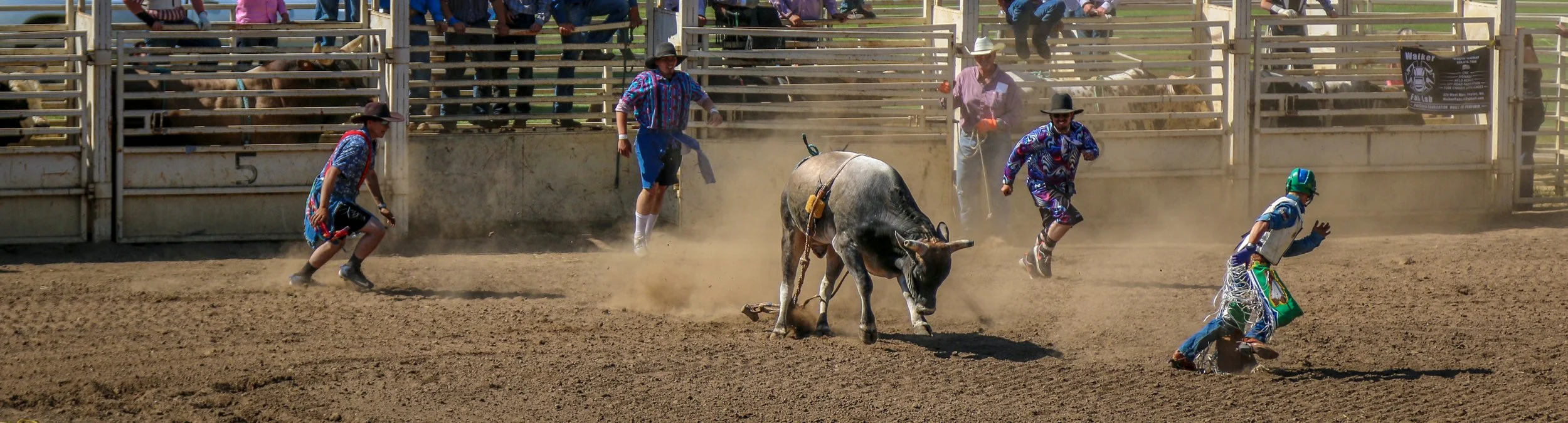
I had a wonderful time at the Dayton Days Rodeo in beautiful Dayton, Washington over Memorial Day Weekend. Here are some of my favorite action shots from the bull riding and barrel racing events, my two favorite rodeo events. In the bull riding, you can definitely see some of the thrill of victory and the agony of defeat in some of these pics. Remembering that a bull rider only needs to stay up for 8 seconds between the gate opening and a successful ride, yet only one or two were able to make it that long. I don’t really shoot a lot of action or sports shots, so these were fun photos to take. Enjoy these photos from the Dayton Days Rodeo.
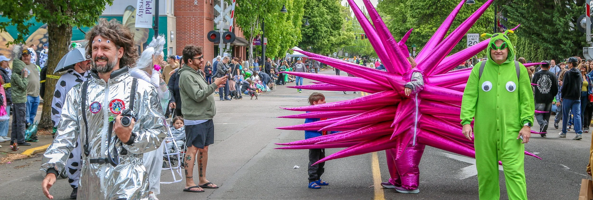
Back in 1950, a local farmer named Paul Trent took two photos of supposed UFOs from his land just outside of McMinnville. These are some of the earliest and most famous UFO photos ever taken. They were printed in Life magazine and in newspapers across the country and around the world. Every year McMinnville hosts a UFO festival which is equal parts serious lectures and discussions at the convention center and tin foil hats and ray guns at the street party downtown. I was thrilled to be able to attend the UFO Fest this year and to be able to take some photos of the parade and the participants in costumes around town. Sometimes it’s nice to take some photos just for fun.
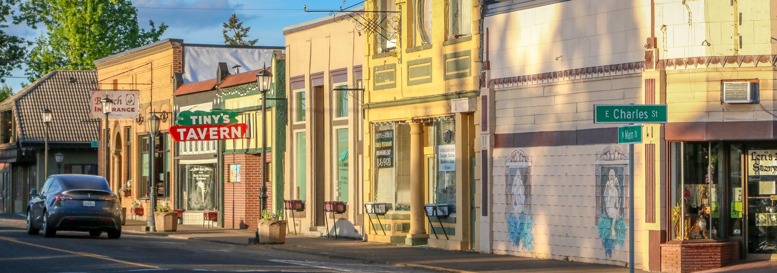
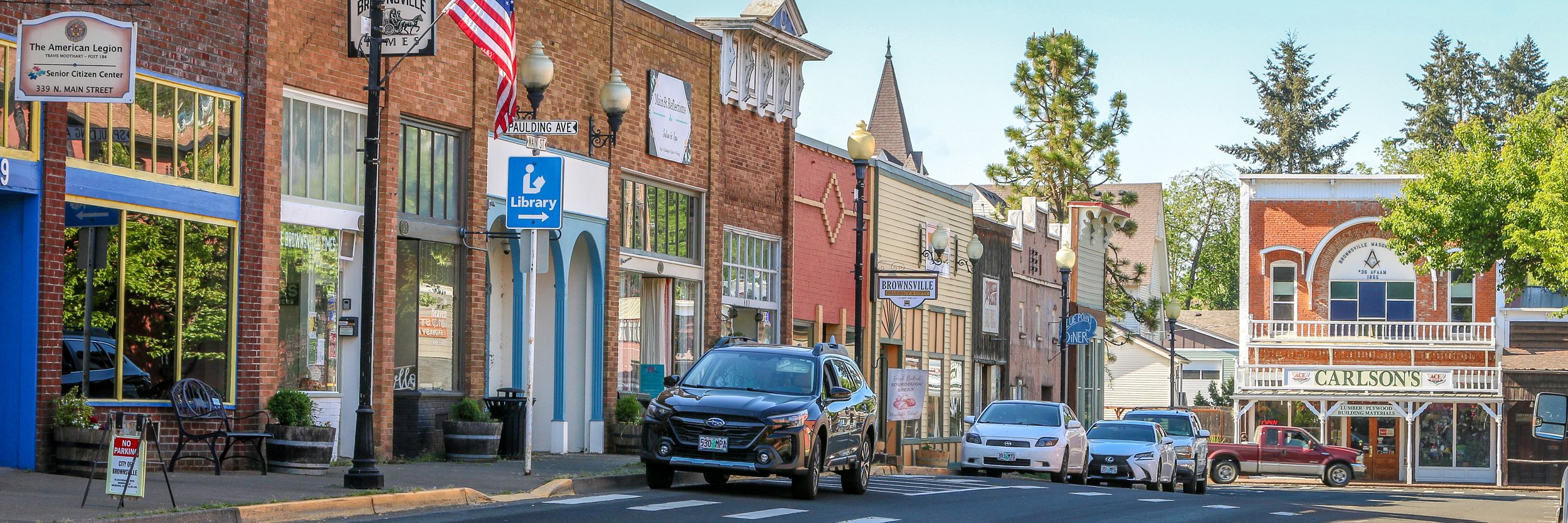
Driving into historic Brownsville, Oregon put a huge smile on my face. I first saw the movie Stand By Me as a teenager, and I had read the Stephen King novella The Body even earlier. This coming-of-age story of four boys navigating adolescence in the small town of Castle Rock (Maine in the novella, Oregon in the movie) really moved me. I’ve seen it dozens of times in the intervening years and Brownsville was where it was filmed. The whole town felt so familiar to me and it really is a quintessential small town and the perfect location for the movie to have been filmed in. I loved just walking the streets and taking it all in and I had a beautiful day to be there. I went to Pioneer Park and watched some young people playing baseball which was fun (the park was the scene of the pie-eating contest in the film with locals used as the extras in the scene). I enjoyed a great lunch at Randy’s and dinner at the Brownsville Tavern and just really enjoyed my visit. I even sat in my van and watched Stand By Me while I was there. I’m not the only person who visits Brownsville because I’m a fan of a 40 year old movie. They even have an annual festival to remember and celebrate the film. If you’re ever cruising through Linn County, pop in and have a look around. It’s a wonderful town full of wonderful people and I’m sure they’ll be glad to have you. Enjoy these photos from Brownsville, Oregon which will always be Castle Rock to me.