Hello Everyone,
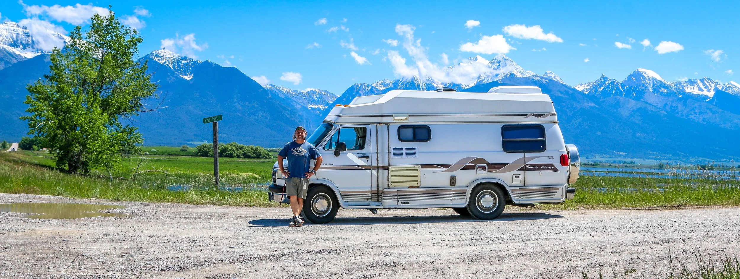
It’s been a hot week here in Montana. Two weeks ago it was snowing in Butte and two days ago we were hitting record high temperatures across the state. It’s been dangerously hot out, especially since I have no air conditioning in my van. I’ve been holed up here in Livingston for a few days and spent the last two nights in a nice, air conditioned hotel room. It was a nice break from the road and from the heat, but it’s frustrating to feel penned in and not be able to go exploring. It’s been a tough summer so far, and the heat is not making things any easier. I’m much better at dealing with the cold than dealing with the heat and my van is the same. That being said, I did get out and see some cool places this week and I’m very grateful to have some friends to hang out with this week, as that really makes a big difference in my morale. The heat should break in the next day or two, and then hopefully it will be a little easier going.
So after I finished up this post last week, I meandered down to the little local history museum there in Great Falls. It was a cute little museum with some interesting exhibits on the history of Great Falls, one called Spirits of Cascade County: Bootlegging, Bureaucracy, and Breweries, and one about feisty Montana women (their words, not mine). There were some cool bronze sculptures and some neat miniature building models as well. They also had a really interesting exhibit in what must have been some sort of event space on the historic Ozark Club, a black owned nightclub which had opened in Great Falls the day that prohibition ended and lasted until the owner’s death. After a nice visit to the museum, I did return to the Sip ‘n Dip Lounge to watch the mermaid in her pool behind the bar. Their tiki drinks were not very good, but the show was fun and I really enjoyed being there. Leaving the lounge, I wandered around downtown a bit and then called it a night.
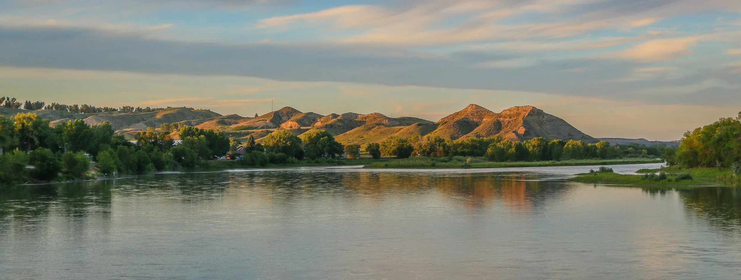
Thursday morning I was up and off and headed towards Fort Benton. There was a long stretch of construction on the road, but I still got there pretty early. I knew it was going to be a hot day (and week), so I found a parking spot in the shade which makes a big difference. Fort Benton sits at the very end of the navigable section of the Missouri River (aka “Old Misery) and apparently just a couple of hundred yards up the river, it’s shallow enough to walk across (I didn’t test this out). Historically, the bigger paddlewheel boats could only get to Fort Benton in the spring when the runoff was at its peak but smaller boats could get there pretty regularly throughout the year. It originated as a fur trading post, became the main supply route to the Montana goldfields and served for several years as a military outpost, although the soldiers there never saw any real excitement. Fort Benton is a pretty little river town which reminded me of the little river towns on the Mississippi as opposed to the rough and ready towns of the Montana frontier.
I spent most of the day at Fort Benton’s three wonderful museums. The smallest one told all kinds of fascinating stories from the history of the town, from the riverboats that came through and the trails that branched out towards the goldfields to the people who had passed through Fort Benton over the years. While I was there, I read the story of Shep, Fort Benton’s beloved dog, a statue of which has a prominent placement along the levee downtown. Shep was a loyal sheepdog whose owner died and was shipped east on the train. Shep lived near the tracks and greeted every inbound train in the hopes of seeing his master again and in so doing, served as Fort Benton’s unofficial greeter until the day he died. It was the railroad, incidentally, which shifted Fort Benton’s importance from being the third biggest city in Montana to the small little town it is today.
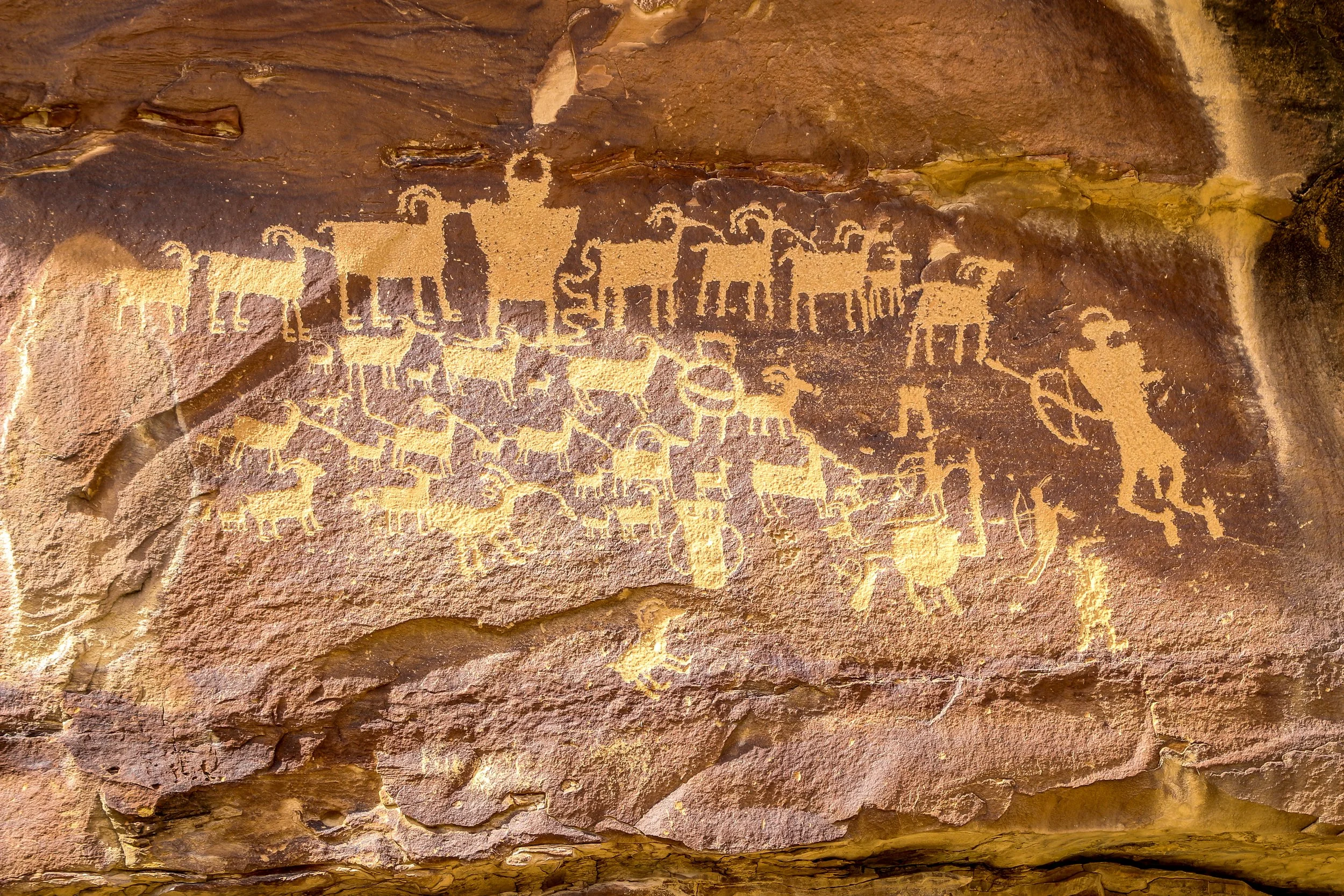
The second museum was in the fort itself, which is a reconstruction with the exception of one original blockhouse. The fur trading post inside was really interesting and there were some lovely artifacts from the local Indian tribes who traded at the fort. They had the recipe for “trade whiskey” which essentially diluted regular whiskey with water and then added tobacco, hot pepper, gunpowder and molasses to give it some zing. In reality it probably made a lot of people sick. There was a wonderful tipi in the fort which they were proud to have added this year. On the other side was a fascinating art museum which contained quite a few prints from the Swiss artist Karl Bodmer. Bodmer accompanied the expedition of Prince Maximillian Alexander Phillip of Wied-Neuwied who came to Montana in 1833 to have a look around. He may have been the region’s first tourist as they were really only there for exploration’s sake. Bodmer made quite a few sketches and paintings from their journey, including many of the Indians they encountered and the wildlife they found along the way. They’re quite a fascinating look at what the area was like before any real settlers had come to Montana at all.
The third museum, which you could find by following the massive bison hoof-prints which were painted on the streets of the town, was primarily an agricultural museum full of tractors and farm equipment. Their prized tractor was the 5 millionth International Harvester to roll out of their production facility. There was a little village out back with some cool old buildings, cabins and businesses. Definitely the part of this museum which was of the most interest to me was the Hornaday Bison. William Hornaday was one of our country’s first conservationists who had raised serious concerns about the looming extinction of the once-plentiful plains bison. As Chief Taxidermist of the Smithsonian, he traveled to Montana in 1886 and shot five bison to be brought home to D.C. to be studied and mounted for the collection. He also brought home a live calf which didn’t live very long after arriving and became the sixth stuffed Hornaday bison. It took them quite some time to find these bison on their expedition and they may have been some of the last bison alive in the region (American bison population once dropped to fewer than 100 individuals before being brought back in one of our great wildlife reintroduction success stories). The bull of the group served as the model for the buffalo nickel, the Department of the Interior logo and the National Park Service badge. The taxidermied bison were on display at the Smithsonian until 1955 when they were put into storage and mostly forgotten about. Thankfully someone decided to set out and find them and bring them home to Montana. After quite a bit of digging, they were brought back together and restored and now can be seen in this museum!
My head full of new information to process, I headed down to the bar at the Grand Union Hotel for a beer. The Grand Union opened in 1882 at the end of the steamboat era and is just dripping with history. In its heyday it was called “The Waldorf of the West” and was finely appointed in black walnut and marble with each room having its own wood-burning stove. Every one of the photos in the bar was taken by Edward Curtis, so I felt right at home there (my van, Shadow Catcher, is named in his honor). There I met Patrick the bartender who has been living in Fort Benton since November, having moved there for better schooling opportunities for his kids. I was the first one in the bar for the evening, so we had a nice long chat about the history of the area and about how each of us got there. They had a bison steak on the menu, so I decided to stick around for dinner. I’m not interested in a bison burger which tastes like any other kind of burger in my opinion (and I’ve had burgers made from everything from emu to musk ox and they all just taste like a burger to me). But a bison steak is something altogether different and special and well worth it when you can find one. Mine was a real treat. After dinner I headed out for a nice evening walk along the levee. It had cooled off considerably and the sky was magnificent. I sat on the pedestrian bridge, perched over the Missouri River, and read my book until the sun went down. Then I popped into the Palace Bar for a beer before calling it a night.
I was up nice and early on Friday morning as there were a few things I wanted to do in Fort Benton before I took off and I wanted to get out ahead of the heat. I was fiddling with my new watch band by the side of my van when a nice man came up and said “good morning”. He told me he either owned or was the caretaker for the building I had parked next to overnight, and I thought he was going to ask me to move on. Instead, he told me there was a secret shower in the bathroom just inside a side entrance and asked if I’d like to use it. I absolutely did, and thought it was such a kind offer. Clean and shiny, I set off to visit the museum of the Upper Missouri River Breaks National Monument, just downriver from town. They had an interesting movie about the area to watch and some cool wildlife displays, but I was really there to see one artifact in particular. In the corner, they had the rifle that Chief Joseph had surrendered after the battle at the Bear’s Paw, the last confrontation of the so-called Nez Perce War (I would visit the battlefield on Saturday, so will write more about it momentarily). I had really hoped to hold the rifle as I had with Kit Carson’s gun in Santa Fe and Devil Anse Hatfield’s gun in West Virginia, but it was sealed into its case pretty good. The lady working there was from Maryland, so we chatted for a bit about home before I headed out.
From Fort Benton, I made a beeline for Havre, a little over an hour up the road. It was hot, but the ride wasn’t too bad and I got into Havre at a reasonable time. I was really excited to take the “Havre, Beneath the Streets” tour and got there in time for the last one of the day. Havre had a terrible fire back in 1904 which levelled about 90% of the city. Determined to perceiver, businesses moved into their basement spaces while the buildings above ground were being rebuilt. They knocked out walls to connect the businesses and had their own little underground city going, complete with a saloon, brothel and opium den for recreation. I’ve been on these underground tours before, and they are very dependent on the storytelling ability of the guide (the tunnels under Moose Jaw, Saskatchewan were the best). Unfortunately our guide had little knowledge and less personality and really just gave us the basics. She told us she was new and she was definitely trying, but it really could have been better. It wasn’t too expensive though and it was cool to get down into the tunnels.
It was pretty hot when I came back above ground, and there wasn’t much else to see in Havre, so I spent the rest of the afternoon in the library. In the evening, I went to see some live music at Vic’s Place which felt more like a community center than a bar. There were families there and little kids running around and plenty of couches to sit on. The music was good and it was a fun place to hang out for the evening. It was still pretty hot out when I wanted to go to sleep, but there was a light breeze and it continued to cool off through the night. The passing trains made quite a racket throughout the night, but I still managed to get some sleep which was good.
I was up super early the next morning as I wanted to get out to the Bear Paw battlefield and then continue down to Lewistown which was three hours down the road. Bear Paw has been somewhere I’ve wanted to see for a long time, and I was happy to finally get there. This was the last battle of what we now call the Nez Perce War of 1877. The Nez Perce who took part in this battle were Chief Joseph’s Wallowa Band who had originated in the Wallowa Valley of what’s now northeast Oregon, a beautiful area I visited last winter. The Nez Perce had always been friends of the Americans who came west, from the time they saved the Lewis and Clark expedition when they came, starving and stumbling, out of the mountains until a decade after the end of the Civil War. They had provided safe passage to emigrants on their journey west and negotiated a reservation in good faith. When that reservation was shrunk by 90% and the Wallowa Band was expelled from their homeland, several young warriors killed four Americans. Knowing that retaliation would be swift and harsh, Chief Joseph decided the safe bet would be to flee to Canada and join up with Sitting Bull who had gone north after the Little Bighorn. Leading a group of 600 people, most of whom were women, children and the elderly, Chief Joseph made it 1,170 miles while his warriors protected their rear repeatedly from the U.S. Army. Thinking they were further ahead than they actually were, they rested in the Bear Paw Mountains to hunt and gather food while they had a dependable water source on hand. This would be their fatal mistake, as the army caught up with them there and finally forced their surrender. They were only 40 miles from the Canadian border. It was quiet out on the battlefield that morning and quite peaceful as I walked in the footsteps of the Nez Perce and Chief Joseph and I was happy to finally get there and see where it all ended.
From the Bear Paw, I headed east and then south along the western edge of the Fort Belknap Reservation, the homeland to the Assiniboine (Nakoda) and Gros Ventre (Aaniiih) Tribes. These tribes have started their own bison heard on the reservation, and I saw one solitary, hot, bison lounging near the fence along the road. I drove past the Little Rocky Mountains, a small but beautiful range in the midst of the prairie, and then dropped down into “the breaks” which lead to the Missouri River. Crossing the river, I began to climb back up to the prairie and a lot of the hills were longer and steeper than I had expected. Meanwhile the temperatures had risen into the 90s and my temperature gauge just kept climbing. Not wanting to overheat in the middle of nowhere, we pulled over to cool down for a while before continuing on into Lewistown.
It was pushing a hundred degrees by the time I arrived, so I found a patch of shade to park in and headed downtown to find something that was open and air-conditioned. What I found was the American Prairie National Discovery Center, which was a beautifully done visitor center focused on the prairie ecosystem which surrounds Lewistown. Their goal is to buy up private land in the areas between federally protected land and Montana’s Indian Reservation land and restore an unbroken prairie ecosystem. Of course there are also signs around town protesting the idea, so this idea is not universally loved by any stretch of the imagination. It was a very modern and well done exhibition, and I especially enjoyed seeing a live black-footed ferret, another animal brought back from the brink of extinction.
It was still too hot to think when the center closed, so I strolled down the street to Big Spring Brewing Company in the old Central Feed building. I had a nice steak salad and nursed a couple of beers over the next hour or two until it cooled off enough to venture back out onto the streets. Lewistown is a nice enough little city with some cool historic buildings to check out, but it’s a pretty small town at the end of the day. I spent a couple of hours reading in the shade until it was cool enough to crawl into my van and get some sleep.
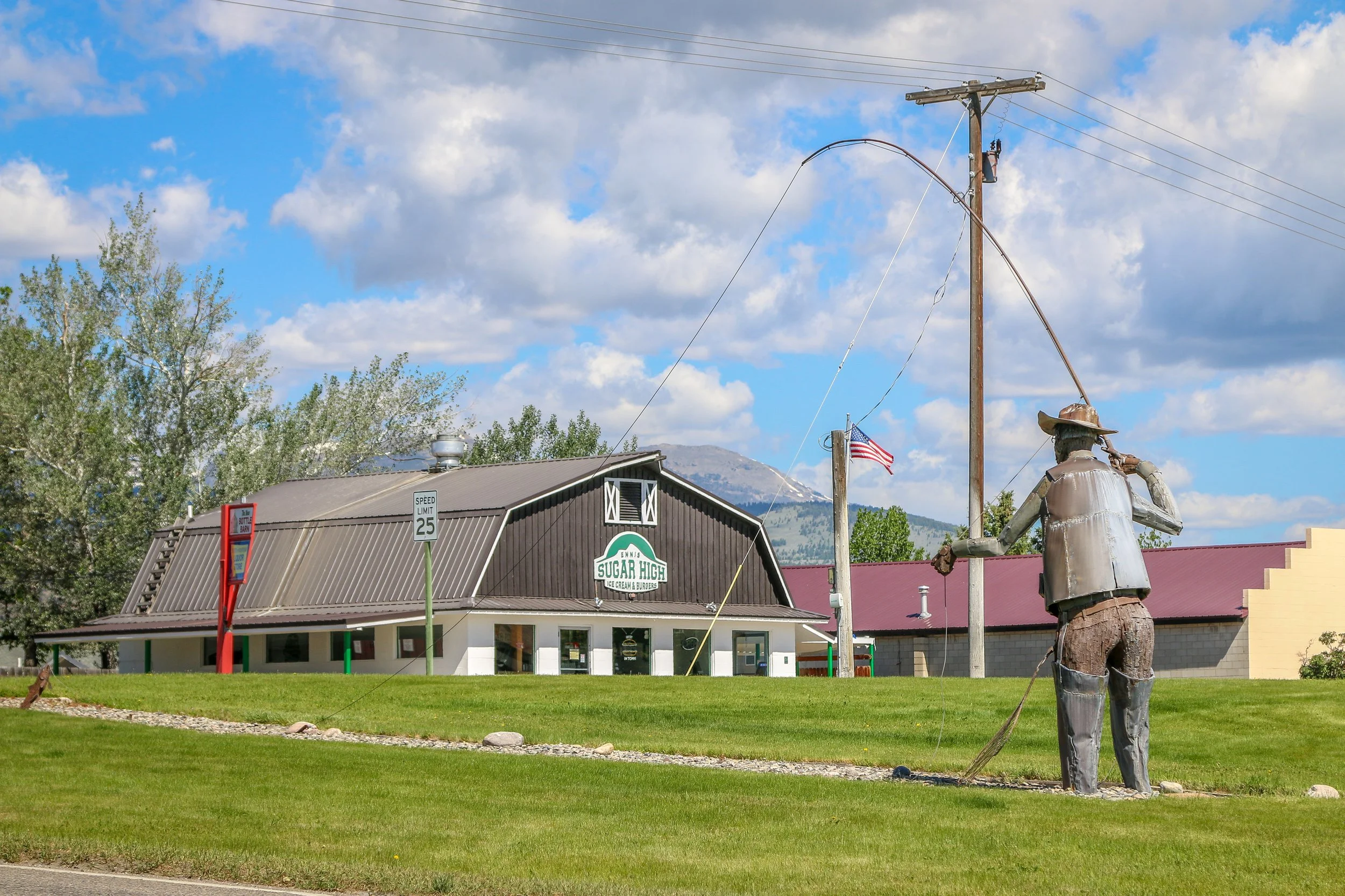
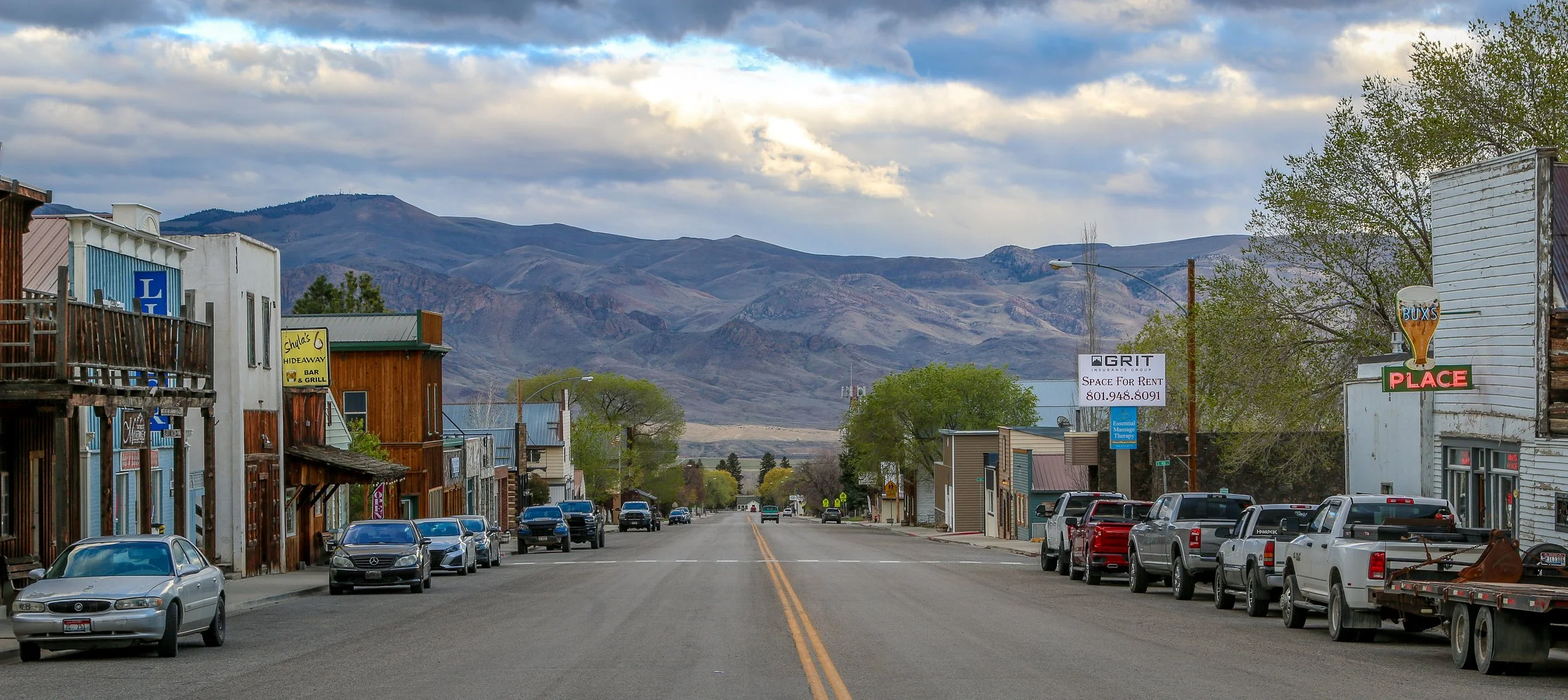
It was another early morning, and I got on the road before 7am and made a beeline for Livingston, the historic gateway city to Yellowstone National Park. I made a quick stop in the cute little town of Big Timber, but otherwise headed straight into Livingston. Because of its proximity to the park, Livingston seems to be doing pretty well, with a buzzing downtown area and plenty of bars and restaurants. It was already pushing 90° by the time I got there, so I found some shade to park in and found a nice cool coffee shop to chill out in for the rest of the morning. I had decided to book a hotel for the next two nights because I was getting really tired of the heat and just needed a break. After a late lunch in the historic train depot, I checked in right at 3pm and cranked my a/c up to high. After relaxing for a few minutes, I went out and got my oil changed and cleaned out some things in my van. It was hot and sweaty work, but I was parked right outside of my room so I had plenty of water to drink and a nice long shower waiting for me when I was done.
I caught a nice, long, air-conditioned nap and by the time I got up it was starting to cool down a bit outside. I wandered back downtown and checked out a couple of cool historic bars. The bartender at The Owl Bar was from Baton Rouge, so we talked a lot about life in Louisiana. Then I met a guy from Alaska at the Hyatt House and we chatted about the great north for a while. By then I was pretty tired, so I wandered back “home” and slept for many hours.
Yesterday, I did almost nothing at all. I spent most of the day in my air-conditioning with the shades closed. I watched more TV than I’ve watched all year, and only broke it up with a stroll down to the grocery store for breakfast and again at lunch. I did get my laundry done which was good, but that was about it. In the evening I came back downtown and enjoyed a couple of beers at the Neptune Brewery, chatting with a lovely Montana couple who had spent the day at their son’s university orientation in Bozeman. Leaving there, I ate some delicious Mexican food for dinner before calling it a day.
I stayed in my hotel this morning right up until checkout time. I did get my van cleaned out a bit to give myself some more room which was good. My friend, Evan, had some things he needed to pick up here in Livingston, so we met up for lunch which was nice. Evan used to work for the same tour company that I did for many years, and then decided he wanted to move to Yellowstone to watch the wolves and guide wildlife tours. After a couple of years, he started his own company which has been doing really well. He’s an interesting guy and I’ve always really enjoyed his friendship, and it was nice to chat for a couple of hours and catch up. We have a mutual friend who is coming to Gardiner, just down the road, tomorrow, so I’m hoping the three of us can meet up for dinner down there.
It’s been a hot week, but today is a little cooler than it has been at least. After lunch, I came to the library to try and finish this week’s post while the heat of the day passes over. It’s Tuesday, but I’m going to go ahead and publish this today as I am heading south towards Yellowstone tomorrow. I’ll be in Gardiner on the north edge of the park for a day or two to try and catch up with my friends and then I’ll be heading on into the park. I’m not sure what my plan is right now, as I need to watch what happens with the weather. I’ve spent plenty of time in Yellowstone over the years and was hoping to get some backpacking in this summer, and I’m still hoping to make that happen. Depending on how it all goes, I may still be in the park at this time next week, so if you don’t hear from me, don’t worry. I’ll be enjoying one of the most fascinating places on the planet and I’ll catch up with you when I come out the other side. Have a great week out there and try and stay cool and hydrated wherever you are. That’s going to be my plan for the week as well. Thank you, as always, for reading.
-Mike